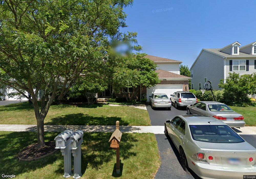
1598 Manhattan St Unit 1 Bolingbrook, IL 60490
Freedom Park NeighborhoodEstimated Value: $522,817 - $552,000
--
Bed
1
Bath
2,915
Sq Ft
$185/Sq Ft
Est. Value
About This Home
This home is located at 1598 Manhattan St Unit 1, Bolingbrook, IL 60490 and is currently estimated at $538,954, approximately $184 per square foot. 1598 Manhattan St Unit 1 is a home located in Will County with nearby schools including Liberty Elementary School, John F Kennedy Middle School, and Plainfield East High School.
Ownership History
Date
Name
Owned For
Owner Type
Purchase Details
Closed on
Mar 26, 2003
Sold by
Pinnacle Corp
Bought by
Geiger James E and Geiger Kimberly A
Current Estimated Value
Home Financials for this Owner
Home Financials are based on the most recent Mortgage that was taken out on this home.
Original Mortgage
$234,892
Outstanding Balance
$100,832
Interest Rate
5.86%
Mortgage Type
Purchase Money Mortgage
Estimated Equity
$438,122
Create a Home Valuation Report for This Property
The Home Valuation Report is an in-depth analysis detailing your home's value as well as a comparison with similar homes in the area
Home Values in the Area
Average Home Value in this Area
Purchase History
| Date | Buyer | Sale Price | Title Company |
|---|---|---|---|
| Geiger James E | $294,000 | Chicago Title Insurance Comp |
Source: Public Records
Mortgage History
| Date | Status | Borrower | Loan Amount |
|---|---|---|---|
| Open | Geiger James E | $234,892 | |
| Closed | Geiger James E | $29,361 |
Source: Public Records
Tax History Compared to Growth
Tax History
| Year | Tax Paid | Tax Assessment Tax Assessment Total Assessment is a certain percentage of the fair market value that is determined by local assessors to be the total taxable value of land and additions on the property. | Land | Improvement |
|---|---|---|---|---|
| 2024 | $12,793 | $154,335 | $38,822 | $115,513 |
| 2023 | $12,793 | $138,866 | $34,931 | $103,935 |
| 2022 | $12,249 | $125,195 | $31,492 | $93,703 |
| 2021 | $10,972 | $117,060 | $29,446 | $87,614 |
| 2020 | $10,752 | $113,211 | $28,478 | $84,733 |
| 2019 | $10,498 | $107,820 | $27,122 | $80,698 |
| 2018 | $10,578 | $107,503 | $27,042 | $80,461 |
| 2017 | $10,423 | $101,898 | $25,632 | $76,266 |
| 2016 | $10,307 | $97,000 | $24,400 | $72,600 |
| 2015 | $10,047 | $93,000 | $23,400 | $69,600 |
| 2014 | $10,047 | $91,100 | $22,900 | $68,200 |
| 2013 | $10,047 | $79,200 | $19,900 | $59,300 |
Source: Public Records
Map
Nearby Homes
- 725 Delacourte Ave
- 1616 Sutton Place Unit 1
- 1488 Schoenherr Ave
- 1536 Trails End Ln Unit 5A
- 1544 Suncrest Ln
- 1692 Trails End Ln Unit 6
- 812 Metropolitan Ave Unit 1
- 652 Timberline Dr
- 402 Marshall Ash St Unit 3
- 1437 Sage Dr
- 558 Pinebrook Dr
- 545 Pinebrook Dr
- 1424 Sage Dr
- 402 S Palmer Dr Unit 2B
- 1433 White Pine Ln
- 7 Snead Ct
- 251 Carolina St
- 536 Sonoma Dr
- 1963 Norwich Ln
- 1499 Raven Dr Unit 4
- 1602 Manhattan St
- 1594 Manhattan St
- 1590 Manhattan St
- 1606 Manhattan St
- 1597 Manhattan St
- 1601 Manhattan St Unit 1
- 1586 Manhattan St
- 1605 Manhattan St
- 1591 Manhattan St Unit 1
- 721 Delacourte Ave Unit 1
- 2 Farmside Ct Unit 3B
- 1582 Manhattan St Unit 1
- 1661 Prairieview Blvd
- 1587 Manhattan St Unit 1
- 722 Belvedere Blvd
- 1 Farmside Ct
- 1614 Manhattan St Unit 1
- 722 Delacourte Ave
- 3 Farmside Ct
- 1578 Manhattan St Unit 1