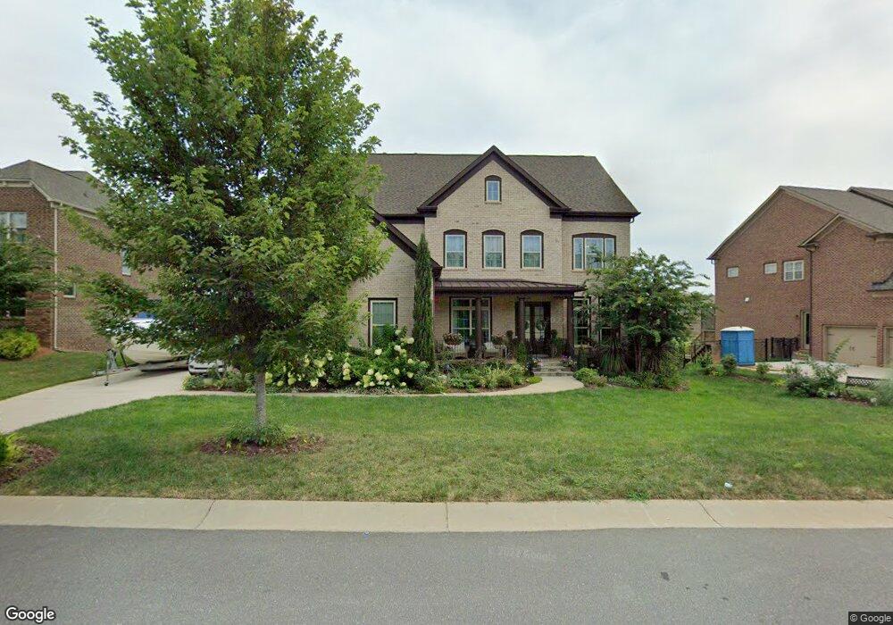
15983 Reynolds Dr Unit 582 Fort Mill, SC 29707
Estimated Value: $854,000 - $964,000
5
Beds
4
Baths
3,786
Sq Ft
$246/Sq Ft
Est. Value
About This Home
This home is located at 15983 Reynolds Dr Unit 582, Fort Mill, SC 29707 and is currently estimated at $929,958, approximately $245 per square foot. 15983 Reynolds Dr Unit 582 is a home located in Lancaster County with nearby schools including Harrisburg Elementary School, Indian Land Middle School, and Indian Land High School.
Ownership History
Date
Name
Owned For
Owner Type
Purchase Details
Closed on
Nov 2, 2016
Sold by
Pulte Home Corporation
Bought by
Kania Robert D and Kania Joann B
Current Estimated Value
Home Financials for this Owner
Home Financials are based on the most recent Mortgage that was taken out on this home.
Original Mortgage
$394,000
Outstanding Balance
$316,314
Interest Rate
3.42%
Mortgage Type
New Conventional
Estimated Equity
$613,644
Purchase Details
Closed on
Jan 27, 2016
Sold by
Jw Homes Llc
Bought by
Pulte Home Corporation
Create a Home Valuation Report for This Property
The Home Valuation Report is an in-depth analysis detailing your home's value as well as a comparison with similar homes in the area
Home Values in the Area
Average Home Value in this Area
Purchase History
| Date | Buyer | Sale Price | Title Company |
|---|---|---|---|
| Kania Robert D | $570,359 | -- | |
| Pulte Home Corporation | $21,411,025 | -- |
Source: Public Records
Mortgage History
| Date | Status | Borrower | Loan Amount |
|---|---|---|---|
| Open | Kania Robert D | $394,000 |
Source: Public Records
Tax History Compared to Growth
Tax History
| Year | Tax Paid | Tax Assessment Tax Assessment Total Assessment is a certain percentage of the fair market value that is determined by local assessors to be the total taxable value of land and additions on the property. | Land | Improvement |
|---|---|---|---|---|
| 2024 | $4,428 | $26,900 | $3,000 | $23,900 |
| 2023 | $4,322 | $26,900 | $3,000 | $23,900 |
| 2022 | $4,247 | $26,900 | $3,000 | $23,900 |
| 2021 | $3,905 | $25,188 | $3,000 | $22,188 |
| 2020 | $3,619 | $22,632 | $3,000 | $19,632 |
| 2019 | $7,652 | $22,632 | $3,000 | $19,632 |
| 2018 | $7,364 | $22,632 | $3,000 | $19,632 |
| 2017 | $3,540 | $0 | $0 | $0 |
| 2016 | $322 | $0 | $0 | $0 |
| 2015 | $812 | $0 | $0 | $0 |
| 2014 | $812 | $0 | $0 | $0 |
| 2013 | $812 | $0 | $0 | $0 |
Source: Public Records
Map
Nearby Homes
- 9032 Possum Hollow Rd
- 2785 Disney Place
- 627 Bolick Rd
- 6458 Chadwell Ct
- 5002 Belleroyal Ct
- 6433 Chadwell Ct
- 9142 Drayton Ln
- 7129 Dove Field Ln
- 9029 Woodview Ct
- 7196 Dove Field Ln
- 3161 Hartson Pointe Dr
- 14268 Grantham Ct
- 3159 Hartson Pointe Dr
- 3129 Hartson Pointe Dr
- 6017 Cadence Ln
- 5125 Longbrooke Ct
- 5157 Longbrooke Ct
- 5128 Longbrooke Ct
- 8737 Whippoorwill Ln
- 4576 Fox Ridge Ln
- 15969 Reynolds Dr Unit 581
- 15969 Reynolds Dr
- 15993 Reynolds Dr Unit 583
- 15993 Reynolds Dr
- 7023 Highland St
- 7015 Highland St
- 16005 Reynolds Dr
- 15957 Reynolds Dr Unit 580
- 15980 Reynolds Dr Unit 513
- 15992 Reynolds Dr
- 7027 Highland St Unit 562
- 15972 Reynolds Dr Unit 514
- 16000 Reynolds Dr
- 7007 Highland St
- 16015 Reynolds Dr Unit 585
- 16015 Reynolds Dr
- 1031 Estates Ave
- 1031 Avon Ct Unit 579
- 15964 Reynolds Dr Unit 515
- 15964 Reynolds Dr