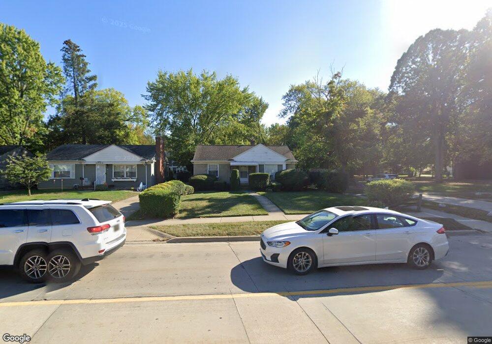
15985 W 14 Mile Rd Beverly Hills, MI 48025
Estimated Value: $246,000 - $301,000
3
Beds
1
Bath
917
Sq Ft
$299/Sq Ft
Est. Value
About This Home
This home is located at 15985 W 14 Mile Rd, Beverly Hills, MI 48025 and is currently estimated at $273,830, approximately $298 per square foot. 15985 W 14 Mile Rd is a home located in Oakland County with nearby schools including Wylie E. Groves High School, Greenfield Elementary School, and Berkshire Middle School.
Ownership History
Date
Name
Owned For
Owner Type
Purchase Details
Closed on
Mar 28, 2003
Sold by
Black David F and Black Diane M
Bought by
Maxwell Richard J and Maxwell Nancy L
Current Estimated Value
Home Financials for this Owner
Home Financials are based on the most recent Mortgage that was taken out on this home.
Original Mortgage
$149,816
Outstanding Balance
$64,880
Interest Rate
5.86%
Mortgage Type
Purchase Money Mortgage
Estimated Equity
$208,950
Purchase Details
Closed on
Oct 12, 1999
Sold by
Black David F
Bought by
Black David F
Create a Home Valuation Report for This Property
The Home Valuation Report is an in-depth analysis detailing your home's value as well as a comparison with similar homes in the area
Home Values in the Area
Average Home Value in this Area
Purchase History
| Date | Buyer | Sale Price | Title Company |
|---|---|---|---|
| Maxwell Richard J | $151,000 | Transnation Title | |
| Black David F | -- | -- |
Source: Public Records
Mortgage History
| Date | Status | Borrower | Loan Amount |
|---|---|---|---|
| Open | Maxwell Richard J | $149,816 |
Source: Public Records
Tax History Compared to Growth
Tax History
| Year | Tax Paid | Tax Assessment Tax Assessment Total Assessment is a certain percentage of the fair market value that is determined by local assessors to be the total taxable value of land and additions on the property. | Land | Improvement |
|---|---|---|---|---|
| 2024 | $2,317 | $112,950 | $0 | $0 |
| 2023 | $2,223 | $103,360 | $0 | $0 |
| 2022 | $2,411 | $97,660 | $0 | $0 |
| 2021 | $2,431 | $92,880 | $0 | $0 |
| 2020 | $2,037 | $87,900 | $0 | $0 |
| 2019 | $1,609 | $84,810 | $0 | $0 |
| 2018 | $2,406 | $77,070 | $0 | $0 |
| 2017 | $2,344 | $77,070 | $0 | $0 |
| 2016 | $2,345 | $72,410 | $0 | $0 |
| 2015 | -- | $58,900 | $0 | $0 |
| 2014 | -- | $52,170 | $0 | $0 |
| 2011 | -- | $44,840 | $0 | $0 |
Source: Public Records
Map
Nearby Homes
- 15858 Kirkshire Ave
- 870 Davis Ave
- 986 Smith Ave
- 251 E 14 Mile Rd
- 1109 Bird Ave
- 350 Catalpa Dr
- 1173 Davis Ave
- 15590 Buckingham Ave
- 1268 Davis Ave
- 32463 Sheridan Dr
- 1485 Cedar Dr
- 16281 Buckingham Ave
- 1106 Bennaville Ave
- 1886 Henrietta St
- 16975 W Fourteen Mile Rd
- 1451 E 14 Mile Rd
- 4402 Berkshire Rd
- 1419 Henrietta St
- 1368 Bennaville Ave
- 1323 Bennaville Ave
- 15965 W 14 Mile Rd
- 587 W 14 Mile Rd
- 569 W 14 Mile Rd
- 15945 W 14 Mile Rd
- 15844 Kirkshire Ave
- 15925 W Fourteen Mile Rd
- 15925 Fourteen Mile Rd
- 1985 Grant St
- 647 E 14 Mile Rd
- 647 E Fourteen Mile
- 15905 W 14 Mile Rd
- 15905 W 14 Mile Rd
- 15830 Kirkshire Ave
- 15905 W Fourteen Mile
- 695 E Fourteen
- 525 E Fourteen Mile Rd Unit Bldg-Unit
- 525 E Fourteen Mile Rd
- 695 E 14 Mile Rd
- 569 E 14 Mile Rd
- 587 E 14 Mile Rd