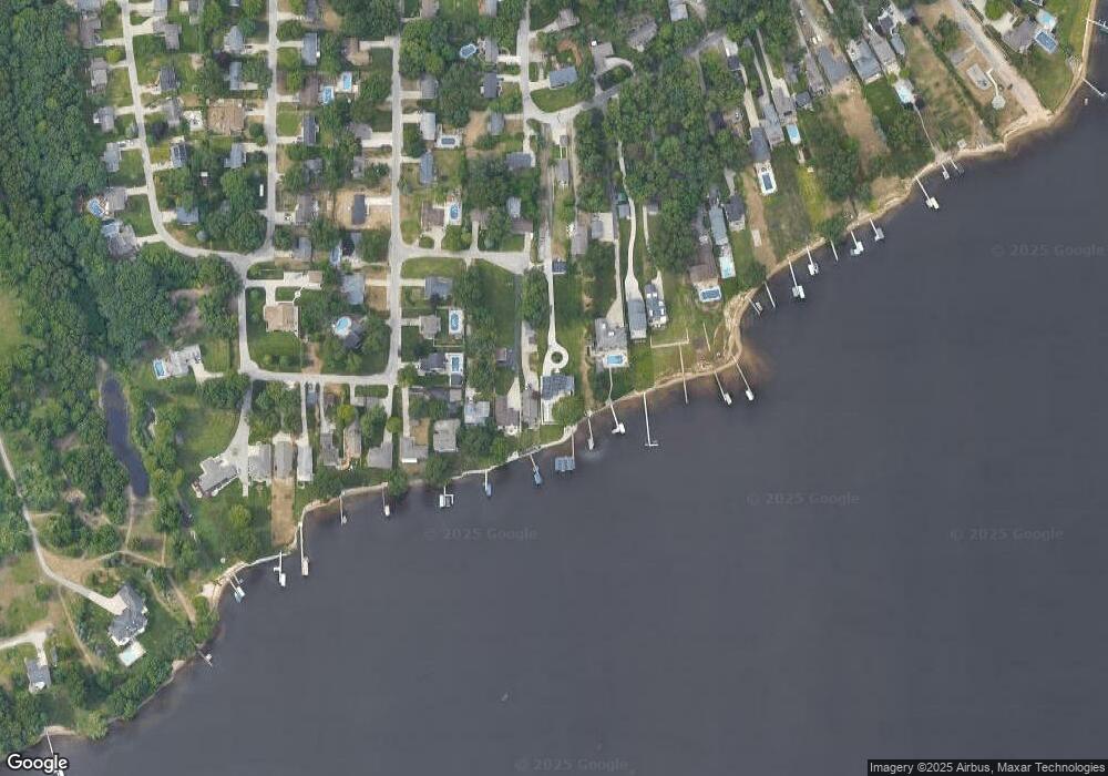
1599 Westwind Ct Muskegon, MI 49445
Estimated Value: $521,000 - $1,832,034
4
Beds
4
Baths
2,479
Sq Ft
$504/Sq Ft
Est. Value
About This Home
This home is located at 1599 Westwind Ct, Muskegon, MI 49445 and is currently estimated at $1,248,678, approximately $503 per square foot. 1599 Westwind Ct is a home located in Muskegon County with nearby schools including Reeths-Puffer High School.
Ownership History
Date
Name
Owned For
Owner Type
Purchase Details
Closed on
Sep 3, 2025
Sold by
Leestma Ryan M
Bought by
Leestma Ryan M and Leestma Emily S
Current Estimated Value
Purchase Details
Closed on
Dec 24, 2008
Sold by
Leestma Ryan M and Leestma Megan R
Bought by
Leestma Ryan M and Leestma Megan R
Purchase Details
Closed on
Jun 23, 2006
Sold by
Sullivan Brian and Sullivan Karyn M
Bought by
Leestma Ryan and Leestma Megan
Home Financials for this Owner
Home Financials are based on the most recent Mortgage that was taken out on this home.
Original Mortgage
$348,000
Interest Rate
6.68%
Mortgage Type
Unknown
Create a Home Valuation Report for This Property
The Home Valuation Report is an in-depth analysis detailing your home's value as well as a comparison with similar homes in the area
Home Values in the Area
Average Home Value in this Area
Purchase History
| Date | Buyer | Sale Price | Title Company |
|---|---|---|---|
| Leestma Ryan M | -- | None Listed On Document | |
| Leestma Ryan M | -- | None Available | |
| Leestma Ryan | -- | Harbor Title |
Source: Public Records
Mortgage History
| Date | Status | Borrower | Loan Amount |
|---|---|---|---|
| Previous Owner | Leestma Ryan | $348,000 |
Source: Public Records
Tax History Compared to Growth
Tax History
| Year | Tax Paid | Tax Assessment Tax Assessment Total Assessment is a certain percentage of the fair market value that is determined by local assessors to be the total taxable value of land and additions on the property. | Land | Improvement |
|---|---|---|---|---|
| 2025 | $16,780 | $907,100 | $0 | $0 |
| 2024 | $6,028 | $738,900 | $0 | $0 |
| 2023 | $5,763 | $697,300 | $0 | $0 |
| 2022 | $15,278 | $635,400 | $0 | $0 |
| 2021 | $23,096 | $575,700 | $0 | $0 |
| 2020 | $22,830 | $446,900 | $0 | $0 |
| 2019 | $12,150 | $237,600 | $0 | $0 |
| 2018 | $8,240 | $251,700 | $0 | $0 |
| 2017 | $9,661 | $203,400 | $0 | $0 |
| 2016 | $2,148 | $202,200 | $0 | $0 |
| 2015 | -- | $194,100 | $0 | $0 |
| 2014 | -- | $216,500 | $0 | $0 |
| 2013 | -- | $202,300 | $0 | $0 |
Source: Public Records
Map
Nearby Homes
- 1601 Westwind Ct
- 1616 Westwind Ct
- 1499 Glenwood Ave
- 421 W Chadwick Dr
- 1463 Glenwood Ave
- 0 Horton Rd Unit 25046889
- 908 Oakmere Place
- 780 Horton Rd
- 1018 Ruddiman Dr
- 1410 Mills Ave
- 2102 Lake Dr
- 777 Ruddiman Dr
- 1829 Moulton Ave
- 1596 Nottingham Ct
- 1045 Greenbriar Dr
- V/L Witham Rd
- 1709 Hampstead Dr
- 1127 S Robinhood Dr
- 1141 N Robinhood Dr
- 230 California Ave
- 1551 Glenwood Ave
- 1603 Westwind Ct
- 1611 Westwind Ct
- 366 E Chadwick Dr
- 386 E Chadwick Dr
- 1535 Glenwood Ave
- 1555 Glenwood Ave
- 1633 Westwind Ct
- 1617 Mulder Dr
- 1602 Westwind Ct
- 383 Horton Rd
- 1545 Glenwood Ave
- 1611 Mulder Dr
- 1559 Glenwood Ave
- 1636 Westwind Ct
- 1517 Glenwood Ave
- 0 E Chadwick Dr
- 1563 Glenwood Ave
- 1621 Mulder Dr
- 1662 Mulder Dr
