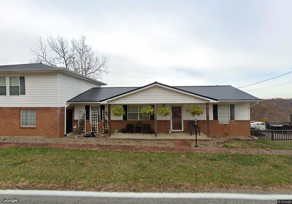
15993 State Route 217 Scottown, WV 45678
Estimated Value: $211,716 - $283,000
4
Beds
2
Baths
1,450
Sq Ft
$162/Sq Ft
Est. Value
About This Home
This home is located at 15993 State Route 217, Scottown, WV 45678 and is currently estimated at $234,179, approximately $161 per square foot. 15993 State Route 217 is a home located in Lawrence County with nearby schools including Fairland East Elementary School, Fairland West Elementary School, and Fairland Middle School.
Ownership History
Date
Name
Owned For
Owner Type
Purchase Details
Closed on
Apr 5, 2019
Sold by
Marshall Carolyn K
Bought by
Hysell Theresa D
Current Estimated Value
Home Financials for this Owner
Home Financials are based on the most recent Mortgage that was taken out on this home.
Original Mortgage
$146,301
Outstanding Balance
$131,555
Interest Rate
5.5%
Mortgage Type
FHA
Estimated Equity
$102,624
Purchase Details
Closed on
Mar 13, 2015
Sold by
Brumfield Johnny Dale and Brumfield Donetta
Bought by
Marshall Carolyn K
Purchase Details
Closed on
Mar 11, 2015
Sold by
Brumfield John and Brumfield Connie
Bought by
Brumfield Ii Johnny Dale
Purchase Details
Closed on
Sep 7, 2007
Sold by
Brumfield John and Brumfield Connie
Bought by
Brumfield Ii Johnny Dale
Home Financials for this Owner
Home Financials are based on the most recent Mortgage that was taken out on this home.
Original Mortgage
$40,000
Interest Rate
6.63%
Mortgage Type
Seller Take Back
Purchase Details
Closed on
Mar 4, 2005
Sold by
Brumfield John
Bought by
Brumfield John
Create a Home Valuation Report for This Property
The Home Valuation Report is an in-depth analysis detailing your home's value as well as a comparison with similar homes in the area
Home Values in the Area
Average Home Value in this Area
Purchase History
| Date | Buyer | Sale Price | Title Company |
|---|---|---|---|
| Hysell Theresa D | $149,000 | -- | |
| Marshall Carolyn K | -- | None Available | |
| Brumfield Ii Johnny Dale | -- | None Available | |
| Brumfield Ii Johnny Dale | $40,000 | Attorney | |
| Brumfield John | -- | None Available |
Source: Public Records
Mortgage History
| Date | Status | Borrower | Loan Amount |
|---|---|---|---|
| Open | Hysell Theresa D | $146,301 | |
| Previous Owner | Brumfield Ii Johnny Dale | $40,000 |
Source: Public Records
Tax History Compared to Growth
Tax History
| Year | Tax Paid | Tax Assessment Tax Assessment Total Assessment is a certain percentage of the fair market value that is determined by local assessors to be the total taxable value of land and additions on the property. | Land | Improvement |
|---|---|---|---|---|
| 2024 | -- | $53,120 | $5,110 | $48,010 |
| 2023 | $1,441 | $53,120 | $5,110 | $48,010 |
| 2022 | $1,439 | $53,120 | $5,110 | $48,010 |
| 2021 | $1,340 | $49,030 | $4,870 | $44,160 |
| 2020 | $1,415 | $49,030 | $4,870 | $44,160 |
| 2019 | $1,414 | $49,030 | $4,870 | $44,160 |
| 2018 | $1,425 | $49,030 | $4,870 | $44,160 |
| 2017 | $1,425 | $49,030 | $4,870 | $44,160 |
| 2016 | $1,321 | $49,030 | $4,870 | $44,160 |
| 2015 | $912 | $32,510 | $4,850 | $27,660 |
| 2014 | $935 | $32,510 | $4,850 | $27,660 |
| 2013 | $911 | $32,510 | $4,850 | $27,660 |
Source: Public Records
Map
Nearby Homes
- 1263 County Road 73
- 0 County Road 12
- 751 County Road 9
- 1101 Tinker Ln
- 1080 Tinker Ln
- 1432 County Road 42
- 1024 Amanda St
- 2255 County Road 66
- 2202 County Road 66
- State Route 790
- 767 Homestead Rd
- 2789 Left Fork 9 Mile Rd
- 0 Ohio 217
- 00 Ohio 217
- 146 Williams St
- 0 Township Road 1057 Unit 182524
- 190 Township Rd
- 1805 Long Creek Rd E
- 477 Township Road 88
- State Route 790
- 15993 State Route 217
- 15964 State Route 217
- 16135 State Route 217
- 16233 State Route 217
- 15662 State Route 217
- 16435 State Route 217
- 16460 State Route 217
- 931 County Road 73
- 16566 State Route 217
- 904 County Road 73
- 244 Private Road 15243 Unit 217
- 1263 1263 County Road 73
- 814 County Road 73
- 1389 County Road 73
- 7562 County Road 12
- 1479 County Road 73
- 1451 County Road 73
- 1505 County Road 73
- 15215 State Route 217
- 7452 County Road 12