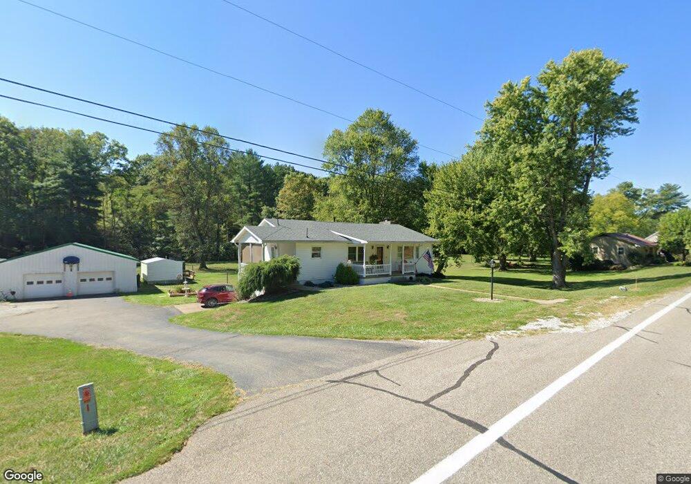
15998 State Route 550 Fleming, OH 45729
Estimated Value: $204,000 - $302,000
3
Beds
2
Baths
1,305
Sq Ft
$183/Sq Ft
Est. Value
About This Home
This home is located at 15998 State Route 550, Fleming, OH 45729 and is currently estimated at $239,346, approximately $183 per square foot. 15998 State Route 550 is a home located in Washington County with nearby schools including Warren High School.
Ownership History
Date
Name
Owned For
Owner Type
Purchase Details
Closed on
Jun 2, 2022
Sold by
Corp Lillian I
Bought by
Corp Lillian I and Kelley Sheila A
Current Estimated Value
Purchase Details
Closed on
May 27, 2022
Sold by
Fouss Cameron D
Bought by
Gibson Trust
Purchase Details
Closed on
Feb 5, 2009
Sold by
Gibson James W and Gibson Juanita M
Bought by
Gibson James W and Gibson Juanita M
Create a Home Valuation Report for This Property
The Home Valuation Report is an in-depth analysis detailing your home's value as well as a comparison with similar homes in the area
Purchase History
We collect this data history from publicly available records. To have your information removed, we recommend requesting removal directly through your county’s website.
| Date | Buyer | Sale Price | Title Company |
|---|---|---|---|
| Corp Lillian I | $250 | None Listed On Document | |
| Gibson Trust | $500 | Fouss Cameron D | |
| Fouss Cameron D | $250 | Fouss Cameron D | |
| Gibson James W | -- | Attorney |
Source: Public Records
Tax History
| Year | Tax Paid | Tax Assessment Tax Assessment Total Assessment is a certain percentage of the fair market value that is determined by local assessors to be the total taxable value of land and additions on the property. | Land | Improvement |
|---|---|---|---|---|
| 2025 | $2,516 | $78,090 | $13,020 | $65,070 |
| 2024 | $2,516 | $64,850 | $10,520 | $54,330 |
| 2023 | $2,090 | $64,850 | $10,520 | $54,330 |
| 2022 | $2,124 | $64,850 | $10,520 | $54,330 |
| 2021 | $1,580 | $48,610 | $7,340 | $41,270 |
| 2020 | $1,578 | $48,610 | $7,340 | $41,270 |
| 2019 | $1,556 | $48,610 | $7,340 | $41,270 |
| 2018 | $1,401 | $43,700 | $6,380 | $37,320 |
| 2017 | $1,394 | $43,700 | $6,380 | $37,320 |
| 2016 | $2,224 | $43,700 | $6,380 | $37,320 |
| 2015 | $1,161 | $41,120 | $6,130 | $34,990 |
| 2014 | $2,116 | $41,120 | $6,130 | $34,990 |
| 2013 | $582 | $41,120 | $6,130 | $34,990 |
Source: Public Records
Map
Nearby Homes
- 330 Wynncrest Dr
- 165 Wynnwood Dr
- 16770 State Route 550
- 109 Clare Kennedy Dr
- 1266 Warren Chapel Rd
- 81 James Rd
- 400 Bethel Rd
- 280 Asher Ln
- 0 Fisher Ridge Rd Tract 6
- 0 Fisher Ridge Rd Tract 7
- 0 Fisher Ridge Rd Tract 5
- 0 Fisher Ridge Rd Tract 2
- 0 Fisher Ridge Rd Tract 1
- 0 Fisher Ridge Rd
- 10174 Veto Rd
- 303 59th St
- 0 Tadpole Run Rd
- 5515 Grand Central Ave
- 20 Silver Globe Rd
- 20043 State Route 550
- 15958 State Route 550
- 15936 State Route 550
- 15850 State Route 550
- 15780 State Route 550
- 15834 Ohio 550
- 15850 Oh 550
- 15850 Ohio 550
- 15780 Oh 550
- 15780 Ohio 550
- 98 Salster Rd
- 15870 State Route 550
- 15768 Ohio 550
- 15901 Ohio 550
- 15752 State Route 550
- 15724 State Route 550
- 15936 Ohio 550
- 96 Salster Rd
- 15901 State Route 550
- 15619 State Route 550
- 15913 State Route 550
Your Personal Tour Guide
Ask me questions while you tour the home.