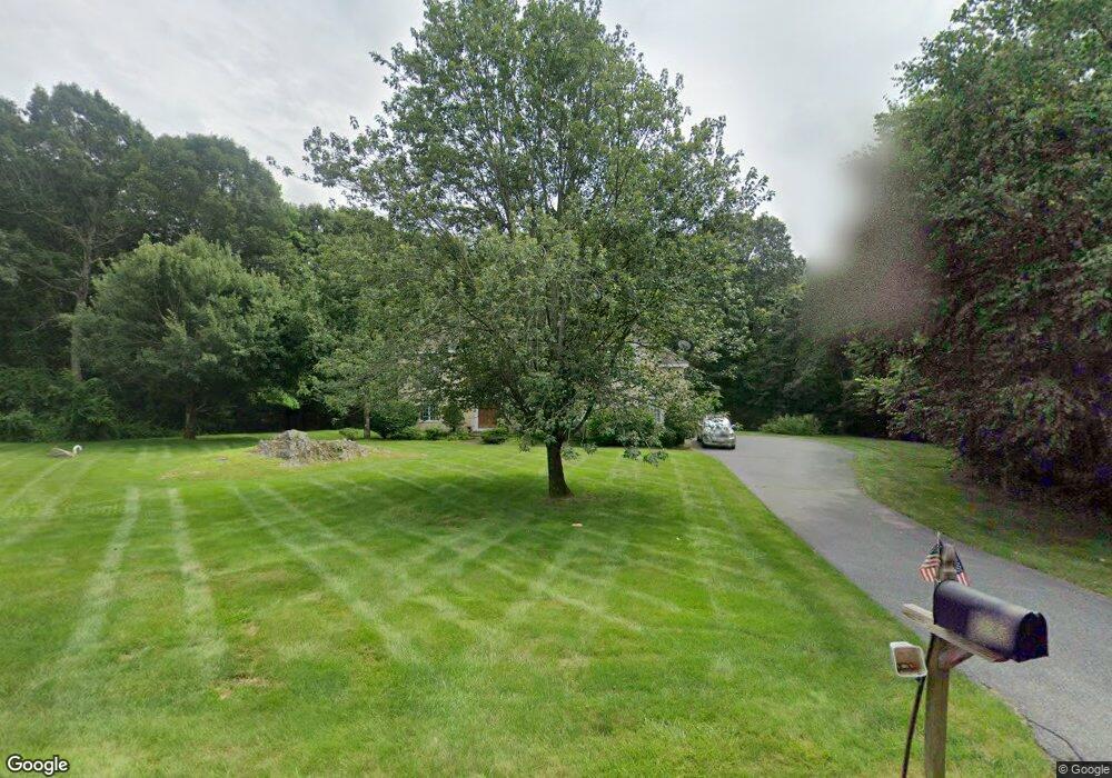
16 Adams St Boylston, MA 01505
Estimated Value: $1,034,012 - $1,255,000
4
Beds
3
Baths
4,120
Sq Ft
$281/Sq Ft
Est. Value
About This Home
This home is located at 16 Adams St, Boylston, MA 01505 and is currently estimated at $1,159,003, approximately $281 per square foot. 16 Adams St is a home located in Worcester County with nearby schools including Tahanto Regional High School and St Mary Elementary School.
Ownership History
Date
Name
Owned For
Owner Type
Purchase Details
Closed on
Sep 25, 1998
Sold by
Ercolani Guy A and Ercolani Susan D
Bought by
Hackett Christopher and Hackett Rebecca L
Current Estimated Value
Purchase Details
Closed on
Aug 1, 1995
Sold by
Marbro Hudston Inc
Bought by
Ercolani Guy and Ercolani Susan
Create a Home Valuation Report for This Property
The Home Valuation Report is an in-depth analysis detailing your home's value as well as a comparison with similar homes in the area
Home Values in the Area
Average Home Value in this Area
Purchase History
| Date | Buyer | Sale Price | Title Company |
|---|---|---|---|
| Hackett Christopher | $430,000 | -- | |
| Ercolani Guy | $75,000 | -- |
Source: Public Records
Mortgage History
| Date | Status | Borrower | Loan Amount |
|---|---|---|---|
| Open | Ercolani Guy | $365,000 | |
| Closed | Ercolani Guy | $375,000 | |
| Closed | Ercolani Guy | $48,000 |
Source: Public Records
Tax History
| Year | Tax Paid | Tax Assessment Tax Assessment Total Assessment is a certain percentage of the fair market value that is determined by local assessors to be the total taxable value of land and additions on the property. | Land | Improvement |
|---|---|---|---|---|
| 2025 | $13,020 | $941,400 | $229,800 | $711,600 |
| 2024 | $11,661 | $844,400 | $229,800 | $614,600 |
| 2023 | $10,708 | $743,600 | $202,200 | $541,400 |
| 2022 | $11,779 | $743,600 | $202,200 | $541,400 |
| 2021 | $3,682 | $711,800 | $202,200 | $509,600 |
| 2020 | $11,730 | $709,200 | $201,800 | $507,400 |
| 2019 | $3,614 | $681,100 | $200,200 | $480,900 |
| 2018 | $3,681 | $658,400 | $200,200 | $458,200 |
| 2017 | $10,613 | $658,400 | $200,200 | $458,200 |
| 2016 | $10,295 | $628,900 | $180,200 | $448,700 |
| 2015 | $10,949 | $628,900 | $180,200 | $448,700 |
| 2014 | $10,168 | $584,700 | $167,000 | $417,700 |
Source: Public Records
Map
Nearby Homes
- 505 Cross St
- 52 Barnard Hill Rd
- 49 Barnard Hill Rd
- 30 Bridle Path
- 15 Rocky Pond Rd
- 1 Harmony Ln Unit 4
- 38 Keyes House Rd
- 279 Sewall St Unit 279
- 281 Sewall St Unit 281
- 289 Sewall St Unit 289
- 291 Sewall St Unit 291
- 7-11 Reservoir St
- 9 Morningside Dr
- 24 Morningside Dr
- 5 Barnard Hill Rd
- 8 Hunter Cir
- 202 Prospect St
- 28 Sewall St
- 17 Wilder Rd
- 2 Clover Glen Cir
Your Personal Tour Guide
Ask me questions while you tour the home.