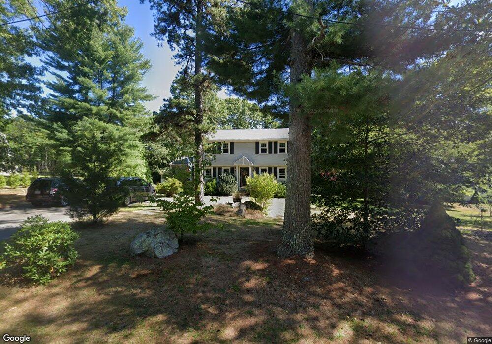
16 Algonquin Way East Freetown, MA 02717
Estimated Value: $634,756 - $736,000
4
Beds
2
Baths
1,938
Sq Ft
$344/Sq Ft
Est. Value
About This Home
This home is located at 16 Algonquin Way, East Freetown, MA 02717 and is currently estimated at $666,939, approximately $344 per square foot. 16 Algonquin Way is a home located in Bristol County with nearby schools including Freetown Elementary School, George R Austin Intermediate School, and Freetown-Lakeville Middle School.
Ownership History
Date
Name
Owned For
Owner Type
Purchase Details
Closed on
Aug 26, 2010
Sold by
Cox Russell D and Cox Sonya L
Bought by
Lundrigan David P and Lundrigan Lisa M
Current Estimated Value
Home Financials for this Owner
Home Financials are based on the most recent Mortgage that was taken out on this home.
Original Mortgage
$250,900
Outstanding Balance
$166,181
Interest Rate
4.5%
Mortgage Type
FHA
Estimated Equity
$500,758
Purchase Details
Closed on
Aug 30, 2001
Sold by
Stonge Lawrence and Stonge Jacqueline A
Bought by
Pietrzyk Mark D and Pietrzyk Rhonda M
Create a Home Valuation Report for This Property
The Home Valuation Report is an in-depth analysis detailing your home's value as well as a comparison with similar homes in the area
Home Values in the Area
Average Home Value in this Area
Purchase History
| Date | Buyer | Sale Price | Title Company |
|---|---|---|---|
| Lundrigan David P | $260,000 | -- | |
| Pietrzyk Mark D | $238,000 | -- |
Source: Public Records
Mortgage History
| Date | Status | Borrower | Loan Amount |
|---|---|---|---|
| Open | Lundrigan David P | $250,900 | |
| Previous Owner | Pietrzyk Mark D | $284,750 | |
| Previous Owner | Pietrzyk Mark D | $220,980 |
Source: Public Records
Tax History Compared to Growth
Tax History
| Year | Tax Paid | Tax Assessment Tax Assessment Total Assessment is a certain percentage of the fair market value that is determined by local assessors to be the total taxable value of land and additions on the property. | Land | Improvement |
|---|---|---|---|---|
| 2025 | $4,942 | $498,700 | $180,500 | $318,200 |
| 2024 | $4,908 | $470,600 | $170,300 | $300,300 |
| 2023 | $4,808 | $448,900 | $153,300 | $295,600 |
| 2022 | $4,579 | $379,700 | $129,900 | $249,800 |
| 2021 | $4,389 | $345,600 | $118,100 | $227,500 |
| 2020 | $4,376 | $336,100 | $113,600 | $222,500 |
| 2019 | $4,132 | $314,200 | $108,200 | $206,000 |
| 2018 | $3,893 | $292,500 | $108,200 | $184,300 |
| 2017 | $3,812 | $286,200 | $108,200 | $178,000 |
| 2016 | $3,639 | $278,000 | $105,100 | $172,900 |
| 2015 | $3,542 | $274,600 | $105,100 | $169,500 |
| 2014 | $3,391 | $268,900 | $102,900 | $166,000 |
Source: Public Records
Map
Nearby Homes
- 144 Chace Rd
- 150 Quanapoag Rd
- Lot 2/3 Quanapoag Rd
- 0 Costa Dr
- 599 Quanapoag Rd
- 195 Slab Bridge Rd
- 1475 Braley Rd Unit 17
- 264 Collins Corner Rd
- 13 Luscomb Ln
- 16 Swallow St
- 4597 Acushnet Ave
- 1069 Cherokee St
- 353 Upland St
- 64 Blaze Rd
- 319 Northwest St
- 300 High Hill Rd
- 210 Heritage Dr
- 34 Poplar Rd
- 145 Heritage Dr
- 24 Bells Brook Rd
- 18 Algonquin Way
- 14 Algonquin Way
- 12 Algonquin Way
- 15 Algonquin Way
- 4 Wamsutta Way
- 13 Algonquin Way
- 10 Algonquin Way
- 11 Algonquin Way
- 3 Fall Brook Ln
- 5 Fall Brook Ln
- 5 Wamsutta Way
- 9 Algonquin Way
- 135 Bullock Rd
- 8 Algonquin Way
- 133 Bullock Rd
- 137 Bullock Rd
- 139 Bullock Rd
- 21 Algonquin Way
- 7 Algonquin Way
- 129 Bullock Rd