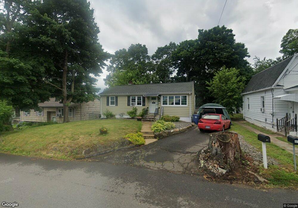
16 Allan St West Haven, CT 06516
Allingtown NeighborhoodEstimated Value: $309,101 - $344,000
3
Beds
1
Bath
988
Sq Ft
$326/Sq Ft
Est. Value
About This Home
This home is located at 16 Allan St, West Haven, CT 06516 and is currently estimated at $322,525, approximately $326 per square foot. 16 Allan St is a home located in New Haven County with nearby schools including Carrigan 5/6 Intermediate School, Harry M. Bailey Middle School, and West Haven High School.
Ownership History
Date
Name
Owned For
Owner Type
Purchase Details
Closed on
Mar 15, 2018
Sold by
Dewarga J Christopher J and Dewarga Rosemary
Bought by
Dewarga Rosemary
Current Estimated Value
Create a Home Valuation Report for This Property
The Home Valuation Report is an in-depth analysis detailing your home's value as well as a comparison with similar homes in the area
Home Values in the Area
Average Home Value in this Area
Purchase History
| Date | Buyer | Sale Price | Title Company |
|---|---|---|---|
| Dewarga Rosemary | -- | -- | |
| Dewarga Rosemary | -- | -- |
Source: Public Records
Mortgage History
| Date | Status | Borrower | Loan Amount |
|---|---|---|---|
| Previous Owner | Dewarga Rosemary | $120,000 | |
| Previous Owner | Dewarga Rosemary | $110,907 |
Source: Public Records
Tax History Compared to Growth
Tax History
| Year | Tax Paid | Tax Assessment Tax Assessment Total Assessment is a certain percentage of the fair market value that is determined by local assessors to be the total taxable value of land and additions on the property. | Land | Improvement |
|---|---|---|---|---|
| 2025 | $6,404 | $188,300 | $61,180 | $127,120 |
| 2024 | $5,521 | $115,290 | $42,350 | $72,940 |
| 2023 | $5,352 | $115,290 | $42,350 | $72,940 |
| 2022 | $5,258 | $115,290 | $42,350 | $72,940 |
| 2021 | $5,260 | $115,290 | $42,350 | $72,940 |
| 2020 | $5,166 | $100,310 | $34,230 | $66,080 |
| 2019 | $5,086 | $100,310 | $34,230 | $66,080 |
| 2018 | $4,947 | $100,310 | $34,230 | $66,080 |
| 2017 | $4,793 | $100,310 | $34,230 | $66,080 |
| 2016 | $4,647 | $100,310 | $34,230 | $66,080 |
| 2015 | $4,275 | $105,070 | $37,660 | $67,410 |
| 2014 | $4,190 | $105,070 | $37,660 | $67,410 |
Source: Public Records
Map
Nearby Homes
- 60 Andrews St
- 38 Chauncey St
- 0 Burwell & Woodfield Rd Unit 24051262
- 0 Burwell Rd
- 29 Birch St
- 14 Homestead Ave
- 81 Homeside Ave
- 65 Westfield St
- 22 Bristol St
- 104 Terrace Ave
- 103 Gilbert St
- 35 Terrace Ave
- 1014 Campbell Ave Unit 14
- 78 Nonquit St
- 194 Homeside Ave
- 100 Yates St
- 63 Glade St Unit C1
- 50 Morris Ave
- 56 Highview Ave
- 52 Highview Ave