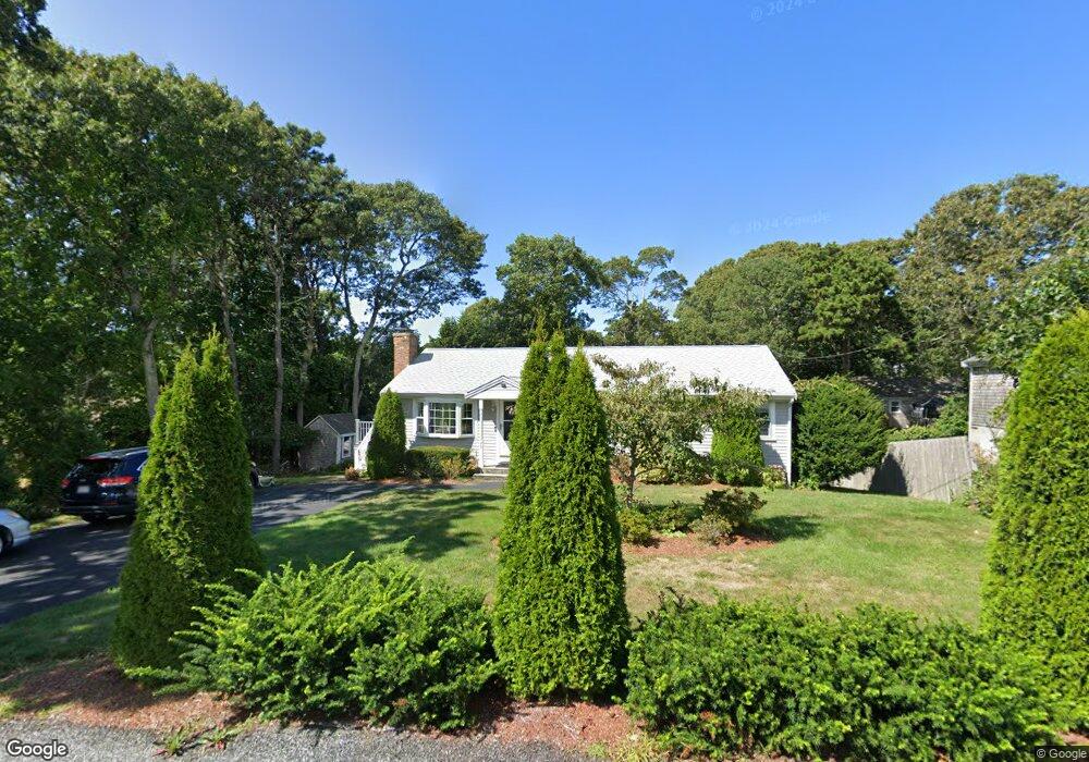
16 April Way Unit 1 Yarmouth Port, MA 02675
Yarmouth Port NeighborhoodEstimated Value: $494,000 - $632,000
3
Beds
1
Bath
1,056
Sq Ft
$521/Sq Ft
Est. Value
About This Home
This home is located at 16 April Way Unit 1, Yarmouth Port, MA 02675 and is currently estimated at $550,019, approximately $520 per square foot. 16 April Way Unit 1 is a home located in Barnstable County with nearby schools including Dennis-Yarmouth Regional High School.
Ownership History
Date
Name
Owned For
Owner Type
Purchase Details
Closed on
May 27, 2015
Sold by
Fritsch Lynda A
Bought by
Charlot Antoine R
Current Estimated Value
Home Financials for this Owner
Home Financials are based on the most recent Mortgage that was taken out on this home.
Original Mortgage
$218,500
Outstanding Balance
$168,628
Interest Rate
3.65%
Mortgage Type
New Conventional
Estimated Equity
$381,391
Purchase Details
Closed on
Feb 27, 2007
Sold by
Monahan Wendy E and Monahan William S
Bought by
Fritsch Lynda A
Home Financials for this Owner
Home Financials are based on the most recent Mortgage that was taken out on this home.
Original Mortgage
$175,000
Interest Rate
6.23%
Mortgage Type
Purchase Money Mortgage
Purchase Details
Closed on
Dec 15, 2003
Sold by
Santos John Stewart and Santos Ruth Ann
Bought by
Monahan William S and Monahan Wendy E
Home Financials for this Owner
Home Financials are based on the most recent Mortgage that was taken out on this home.
Original Mortgage
$190,800
Interest Rate
5.9%
Mortgage Type
Purchase Money Mortgage
Create a Home Valuation Report for This Property
The Home Valuation Report is an in-depth analysis detailing your home's value as well as a comparison with similar homes in the area
Home Values in the Area
Average Home Value in this Area
Purchase History
| Date | Buyer | Sale Price | Title Company |
|---|---|---|---|
| Charlot Antoine R | $230,000 | -- | |
| Fritsch Lynda A | $261,700 | -- | |
| Monahan William S | $212,000 | -- |
Source: Public Records
Mortgage History
| Date | Status | Borrower | Loan Amount |
|---|---|---|---|
| Open | Charlot Antoine R | $218,500 | |
| Previous Owner | Monahan William S | $174,400 | |
| Previous Owner | Fritsch Lynda A | $175,000 | |
| Previous Owner | Monahan William S | $190,800 |
Source: Public Records
Tax History Compared to Growth
Tax History
| Year | Tax Paid | Tax Assessment Tax Assessment Total Assessment is a certain percentage of the fair market value that is determined by local assessors to be the total taxable value of land and additions on the property. | Land | Improvement |
|---|---|---|---|---|
| 2025 | $3,021 | $426,700 | $161,800 | $264,900 |
| 2024 | $2,832 | $383,800 | $140,700 | $243,100 |
| 2023 | $2,782 | $343,000 | $127,900 | $215,100 |
| 2022 | $2,688 | $292,800 | $122,100 | $170,700 |
| 2021 | $2,547 | $266,400 | $122,100 | $144,300 |
| 2020 | $2,576 | $257,600 | $129,200 | $128,400 |
| 2019 | $2,410 | $238,600 | $129,200 | $109,400 |
| 2018 | $2,234 | $217,100 | $107,700 | $109,400 |
| 2017 | $2,175 | $217,100 | $107,700 | $109,400 |
| 2016 | $2,081 | $208,500 | $99,100 | $109,400 |
| 2015 | $2,100 | $209,200 | $94,800 | $114,400 |
Source: Public Records
Map
Nearby Homes
- 44 Stratford Ln
- 6 Nimble Hill Dr
- 800 Route 6a
- 800 Route 6a
- 43 Canterbury Rd
- 64 Kates Path
- 17 Kates Path Unit A
- 228 Kates Path
- 21 Boxwood Cir
- 111 Merchant Ave
- 19 John Halls Cartpath Village Unit E
- 17 Nottingham Dr
- 59 Route 6a Unit 29-4
- 19 John Hall Cartway Unit E
- 42 John Hall Cartway Unit 42
- 50 John Hall Cartway
- 50 John Hall Cartway Unit 50
- 28 Oak Glen
- 13 Covey Dr
- 158 Kates Path