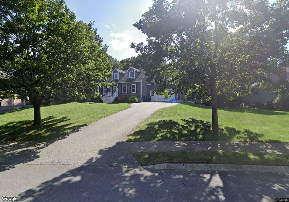
16 Ashwood Ave Wilmington, MA 01887
Estimated Value: $960,497 - $1,081,000
3
Beds
3
Baths
2,500
Sq Ft
$407/Sq Ft
Est. Value
About This Home
This home is located at 16 Ashwood Ave, Wilmington, MA 01887 and is currently estimated at $1,018,624, approximately $407 per square foot. 16 Ashwood Ave is a home located in Middlesex County with nearby schools including Wilmington Middle School, Wilmington High School, and The Pike School.
Ownership History
Date
Name
Owned For
Owner Type
Purchase Details
Closed on
Jun 30, 2003
Sold by
Connors Christian D and Connors Jessica
Bought by
Jenks Corey D
Current Estimated Value
Home Financials for this Owner
Home Financials are based on the most recent Mortgage that was taken out on this home.
Original Mortgage
$368,000
Interest Rate
5.53%
Mortgage Type
Purchase Money Mortgage
Purchase Details
Closed on
Jun 9, 1998
Sold by
Steines Richard C and Steines Jill K
Bought by
Connors Christian D
Purchase Details
Closed on
May 15, 1991
Sold by
Fonzi Fonzi Sr Daniel D Sr Daniel D
Bought by
Steines Richard C
Create a Home Valuation Report for This Property
The Home Valuation Report is an in-depth analysis detailing your home's value as well as a comparison with similar homes in the area
Home Values in the Area
Average Home Value in this Area
Purchase History
| Date | Buyer | Sale Price | Title Company |
|---|---|---|---|
| Jenks Corey D | $460,000 | -- | |
| Connors Christian D | $267,000 | -- | |
| Steines Richard C | $200,000 | -- |
Source: Public Records
Mortgage History
| Date | Status | Borrower | Loan Amount |
|---|---|---|---|
| Open | Steines Richard C | $392,800 | |
| Closed | Jenks Corey D | $368,000 | |
| Previous Owner | Steines Richard C | $214,000 |
Source: Public Records
Tax History Compared to Growth
Tax History
| Year | Tax Paid | Tax Assessment Tax Assessment Total Assessment is a certain percentage of the fair market value that is determined by local assessors to be the total taxable value of land and additions on the property. | Land | Improvement |
|---|---|---|---|---|
| 2025 | $9,998 | $873,200 | $345,500 | $527,700 |
| 2024 | $9,446 | $826,400 | $345,500 | $480,900 |
| 2023 | $9,160 | $767,200 | $293,200 | $474,000 |
| 2022 | $8,963 | $687,900 | $244,200 | $443,700 |
| 2021 | $8,811 | $636,600 | $222,000 | $414,600 |
| 2020 | $8,756 | $644,800 | $222,000 | $422,800 |
| 2019 | $8,598 | $625,300 | $217,100 | $408,200 |
| 2018 | $8,104 | $562,400 | $206,800 | $355,600 |
| 2017 | $7,858 | $543,800 | $206,800 | $337,000 |
| 2016 | $7,334 | $501,300 | $197,000 | $304,300 |
| 2015 | $7,001 | $487,200 | $197,000 | $290,200 |
| 2014 | $6,711 | $471,300 | $187,700 | $283,600 |
Source: Public Records
Map
Nearby Homes
- 398 Andover St
- 23 Pomeroy Rd
- 2 Clover Cir
- 12 Taylor Cove Dr Unit 6
- 13 Taylor Cove Dr Unit 13
- B1 Colonial Dr Unit 8
- 497 S Main St
- 24 Enfield Dr
- 30A Colonial Dr Unit 6
- 20 Colonial Dr Unit 3
- 4 Porter Rd
- 10 Voke St
- 18 Boston Rd
- 9 Marie Dr
- 300 Martins Landing Unit 107
- 250 Martins Landing Unit 213
- 7 Countryside Way
- 2 Regency Ridge
- 260 Martins Landing Unit 103
- 240 Martins Landing Unit 409
- 18 Ashwood Ave
- 14 Ashwood Ave
- 15 Ashwood Ave
- 17 Ashwood Ave
- 12 Ashwood Ave
- 11 Ashwood Ave
- 10 Blueberry Ln
- 20 Ashwood Ave
- 9 Ashwood Ave
- 2 Dogwood Ln
- 2 Dogwood Ln
- 12 Blueberry Ln
- 10 Ashwood Ave
- 19 Ashwood Ave
- 21 Ashwood Ave
- 7 Ashwood Ave
- 14 Blueberry Ln
- 22 Ashwood Ave
- 18 Dogwood Ln Unit 1801
- 12 Fiorenza Dr