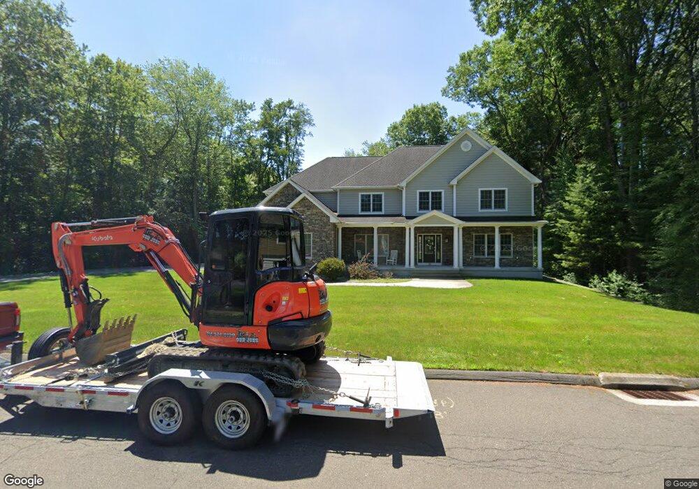
16 Briar Cliff Dr Wilbraham, MA 01095
Estimated Value: $913,841 - $1,021,000
5
Beds
3
Baths
4,318
Sq Ft
$222/Sq Ft
Est. Value
About This Home
This home is located at 16 Briar Cliff Dr, Wilbraham, MA 01095 and is currently estimated at $956,947, approximately $221 per square foot. 16 Briar Cliff Dr is a home with nearby schools including Minnechaug Regional High School, Springfield International Charter School, and Wilbraham & Monson Academy.
Ownership History
Date
Name
Owned For
Owner Type
Purchase Details
Closed on
Oct 11, 2013
Sold by
Viscito Leonard
Bought by
Coyne Andrew J
Current Estimated Value
Home Financials for this Owner
Home Financials are based on the most recent Mortgage that was taken out on this home.
Original Mortgage
$86,800
Outstanding Balance
$65,299
Interest Rate
4.53%
Mortgage Type
New Conventional
Estimated Equity
$891,648
Create a Home Valuation Report for This Property
The Home Valuation Report is an in-depth analysis detailing your home's value as well as a comparison with similar homes in the area
Home Values in the Area
Average Home Value in this Area
Purchase History
| Date | Buyer | Sale Price | Title Company |
|---|---|---|---|
| Coyne Andrew J | $123,000 | -- |
Source: Public Records
Mortgage History
| Date | Status | Borrower | Loan Amount |
|---|---|---|---|
| Open | Coyne Andrew J | $86,800 |
Source: Public Records
Tax History Compared to Growth
Tax History
| Year | Tax Paid | Tax Assessment Tax Assessment Total Assessment is a certain percentage of the fair market value that is determined by local assessors to be the total taxable value of land and additions on the property. | Land | Improvement |
|---|---|---|---|---|
| 2025 | $14,935 | $835,300 | $115,200 | $720,100 |
| 2024 | $14,650 | $791,900 | $115,200 | $676,700 |
| 2023 | $13,103 | $709,200 | $115,200 | $594,000 |
| 2022 | $13,103 | $639,500 | $115,200 | $524,300 |
| 2021 | $13,771 | $599,800 | $116,200 | $483,600 |
| 2020 | $13,424 | $599,800 | $116,200 | $483,600 |
| 2019 | $13,076 | $599,800 | $116,200 | $483,600 |
| 2018 | $12,923 | $570,800 | $116,200 | $454,600 |
| 2017 | $11,429 | $519,500 | $116,200 | $403,300 |
| 2016 | $2,603 | $120,500 | $120,500 | $0 |
| 2015 | $2,819 | $135,000 | $135,000 | $0 |
Source: Public Records
Map
Nearby Homes
- 11 Wellfleet Dr
- 15 Sandalwood Dr Unit site 00
- 26 Sandalwood Dr
- 34 Blacksmith Rd
- 103 Sandalwood Dr Unit site 00
- 111 Sandalwood Dr Unit site 00
- 57 Sandalwood Dr Unit site 61
- 99 Sandalwood Dr Unit site 00
- 6V Melikian Dr
- 6 Teak Terrace Unit 24
- 10 Forest Glade Dr
- 500 Springfield St
- 136 Joan St
- 211 Glenoak Dr
- 24 Lodge Ln Unit 24
- 116 Cherry Dr Unit 116
- 19 Linwood Dr
- 41 Queensbury Dr
- 2205 Boston Rd Unit I 82
- 8 Patriot Ridge Ln