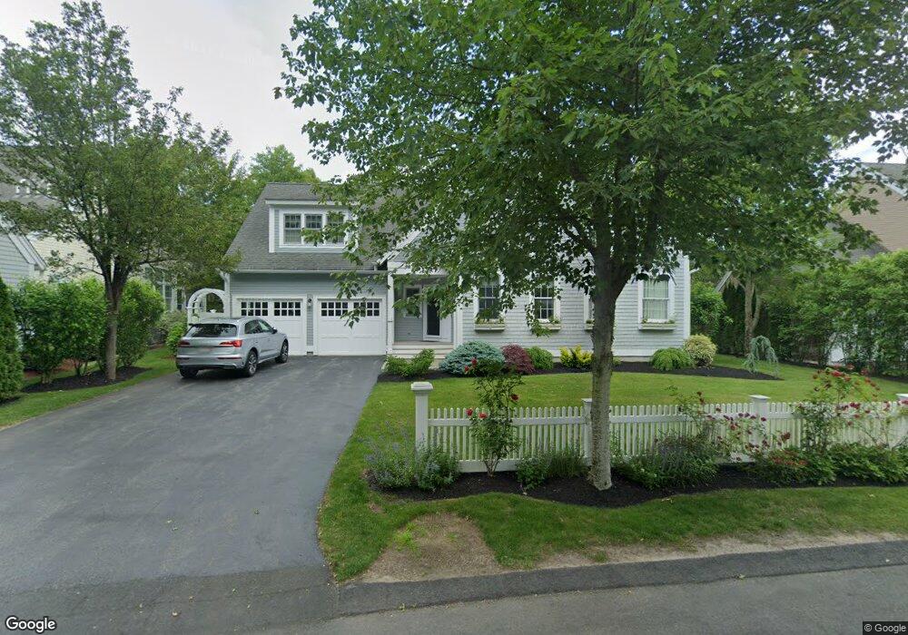
16 Bridge Gate Plymouth, MA 02360
The Pinehills NeighborhoodEstimated Value: $1,072,335 - $1,264,000
3
Beds
4
Baths
3,386
Sq Ft
$348/Sq Ft
Est. Value
About This Home
This home is located at 16 Bridge Gate, Plymouth, MA 02360 and is currently estimated at $1,179,584, approximately $348 per square foot. 16 Bridge Gate is a home located in Plymouth County with nearby schools including Nathaniel Morton Elementary School, Plymouth Community Intermediate, and Plymouth North High School.
Ownership History
Date
Name
Owned For
Owner Type
Purchase Details
Closed on
Dec 18, 2007
Sold by
Thorndike Prop Mass Ll and Geisinger
Bought by
Defalco Gordon A and Fitzgerald Kathleen L
Current Estimated Value
Home Financials for this Owner
Home Financials are based on the most recent Mortgage that was taken out on this home.
Original Mortgage
$642,744
Outstanding Balance
$406,830
Interest Rate
6.3%
Mortgage Type
Purchase Money Mortgage
Estimated Equity
$772,754
Create a Home Valuation Report for This Property
The Home Valuation Report is an in-depth analysis detailing your home's value as well as a comparison with similar homes in the area
Home Values in the Area
Average Home Value in this Area
Purchase History
| Date | Buyer | Sale Price | Title Company |
|---|---|---|---|
| Defalco Gordon A | $714,160 | -- |
Source: Public Records
Mortgage History
| Date | Status | Borrower | Loan Amount |
|---|---|---|---|
| Open | Defalco Gordon A | $300,000 | |
| Open | Defalco Gordon A | $642,744 |
Source: Public Records
Tax History Compared to Growth
Tax History
| Year | Tax Paid | Tax Assessment Tax Assessment Total Assessment is a certain percentage of the fair market value that is determined by local assessors to be the total taxable value of land and additions on the property. | Land | Improvement |
|---|---|---|---|---|
| 2025 | $11,089 | $873,800 | $239,500 | $634,300 |
| 2024 | $10,579 | $822,000 | $226,600 | $595,400 |
| 2023 | $10,219 | $745,400 | $188,800 | $556,600 |
| 2022 | $9,883 | $640,500 | $179,600 | $460,900 |
| 2021 | $9,812 | $607,200 | $179,600 | $427,600 |
| 2020 | $9,764 | $597,200 | $175,000 | $422,200 |
| 2019 | $9,848 | $595,400 | $170,400 | $425,000 |
| 2018 | $9,764 | $593,200 | $165,800 | $427,400 |
| 2017 | $9,606 | $579,400 | $165,800 | $413,600 |
| 2016 | $9,471 | $582,100 | $165,800 | $416,300 |
| 2015 | $9,088 | $584,800 | $165,800 | $419,000 |
| 2014 | $8,141 | $538,100 | $169,400 | $368,700 |
Source: Public Records
Map
Nearby Homes
- 18 Great Kame
- 10 Shutter Latch
- 68 Bentgrass Mist Unit 68
- 55 Bentgrass Mist Unit 55
- 5 Morning Stroll
- 61 Bentgrass Mist Unit 61
- 59 Bentgrass Mist Unit 59
- 12 Stones Throw
- 19 Ludlow Trail
- 48 Briarwood
- 30 Broadleaf
- 12 Broadleaf
- 4 Broadleaf Unit 15
- 7 Broadleaf
- 7 Broadleaf Unit 3
- 15 Broadleaf
- 4 Broadleaf
- 10 Broadleaf
- 9 Broadleaf
- Hager Plan at Toll Brothers at The Pinehills - Broadleaf
- 14 Bridge Gate
- 18 Bridge Gate
- 12 Bridge Gate
- 20 Bridge Gate
- Lot 331/21 Bridge Gate
- Lot 321 Bridge Gate
- Lot 330 Bridge Gate
- Lot 326 Bridge Gate
- Lot 324 Bridge Gate
- Lot 332 Bridge Gate
- Lot 331 Bridge Gate
- Lot 329 Bridge Gate
- Lot 325 Bridge Gate
- Lot 328 Bridge Gate
- Lot 318 Bridge Gate
- Lot 316 Bridge Gate
- Lot 315 Bridge Gate
- 328 Bridge Gate
- 326 Bridge Gate
- 321 Bridge Gate