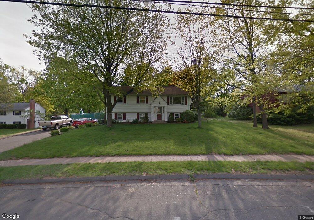
16 Butternut Dr East Hartford, CT 06118
Estimated Value: $437,000 - $496,000
3
Beds
3
Baths
2,240
Sq Ft
$206/Sq Ft
Est. Value
About This Home
This home is located at 16 Butternut Dr, East Hartford, CT 06118 and is currently estimated at $461,556, approximately $206 per square foot. 16 Butternut Dr is a home located in Hartford County with nearby schools including Governor William Pitkin School, East Hartford Middle School, and East Hartford High School.
Ownership History
Date
Name
Owned For
Owner Type
Purchase Details
Closed on
Nov 22, 2010
Sold by
Morrison Mary Jo
Bought by
Mary Jo Morrison Ret and Morrison Mary Jo
Current Estimated Value
Home Financials for this Owner
Home Financials are based on the most recent Mortgage that was taken out on this home.
Original Mortgage
$177,083
Interest Rate
4.37%
Purchase Details
Closed on
Sep 10, 2010
Sold by
Mary Jo Morrison Ret and Morrison Mary Jo
Bought by
Morrison Mary Jo
Home Financials for this Owner
Home Financials are based on the most recent Mortgage that was taken out on this home.
Original Mortgage
$177,083
Interest Rate
4.37%
Purchase Details
Closed on
Feb 1, 2007
Sold by
Veltri Richard D and Veltri Shirley A
Bought by
Morrison Mary Jo
Home Financials for this Owner
Home Financials are based on the most recent Mortgage that was taken out on this home.
Original Mortgage
$185,000
Interest Rate
6.16%
Create a Home Valuation Report for This Property
The Home Valuation Report is an in-depth analysis detailing your home's value as well as a comparison with similar homes in the area
Home Values in the Area
Average Home Value in this Area
Purchase History
| Date | Buyer | Sale Price | Title Company |
|---|---|---|---|
| Mary Jo Morrison Ret | -- | -- | |
| Morrison Mary Jo | -- | -- | |
| Morrison Mary Jo | $315,000 | -- |
Source: Public Records
Mortgage History
| Date | Status | Borrower | Loan Amount |
|---|---|---|---|
| Previous Owner | Morrison Mary Jo | $177,083 | |
| Previous Owner | Morrison Mary Jo | $185,000 | |
| Previous Owner | Morrison Mary Jo | $72,000 |
Source: Public Records
Tax History Compared to Growth
Tax History
| Year | Tax Paid | Tax Assessment Tax Assessment Total Assessment is a certain percentage of the fair market value that is determined by local assessors to be the total taxable value of land and additions on the property. | Land | Improvement |
|---|---|---|---|---|
| 2025 | $10,393 | $226,430 | $46,330 | $180,100 |
| 2024 | $9,963 | $226,430 | $46,330 | $180,100 |
| 2023 | $9,632 | $226,430 | $46,330 | $180,100 |
| 2022 | $9,284 | $226,430 | $46,330 | $180,100 |
| 2021 | $8,850 | $179,330 | $35,090 | $144,240 |
| 2020 | $8,952 | $179,330 | $35,090 | $144,240 |
| 2019 | $8,807 | $179,330 | $35,090 | $144,240 |
| 2018 | $8,547 | $179,330 | $35,090 | $144,240 |
| 2017 | $8,437 | $179,330 | $35,090 | $144,240 |
| 2016 | $8,315 | $181,320 | $35,090 | $146,230 |
| 2015 | $8,315 | $181,320 | $35,090 | $146,230 |
| 2014 | $8,232 | $181,320 | $35,090 | $146,230 |
Source: Public Records
Map
Nearby Homes
- 122 Janet Dr
- 0 Deborah Dr Unit 117 24077631
- 0 Deborah Dr Unit 115
- 49 Deborah Dr Unit 123
- 6 Judy Dr
- 50 Hilton Dr
- 94 Lydall Rd
- 30 Shaughnessy Dr
- 42 Godar Terrace
- 218 Wakefield Cir Unit 218
- 42 Patton St
- 604 Forest St
- 143R Oak St
- 127 Ridgewood Rd
- 1060 Forbes St
- 164 Roxbury Rd
- 381 Oak St
- 115 Greenwood St
- 4 Gladys Rd
- 366 Hills St