Estimated Value: $301,000 - $323,000
3
Beds
2
Baths
1,564
Sq Ft
$200/Sq Ft
Est. Value
About This Home
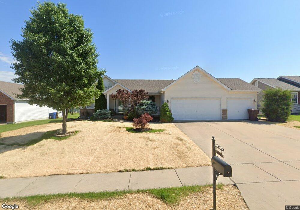
This home is located at 16 Cambridge Ct, Troy, MO 63379 and is currently estimated at $313,301, approximately $200 per square foot. 16 Cambridge Ct is a home located in Lincoln County with nearby schools including Lincoln Elementary School, Troy South Middle School, and Troy Buchanan High School.
Ownership History
Date
Name
Owned For
Owner Type
Purchase Details
Closed on
May 13, 2017
Sold by
Creek Michael T
Bought by
Creek Michael T and Creek Jennifer J
Current Estimated Value
Home Financials for this Owner
Home Financials are based on the most recent Mortgage that was taken out on this home.
Original Mortgage
$17,500
Outstanding Balance
$14,553
Interest Rate
4.1%
Mortgage Type
Credit Line Revolving
Estimated Equity
$298,748
Purchase Details
Closed on
Apr 25, 2013
Sold by
Wolfe Matthew P and Wolfe Dawn
Bought by
Creek Michael T
Home Financials for this Owner
Home Financials are based on the most recent Mortgage that was taken out on this home.
Original Mortgage
$140,600
Interest Rate
4.43%
Mortgage Type
New Conventional
Purchase Details
Closed on
Mar 21, 2006
Sold by
Wingate Development Group Llc
Bought by
Wolfe Mathew P
Home Financials for this Owner
Home Financials are based on the most recent Mortgage that was taken out on this home.
Original Mortgage
$37,000
Interest Rate
6.19%
Mortgage Type
Credit Line Revolving
Create a Home Valuation Report for This Property
The Home Valuation Report is an in-depth analysis detailing your home's value as well as a comparison with similar homes in the area
Home Values in the Area
Average Home Value in this Area
Purchase History
| Date | Buyer | Sale Price | Title Company |
|---|---|---|---|
| Creek Michael T | -- | None Available | |
| Creek Michael T | -- | None Available | |
| Wolfe Mathew P | -- | None Available |
Source: Public Records
Mortgage History
| Date | Status | Borrower | Loan Amount |
|---|---|---|---|
| Open | Creek Michael T | $17,500 | |
| Previous Owner | Creek Michael T | $140,600 | |
| Previous Owner | Wolfe Mathew P | $37,000 |
Source: Public Records
Tax History Compared to Growth
Tax History
| Year | Tax Paid | Tax Assessment Tax Assessment Total Assessment is a certain percentage of the fair market value that is determined by local assessors to be the total taxable value of land and additions on the property. | Land | Improvement |
|---|---|---|---|---|
| 2025 | $2,201 | $37,618 | $4,590 | $33,028 |
| 2024 | $2,201 | $34,386 | $3,838 | $30,548 |
| 2023 | $2,188 | $34,386 | $3,838 | $30,548 |
| 2022 | $2,086 | $32,634 | $3,838 | $28,796 |
| 2021 | $2,097 | $171,760 | $0 | $0 |
| 2020 | $1,856 | $151,680 | $0 | $0 |
| 2019 | $1,856 | $151,480 | $0 | $0 |
| 2018 | $1,895 | $29,045 | $0 | $0 |
| 2017 | $1,900 | $29,045 | $0 | $0 |
| 2016 | $1,717 | $25,542 | $0 | $0 |
| 2015 | $1,721 | $25,542 | $0 | $0 |
| 2014 | $1,740 | $25,768 | $0 | $0 |
| 2013 | -- | $25,768 | $0 | $0 |
Source: Public Records
Map
Nearby Homes
- 206 Bo Ct
- 156 Sweetgum Dr
- 40 Fourfield Dr
- 310 Red Wing Ct
- 0
- 0 Westridge Dr
- 0 Westborough Estates (Lot 58)
- 0 Westborough Estates (Lot 57)
- 0 Westborough Estates (Lot 5)
- 432 Westridge Dr
- 42 + - Acres Snyder Rd
- 0 Westborough Estates (Lot 60)
- 453 Westridge Dr
- 459 Westridge Dr
- 456 Westridge Dr
- 452 Westridge Dr
- 48.826 AC Snyder Rd
- 240 Meadow Crest Dr
- 405 Excalibur Blvd
- 6409 Bobeen Ln
- 20 Cambridge Ct
- 12 Cambridge Ct
- 24 Cambridge Ct
- 18 Eddington Ct
- 31 Oxford Place
- 8 Cambridge Ct
- 24 Cambridge Ct
- 15 Cambridge Ct
- 21 Eddington Ct
- 28 Cambridge Ct
- 19 Cambridge Ct
- 134 Wingate Dr
- 28 Cambridge Ct
- 35 Oxford Place
- 27 Oxford Place
- 4 Cambridge Ct
- 21 Eddington Court (Lot #122)
- 17 Eddington Ct
- 23 Cambridge Ct
- 30 Cambridge Ct