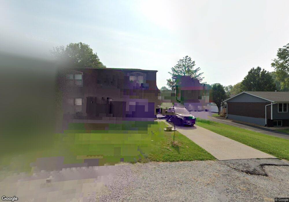
16 Carol Dr Unit 16-18 Collinsville, IL 62234
Estimated Value: $208,000 - $268,000
--
Bed
4
Baths
2,560
Sq Ft
$94/Sq Ft
Est. Value
About This Home
This home is located at 16 Carol Dr Unit 16-18, Collinsville, IL 62234 and is currently estimated at $239,477, approximately $93 per square foot. 16 Carol Dr Unit 16-18 is a home located in Madison County with nearby schools including John A Renfro Elementary School, Dorris Intermediate School, and Collinsville Middle School.
Ownership History
Date
Name
Owned For
Owner Type
Purchase Details
Closed on
Mar 3, 2021
Sold by
Lindow Properties Llc
Bought by
Cbh Holdings Llc
Current Estimated Value
Home Financials for this Owner
Home Financials are based on the most recent Mortgage that was taken out on this home.
Original Mortgage
$295,000
Outstanding Balance
$264,447
Interest Rate
2.7%
Mortgage Type
New Conventional
Estimated Equity
-$24,970
Purchase Details
Closed on
Nov 2, 2015
Sold by
Bohnenstiehl Robert P
Bought by
Lindow Properties Llc
Home Financials for this Owner
Home Financials are based on the most recent Mortgage that was taken out on this home.
Original Mortgage
$130,000
Interest Rate
4.5%
Mortgage Type
Future Advance Clause Open End Mortgage
Purchase Details
Closed on
Jun 11, 2008
Sold by
Bohnenstiehl Robert P and Bohnenstiehl Margaret M
Bought by
Bohnenstiehl Robert P and Bohnenstiehl Margaret M
Create a Home Valuation Report for This Property
The Home Valuation Report is an in-depth analysis detailing your home's value as well as a comparison with similar homes in the area
Home Values in the Area
Average Home Value in this Area
Purchase History
| Date | Buyer | Sale Price | Title Company |
|---|---|---|---|
| Cbh Holdings Llc | $295,000 | Abstracts & Titles | |
| Lindow Properties Llc | $130,000 | Abstracts & Titles Inc | |
| Bohnenstiehl Robert P | -- | None Available |
Source: Public Records
Mortgage History
| Date | Status | Borrower | Loan Amount |
|---|---|---|---|
| Open | Cbh Holdings Llc | $295,000 | |
| Previous Owner | Lindow Properties Llc | $130,000 |
Source: Public Records
Tax History Compared to Growth
Tax History
| Year | Tax Paid | Tax Assessment Tax Assessment Total Assessment is a certain percentage of the fair market value that is determined by local assessors to be the total taxable value of land and additions on the property. | Land | Improvement |
|---|---|---|---|---|
| 2024 | $4,723 | $73,870 | $15,510 | $58,360 |
| 2023 | $4,723 | $68,380 | $14,360 | $54,020 |
| 2022 | $4,500 | $63,230 | $13,280 | $49,950 |
| 2021 | $4,023 | $58,240 | $12,220 | $46,020 |
| 2020 | $3,879 | $55,570 | $11,660 | $43,910 |
| 2019 | $3,776 | $53,670 | $11,260 | $42,410 |
| 2018 | $3,691 | $50,840 | $10,670 | $40,170 |
| 2017 | $3,215 | $43,330 | $10,470 | $32,860 |
| 2016 | $3,921 | $50,170 | $10,470 | $39,700 |
| 2015 | $3,658 | $48,870 | $10,200 | $38,670 |
| 2014 | $3,658 | $48,870 | $10,200 | $38,670 |
| 2013 | $3,658 | $48,870 | $10,200 | $38,670 |
Source: Public Records
Map
Nearby Homes
- 10 White Lily Dr
- 0 N Keebler Ave
- 414 Bunker Hill Dr
- 625 W Country Ln
- 203 Greenfield Dr
- 22 Brookwood Dr
- 1224 Cedar Ridge Ct
- 5 Brookwood Dr
- 2007 Belt Line Rd
- 2 Chelsea Rd
- 102 Toni Ct
- 1120 Williams St
- 1210 Constance St
- 308 Brown Ave
- 706 Illinois Ave
- 1121 Carraway Ct
- 1227 Ridge Ave
- 617 N Morrison Ave
- 0 Mabry Dr
- 54 Oak Leaf Dr