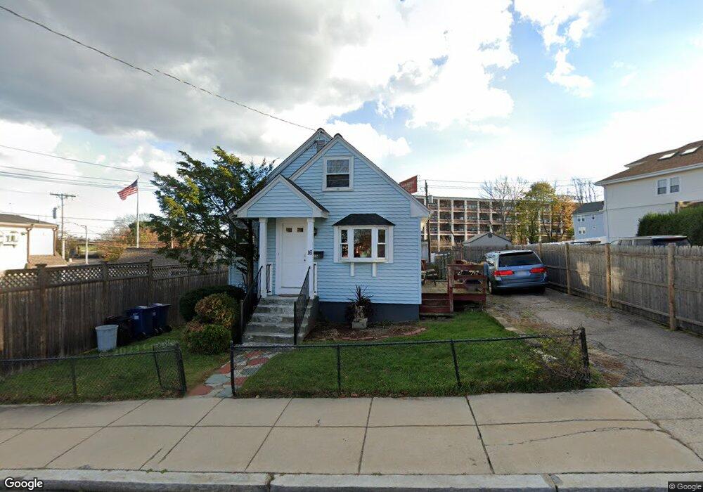
16 Cedar Grove St Dorchester Center, MA 02124
Lower Mills NeighborhoodEstimated Value: $699,838 - $774,000
2
Beds
1
Bath
1,149
Sq Ft
$639/Sq Ft
Est. Value
About This Home
This home is located at 16 Cedar Grove St, Dorchester Center, MA 02124 and is currently estimated at $734,710, approximately $639 per square foot. 16 Cedar Grove St is a home located in Suffolk County with nearby schools including Neighborhood House Charter School, Conservatory Lab Upper School, and St Brendan School.
Ownership History
Date
Name
Owned For
Owner Type
Purchase Details
Closed on
Jan 17, 1989
Sold by
Delaney John F
Bought by
Toner James P
Current Estimated Value
Home Financials for this Owner
Home Financials are based on the most recent Mortgage that was taken out on this home.
Original Mortgage
$139,500
Interest Rate
10.39%
Mortgage Type
Purchase Money Mortgage
Create a Home Valuation Report for This Property
The Home Valuation Report is an in-depth analysis detailing your home's value as well as a comparison with similar homes in the area
Home Values in the Area
Average Home Value in this Area
Purchase History
| Date | Buyer | Sale Price | Title Company |
|---|---|---|---|
| Toner James P | $155,000 | -- |
Source: Public Records
Mortgage History
| Date | Status | Borrower | Loan Amount |
|---|---|---|---|
| Open | Toner James P | $108,000 | |
| Closed | Toner James P | $139,500 | |
| Previous Owner | Toner James P | $20,000 |
Source: Public Records
Tax History Compared to Growth
Tax History
| Year | Tax Paid | Tax Assessment Tax Assessment Total Assessment is a certain percentage of the fair market value that is determined by local assessors to be the total taxable value of land and additions on the property. | Land | Improvement |
|---|---|---|---|---|
| 2025 | $6,669 | $575,900 | $239,500 | $336,400 |
| 2024 | $6,286 | $576,700 | $194,600 | $382,100 |
| 2023 | $5,790 | $539,100 | $181,900 | $357,200 |
| 2022 | $5,640 | $518,400 | $174,900 | $343,500 |
| 2021 | $5,143 | $482,000 | $166,600 | $315,400 |
| 2020 | $4,746 | $449,400 | $162,100 | $287,300 |
| 2019 | $4,425 | $419,800 | $122,500 | $297,300 |
| 2018 | $4,037 | $385,200 | $122,500 | $262,700 |
| 2017 | $3,885 | $366,900 | $122,500 | $244,400 |
| 2016 | $3,737 | $339,700 | $122,500 | $217,200 |
| 2015 | $3,394 | $280,300 | $121,100 | $159,200 |
| 2014 | $3,458 | $274,900 | $121,100 | $153,800 |
Source: Public Records
Map
Nearby Homes
- 61 Hill Top St
- 103 Minot St
- 107 Minot St
- 118-120 Granite Ave Unit 2
- 102 Milton St
- 45 Chickatawbut St Unit 1
- 43 Chickatawbut St
- 22 Chickatawbut St Unit 2
- 400-412 Neponset Ave
- 378 Neponset Ave
- 701 Adams St Unit 9
- 60 Newbury St Unit 10
- 51 Coffey St Unit 51C
- 40 Westmoreland St Unit 8
- 251 Minot St Unit 6
- 37 Westmoreland St
- 885-887 Adams St Unit 1
- 45 Hancock St Unit 203
- 80 Beaumont St Unit 101
- 859 Adams St Unit 859
- 1 Hill Top St
- 36 Cedar Grove St
- 25 Cedar Grove St
- 17 Cedar Grove St
- 40 Cedar Grove St
- 35 Cedar Grove St
- 15 Hill Top St Unit 2
- 15 Hill Top St Unit 1
- 17 Hill Top St
- 17 Hill Top St Unit 1
- 37 Cedar Grove St
- 31 Hallet Davis St
- 201 Milton St
- 41 Cedar Grove St
- 205 Milton St
- 48 Cedar Grove St
- 195 Milton St
- 16 Hill Top St
- 16 Hill Top St Unit 1
- 21 Hill Top St