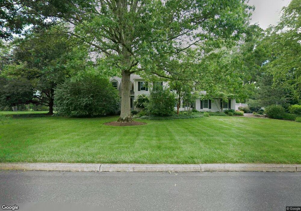
16 Charter Cir Doylestown, PA 18901
Estimated Value: $762,465 - $938,000
4
Beds
3
Baths
2,686
Sq Ft
$312/Sq Ft
Est. Value
About This Home
This home is located at 16 Charter Cir, Doylestown, PA 18901 and is currently estimated at $838,616, approximately $312 per square foot. 16 Charter Cir is a home located in Bucks County with nearby schools including Doyle El School, Lenape Middle School, and Central Bucks High School-West.
Ownership History
Date
Name
Owned For
Owner Type
Purchase Details
Closed on
Mar 23, 1994
Sold by
Furst W Daniel and Furst Pamela D
Bought by
Nangeroni James F and Nangeroni Sarah O
Current Estimated Value
Home Financials for this Owner
Home Financials are based on the most recent Mortgage that was taken out on this home.
Original Mortgage
$224,100
Interest Rate
7.07%
Purchase Details
Closed on
Jun 18, 1985
Bought by
Furst Furst W and Furst Pamela D
Create a Home Valuation Report for This Property
The Home Valuation Report is an in-depth analysis detailing your home's value as well as a comparison with similar homes in the area
Home Values in the Area
Average Home Value in this Area
Purchase History
| Date | Buyer | Sale Price | Title Company |
|---|---|---|---|
| Nangeroni James F | $249,000 | Fidelity National Title Ins | |
| Furst Furst W | $140,900 | -- |
Source: Public Records
Mortgage History
| Date | Status | Borrower | Loan Amount |
|---|---|---|---|
| Closed | Nangeroni James F | $224,100 |
Source: Public Records
Tax History Compared to Growth
Tax History
| Year | Tax Paid | Tax Assessment Tax Assessment Total Assessment is a certain percentage of the fair market value that is determined by local assessors to be the total taxable value of land and additions on the property. | Land | Improvement |
|---|---|---|---|---|
| 2025 | $8,827 | $49,880 | $7,920 | $41,960 |
| 2024 | $8,827 | $49,880 | $7,920 | $41,960 |
| 2023 | $8,323 | $49,880 | $7,920 | $41,960 |
| 2022 | $8,323 | $49,880 | $7,920 | $41,960 |
| 2021 | $8,152 | $49,880 | $7,920 | $41,960 |
| 2020 | $8,114 | $49,880 | $7,920 | $41,960 |
| 2019 | $8,027 | $49,880 | $7,920 | $41,960 |
| 2018 | $8,002 | $49,880 | $7,920 | $41,960 |
| 2017 | $7,940 | $49,880 | $7,920 | $41,960 |
| 2016 | $7,890 | $49,880 | $7,920 | $41,960 |
| 2015 | -- | $49,880 | $7,920 | $41,960 |
| 2014 | -- | $49,880 | $7,920 | $41,960 |
Source: Public Records
Map
Nearby Homes
- 100 Bishops Gate Ln Unit 67
- 114 Blackfriars Cir
- 1 Gatehouse Ln
- 62 Constitution Ave
- 4 Old Colonial Dr Unit 254
- 333 Dorset Ct Unit 333
- 418 North St
- 3723 William Daves Rd
- 5437 Rinker Cir Unit 283
- 157 Pine Run Rd
- 215 N Franklin St
- 3765 William Daves Rd
- 90 Chapman Ave
- 4748 Bishop Cir
- 169 N Main St
- 3838 Jacob Stout Rd
- 146 N Church St
- 37 N Clinton St
- 146 E Court St
- 20 E Court St
- 18 Charter Cir
- 14 Charter Cir
- 8 Charter Cir
- 218 Larch Cir
- 220 Sandy Knoll Dr
- 216 Larch Cir
- 10 Charter Cir
- 12 Charter Cir
- 20 Charter Cir
- 228 Sandy Knoll Dr
- 6 Settlers Dr
- 22 Charter Cir
- 214 Larch Cir
- 77 Meetinghouse Rd
- 95 Meetinghouse Rd
- 4 Settlers Dr
- 103 Meetinghouse Rd
- 212 Larch Cir
- 73 Meetinghouse Rd
- 210 Larch Cir