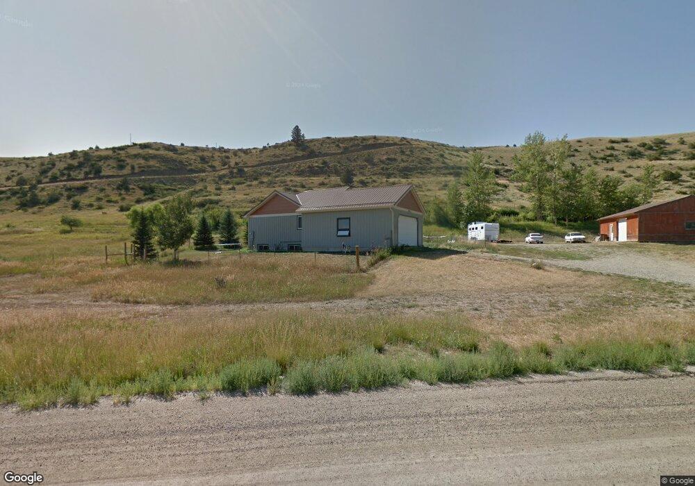
16 Circle t Ln Absarokee, MT 59001
Estimated Value: $484,883 - $605,000
5
Beds
3
Baths
2,704
Sq Ft
$202/Sq Ft
Est. Value
About This Home
This home is located at 16 Circle t Ln, Absarokee, MT 59001 and is currently estimated at $544,942, approximately $201 per square foot. 16 Circle t Ln is a home located in Stillwater County with nearby schools including Absarokee School, Absarokee Junior High School, and Absarokee High School.
Ownership History
Date
Name
Owned For
Owner Type
Purchase Details
Closed on
Aug 10, 2018
Bought by
Planichek Seth
Current Estimated Value
Purchase Details
Closed on
Dec 7, 2009
Sold by
Vanpelt Robb W and Hart Breda S
Bought by
Franco Daniel and Franco Jennifer
Purchase Details
Closed on
Mar 5, 2008
Sold by
Vanpelt Robb W
Bought by
Vanpelt Robb W and Hart Brenda S
Create a Home Valuation Report for This Property
The Home Valuation Report is an in-depth analysis detailing your home's value as well as a comparison with similar homes in the area
Purchase History
| Date | Buyer | Sale Price | Title Company |
|---|---|---|---|
| Planichek Seth | -- | -- | |
| Franco Daniel | -- | -- | |
| Vanpelt Robb W | -- | -- |
Source: Public Records
Tax History
| Year | Tax Paid | Tax Assessment Tax Assessment Total Assessment is a certain percentage of the fair market value that is determined by local assessors to be the total taxable value of land and additions on the property. | Land | Improvement |
|---|---|---|---|---|
| 2025 | $1,783 | $492,300 | $0 | $0 |
| 2024 | $2,488 | $418,000 | $0 | $0 |
| 2023 | $2,553 | $418,000 | $0 | $0 |
| 2022 | $2,087 | $320,500 | $0 | $0 |
| 2021 | $1,901 | $320,500 | $0 | $0 |
| 2020 | $1,825 | $274,400 | $0 | $0 |
| 2019 | $1,855 | $274,400 | $0 | $0 |
| 2018 | $1,512 | $208,200 | $0 | $0 |
| 2017 | $1,585 | $208,400 | $0 | $0 |
| 2016 | $1,471 | $208,200 | $0 | $0 |
| 2015 | $1,296 | $208,200 | $0 | $0 |
| 2014 | $1,379 | $117,360 | $0 | $0 |
Source: Public Records
Map
Nearby Homes
- A Johnson Dr Unit A
- 10 Alison Dr
- 21 & 23 S Woodard Ave Unit 2 -HOMES For Price o
- 30 Henry St
- 12 Avis St
- 12 Crow Child Trail
- 20 Crow Child Trail
- 2994 Highway 78
- 41 Crow Child Trail
- 15.9 Ac Buck Creek Rd
- 2825 & 2830 Highway 78 S
- 91 Upper Hawk Valley Rd
- 37 Barham Rd
- 79 Meyers Rd
- 79 Myers Rd
- TBD Brumfield RD Brumfield Rd
- 42 Bozeman Trail
- 26 Yates Rd
- 26 O'Dare Dr
- 140 Nighthawk Rd
Your Personal Tour Guide
Ask me questions while you tour the home.