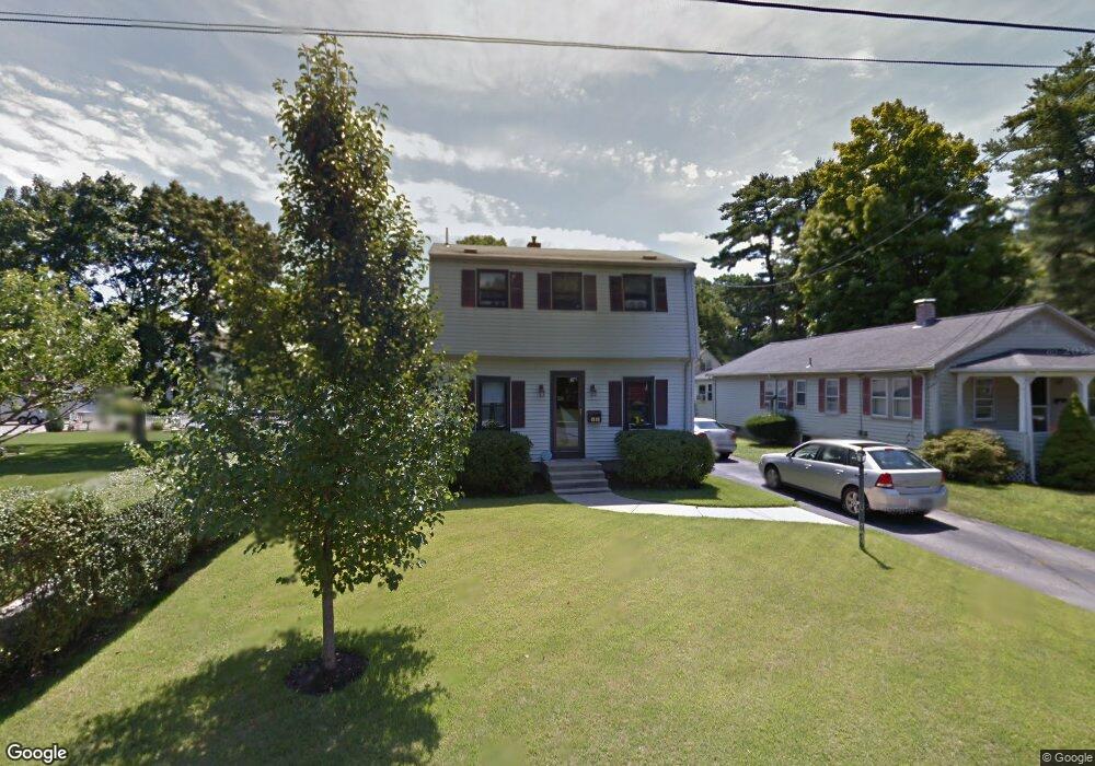
16 Clark St Foxboro, MA 02035
Estimated Value: $640,328 - $731,000
4
Beds
2
Baths
1,814
Sq Ft
$373/Sq Ft
Est. Value
About This Home
This home is located at 16 Clark St, Foxboro, MA 02035 and is currently estimated at $676,832, approximately $373 per square foot. 16 Clark St is a home located in Norfolk County with nearby schools including Foxborough High School, Foxborough Regional Charter School, and The Sage School.
Ownership History
Date
Name
Owned For
Owner Type
Purchase Details
Closed on
Jul 28, 2000
Sold by
Reilly Philip J and Rielly Elizabeth A
Bought by
Conway Lois M and Smith Jeffrey M
Current Estimated Value
Home Financials for this Owner
Home Financials are based on the most recent Mortgage that was taken out on this home.
Original Mortgage
$165,000
Outstanding Balance
$59,658
Interest Rate
8.18%
Mortgage Type
Purchase Money Mortgage
Estimated Equity
$617,174
Create a Home Valuation Report for This Property
The Home Valuation Report is an in-depth analysis detailing your home's value as well as a comparison with similar homes in the area
Home Values in the Area
Average Home Value in this Area
Purchase History
| Date | Buyer | Sale Price | Title Company |
|---|---|---|---|
| Conway Lois M | $215,000 | -- |
Source: Public Records
Mortgage History
| Date | Status | Borrower | Loan Amount |
|---|---|---|---|
| Open | Conway Lois M | $165,000 | |
| Previous Owner | Conway Lois M | $75,000 |
Source: Public Records
Tax History Compared to Growth
Tax History
| Year | Tax Paid | Tax Assessment Tax Assessment Total Assessment is a certain percentage of the fair market value that is determined by local assessors to be the total taxable value of land and additions on the property. | Land | Improvement |
|---|---|---|---|---|
| 2025 | $6,129 | $463,600 | $201,100 | $262,500 |
| 2024 | $6,100 | $451,500 | $201,100 | $250,400 |
| 2023 | $5,907 | $415,700 | $191,500 | $224,200 |
| 2022 | $5,737 | $395,100 | $183,200 | $211,900 |
| 2021 | $5,505 | $373,500 | $166,500 | $207,000 |
| 2020 | $5,340 | $366,500 | $166,500 | $200,000 |
| 2019 | $5,066 | $344,600 | $158,600 | $186,000 |
| 2018 | $4,945 | $339,400 | $158,600 | $180,800 |
| 2017 | $4,763 | $316,700 | $148,200 | $168,500 |
| 2016 | $4,625 | $312,100 | $142,600 | $169,500 |
| 2015 | $4,536 | $298,600 | $120,400 | $178,200 |
| 2014 | $4,319 | $288,100 | $118,100 | $170,000 |
Source: Public Records
Map
Nearby Homes
- 84 South St
- 11 W Belcher Rd Unit 2
- 84 Cocasset St Unit A6
- 24 Mechanic St
- 14 Baker St
- 18 Winter St Unit E
- 14 Winter St Unit B
- 12 Spring St
- 356 Central St
- 80 Mill St
- 73 Ridge Rd
- 186 Mechanic St
- 277 Central St
- 619 N Main St
- 9 Independence Dr Unit 9
- 11 Goodwin Dr
- 35 Independence Dr Unit 35
- 44 Angell St Unit 44
- 28 Angell St
- 170 Cannon Forge Dr
- 18 Clark St
- 14 Clark St
- 15 Carpenter St
- 13 W Leonard St
- 22 W Leonard St
- 17 Clark St
- 16 Carpenter St
- 26 W Leonard St
- 21 Carpenter St
- 14 W Leonard St
- 22 Carpenter St
- 22 Carpenter St Unit 1
- 10 Clark St
- 12 W Leonard St
- 25 Carpenter St
- 24 Carpenter St
- 12 Carpenter St
- 13 Clark St
- 10-1/2 W Leonard St
- 10 1/2 W Leonard St