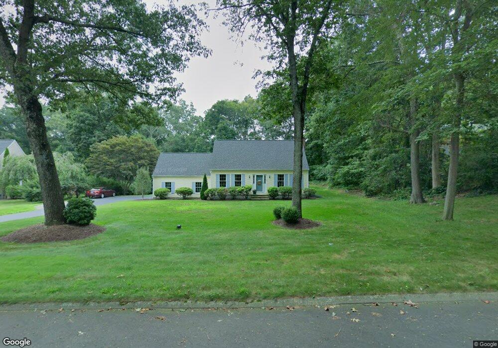
16 Colonial Dr Clinton, CT 06413
Estimated Value: $468,000 - $605,000
3
Beds
3
Baths
1,382
Sq Ft
$389/Sq Ft
Est. Value
About This Home
This home is located at 16 Colonial Dr, Clinton, CT 06413 and is currently estimated at $536,933, approximately $388 per square foot. 16 Colonial Dr is a home located in Middlesex County with nearby schools including Lewin G. Joel Jr. School and The Morgan School.
Ownership History
Date
Name
Owned For
Owner Type
Purchase Details
Closed on
Nov 4, 2022
Sold by
Viglione Albert J
Bought by
Viglione Annette M
Current Estimated Value
Purchase Details
Closed on
Jul 21, 1994
Sold by
Hxl Inc
Bought by
Viglione Albert J and Viglione Annette M
Create a Home Valuation Report for This Property
The Home Valuation Report is an in-depth analysis detailing your home's value as well as a comparison with similar homes in the area
Home Values in the Area
Average Home Value in this Area
Purchase History
| Date | Buyer | Sale Price | Title Company |
|---|---|---|---|
| Viglione Annette M | -- | None Available | |
| Viglione Annette M | -- | None Available | |
| Viglione Albert J | $167,000 | -- | |
| Viglione Albert J | $167,000 | -- |
Source: Public Records
Mortgage History
| Date | Status | Borrower | Loan Amount |
|---|---|---|---|
| Previous Owner | Viglione Albert J | $130,000 | |
| Previous Owner | Viglione Albert J | $130,000 | |
| Previous Owner | Viglione Albert J | $136,000 |
Source: Public Records
Tax History
| Year | Tax Paid | Tax Assessment Tax Assessment Total Assessment is a certain percentage of the fair market value that is determined by local assessors to be the total taxable value of land and additions on the property. | Land | Improvement |
|---|---|---|---|---|
| 2025 | $6,798 | $218,300 | $58,500 | $159,800 |
| 2024 | $6,606 | $218,300 | $58,500 | $159,800 |
| 2023 | $6,512 | $218,300 | $58,500 | $159,800 |
| 2022 | $6,512 | $218,300 | $58,500 | $159,800 |
| 2021 | $6,381 | $213,900 | $64,000 | $149,900 |
| 2020 | $6,684 | $213,900 | $64,000 | $149,900 |
| 2019 | $6,684 | $213,900 | $64,000 | $149,900 |
| 2018 | $6,533 | $213,900 | $64,000 | $149,900 |
| 2017 | $6,398 | $213,900 | $64,000 | $149,900 |
| 2016 | $5,805 | $213,900 | $64,000 | $149,900 |
| 2015 | $5,769 | $215,500 | $66,900 | $148,600 |
| 2014 | $5,661 | $215,500 | $66,900 | $148,600 |
Source: Public Records
Map
Nearby Homes
- 8 Egypt Ln
- 131 Cow Hill Rd
- 10 Stonewall Ln
- 34 Hurd Bridge Rd
- 43 Evergreen Park
- 166 Glenwood Rd
- 106 Glenwood Rd
- 244 Cow Hill Rd
- 4 Laurel Ln
- 0 Fairy Dell Rd
- 48A Ironworks Rd
- 50 Jefferson Cir
- 73 Airline Rd
- 50 Kelseytown Rd
- 4 Van Dyke Ln
- 94 Kelseytown Rd
- 16 Silverbrook Ln
- 19 Evergreen Dr
- 6 Evergreen Dr
- 11 Longview Terrace
- 14 Colonial Dr
- 18 Colonial Dr
- 2 Davis Farm Rd
- 12 Colonial Dr
- 19 Colonial Dr
- 17 Colonial Dr
- 21 Colonial Dr
- 1 Davis Farm Rd
- 15 Colonial Dr
- 13 Colonial Dr
- 3 Davis Farm Rd
- 7 Egypt Ln
- 27 Rocky Ledge Dr
- 6 Davis Farm Rd
- 8 Colonial Dr
- 5 Davis Farm Rd
- 118 Killingworth Turnpike
- 116 Killingworth Turnpike
- 9 Egypt Ln
- 8 Davis Farm Rd
Your Personal Tour Guide
Ask me questions while you tour the home.