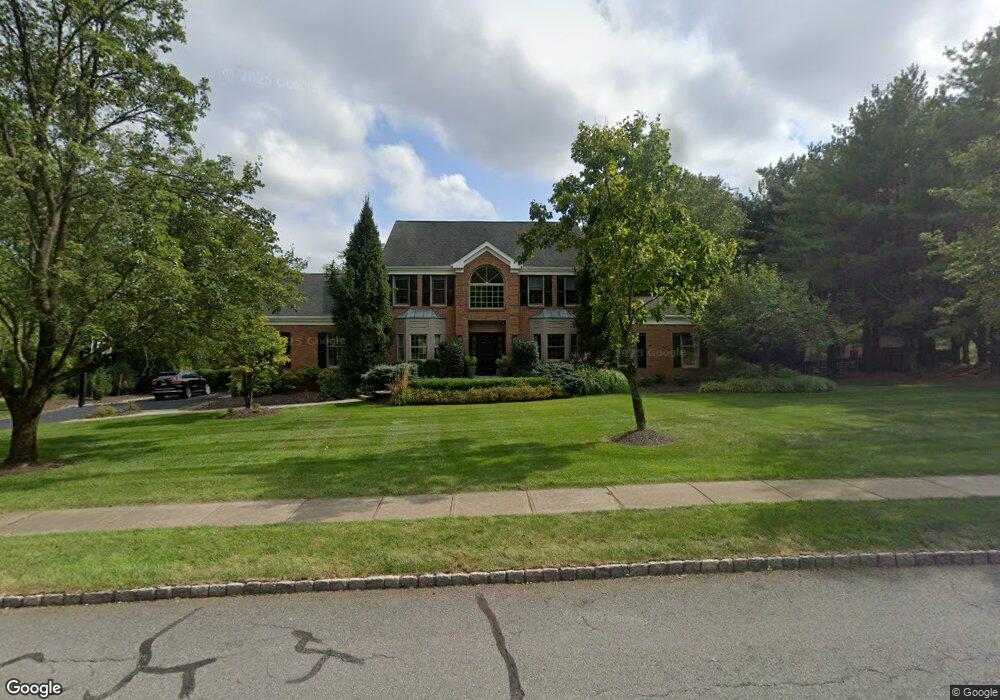
16 Covered Bridge Rd Flemington, NJ 08822
Estimated Value: $912,000 - $1,074,000
--
Bed
--
Bath
4,378
Sq Ft
$231/Sq Ft
Est. Value
About This Home
This home is located at 16 Covered Bridge Rd, Flemington, NJ 08822 and is currently estimated at $1,012,320, approximately $231 per square foot. 16 Covered Bridge Rd is a home located in Hunterdon County with nearby schools including Francis A. Desmares Elementary School, Reading Fleming Intermediate School, and J.P. Case Middle School.
Ownership History
Date
Name
Owned For
Owner Type
Purchase Details
Closed on
Oct 25, 1996
Sold by
Walters Michael J and Walters Nancy G
Bought by
Anerella Roger S and Anerella Christine A
Current Estimated Value
Home Financials for this Owner
Home Financials are based on the most recent Mortgage that was taken out on this home.
Original Mortgage
$327,100
Outstanding Balance
$29,869
Interest Rate
7.25%
Estimated Equity
$982,452
Purchase Details
Closed on
Jul 12, 1994
Sold by
Kupiec James W and Kupiec Joann M
Bought by
Walters Michael J and Walters Nancy G
Purchase Details
Closed on
Jan 21, 1992
Sold by
Robin Hill Inc
Bought by
Kupiec James W and Kupiec Joann M
Purchase Details
Closed on
Dec 18, 1991
Sold by
Robin Hill Associates
Bought by
Robin Hill Inc
Create a Home Valuation Report for This Property
The Home Valuation Report is an in-depth analysis detailing your home's value as well as a comparison with similar homes in the area
Home Values in the Area
Average Home Value in this Area
Purchase History
| Date | Buyer | Sale Price | Title Company |
|---|---|---|---|
| Anerella Roger S | $363,500 | -- | |
| Walters Michael J | $365,000 | -- | |
| Kupiec James W | $309,000 | -- | |
| Robin Hill Inc | $115,000 | -- |
Source: Public Records
Mortgage History
| Date | Status | Borrower | Loan Amount |
|---|---|---|---|
| Open | Anerella Roger S | $327,100 |
Source: Public Records
Tax History Compared to Growth
Tax History
| Year | Tax Paid | Tax Assessment Tax Assessment Total Assessment is a certain percentage of the fair market value that is determined by local assessors to be the total taxable value of land and additions on the property. | Land | Improvement |
|---|---|---|---|---|
| 2025 | $20,667 | $713,400 | $235,700 | $477,700 |
| 2024 | $19,433 | $713,400 | $235,700 | $477,700 |
| 2023 | $19,433 | $713,400 | $235,700 | $477,700 |
| 2022 | $18,941 | $713,400 | $235,700 | $477,700 |
| 2021 | $17,769 | $713,400 | $235,700 | $477,700 |
| 2020 | $18,136 | $705,400 | $235,700 | $469,700 |
| 2019 | $17,769 | $705,400 | $235,700 | $469,700 |
| 2018 | $17,550 | $705,400 | $235,700 | $469,700 |
| 2017 | $17,282 | $705,400 | $235,700 | $469,700 |
| 2016 | $16,972 | $705,400 | $235,700 | $469,700 |
| 2015 | $16,542 | $705,400 | $235,700 | $469,700 |
| 2014 | $16,323 | $705,400 | $235,700 | $469,700 |
Source: Public Records
Map
Nearby Homes
- 28 Old Clinton Rd
- 23 Valley View Dr
- 31 Cherryville Hollow Rd
- 10 Jacobus Ln
- 14 William Barnes Rd
- 25 Haddenford Dr
- 201 Hankinson Rd
- 1 Dale Dr
- 6 W View Dr
- 5 Morningside Ct
- 525 Stanton Station Rd
- 125 Cherryville Hollow Rd
- 59 Cherryville Stanton Rd
- 158 Featherbed Ln
- 31 E Main St
- 92 Park Ave
- 12 Corcoran St
- 5 William Martin Way Unit 5
- 0 Hardscrabble Hill Rd
- 29 Royal Rd
- 18 Covered Bridge Rd
- 14 Covered Bridge Rd
- 15 Covered Bridge Rd
- 17 Covered Bridge Rd
- 20 Covered Bridge Rd
- 12 Covered Bridge Rd
- 19 Covered Bridge Rd
- 21 Covered Bridge Rd
- 11 Covered Bridge Rd
- 10 Covered Bridge Rd
- 349 Hwy 31 Unit 302
- 349 State Route 31 Unit 601
- 349 Highway 31 Unit 501
- 349 Highway 31 Unit 1501
- 349 Highway 31 Unit 601&2
- 349 Highway 31 Unit 301
- 349 Highway 31 Unit 601
- 349 Highway 31 Unit 602
- 349 Highway 31 Unit 401
- 349 Highway 31 Unit 302