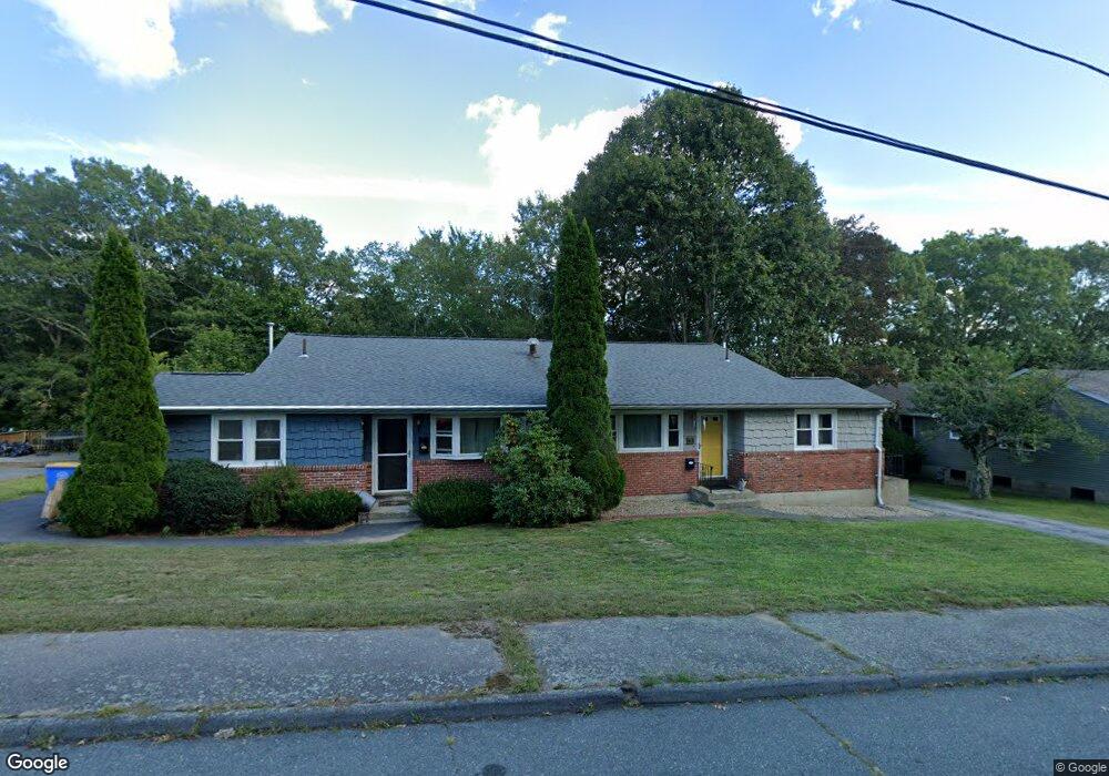
16 Decota Dr Unit B Randolph, MA 02368
North Randolph NeighborhoodEstimated Value: $303,000 - $407,000
2
Beds
1
Bath
1,252
Sq Ft
$285/Sq Ft
Est. Value
About This Home
This home is located at 16 Decota Dr Unit B, Randolph, MA 02368 and is currently estimated at $356,821, approximately $285 per square foot. 16 Decota Dr Unit B is a home located in Norfolk County with nearby schools including Randolph High School and Lighthouse Baptist Christian Academy.
Ownership History
Date
Name
Owned For
Owner Type
Purchase Details
Closed on
May 19, 2006
Sold by
Reed Patricia M
Bought by
Vassall Kathryn A
Current Estimated Value
Home Financials for this Owner
Home Financials are based on the most recent Mortgage that was taken out on this home.
Original Mortgage
$204,000
Outstanding Balance
$115,679
Interest Rate
6.42%
Mortgage Type
Purchase Money Mortgage
Estimated Equity
$241,142
Purchase Details
Closed on
Jul 28, 2003
Sold by
Rushton Gregory A
Bought by
Reed Patricia M
Home Financials for this Owner
Home Financials are based on the most recent Mortgage that was taken out on this home.
Original Mortgage
$176,800
Interest Rate
5.27%
Mortgage Type
Purchase Money Mortgage
Purchase Details
Closed on
Jun 3, 2003
Sold by
Rushton Gregory A
Bought by
Robson Kandy K
Home Financials for this Owner
Home Financials are based on the most recent Mortgage that was taken out on this home.
Original Mortgage
$176,800
Interest Rate
5.27%
Mortgage Type
Purchase Money Mortgage
Create a Home Valuation Report for This Property
The Home Valuation Report is an in-depth analysis detailing your home's value as well as a comparison with similar homes in the area
Home Values in the Area
Average Home Value in this Area
Purchase History
We collect this data history from publicly available records. To have your information removed, we recommend requesting removal directly through your county’s website.
| Date | Buyer | Sale Price | Title Company |
|---|---|---|---|
| Vassall Kathryn A | $255,000 | -- | |
| Reed Patricia M | $221,000 | -- | |
| Robson Kandy K | $212,000 | -- |
Source: Public Records
Mortgage History
We collect this data history from publicly available records. To have your information removed, we recommend requesting removal directly through your county’s website.
| Date | Status | Borrower | Loan Amount |
|---|---|---|---|
| Open | Vassall Kathryn A | $204,000 | |
| Closed | Vassall Kathryn A | $51,000 | |
| Previous Owner | Reed Patricia M | $176,800 | |
| Previous Owner | Robson Kandy K | $201,400 |
Source: Public Records
Tax History
| Year | Tax Paid | Tax Assessment Tax Assessment Total Assessment is a certain percentage of the fair market value that is determined by local assessors to be the total taxable value of land and additions on the property. | Land | Improvement |
|---|---|---|---|---|
| 2025 | $2,981 | $256,800 | $0 | $256,800 |
| 2024 | $3,004 | $262,400 | $0 | $262,400 |
| 2023 | $2,749 | $227,600 | $0 | $227,600 |
| 2022 | $2,666 | $196,000 | $0 | $196,000 |
| 2021 | $2,669 | $180,600 | $0 | $180,600 |
| 2020 | $2,730 | $183,100 | $0 | $183,100 |
| 2019 | $2,662 | $177,700 | $0 | $177,700 |
| 2018 | $2,522 | $158,800 | $0 | $158,800 |
| 2017 | $2,451 | $151,500 | $0 | $151,500 |
| 2016 | $2,384 | $137,100 | $0 | $137,100 |
| 2015 | $2,568 | $141,900 | $0 | $141,900 |
Source: Public Records
Map
Nearby Homes
- 66 Orchard St
- 17 Norroway Ave
- 1 Royal Crest Dr Unit 3
- 19 Clark St
- 60 Pond Ln
- 36 Raechel Rd
- 12 Jasper Ln Unit 12
- 23 Emily Jeffers Rd
- 37 Jasper Ln Unit 37
- 304 High St
- 52 Jasper Ln
- 93 Cross St
- 240 Grove St
- 181 Oak St
- 13 Wordsworth St
- 24 Nelson Dr Unit 2D
- 9 Denise Dr
- 55 Lillian St N
- 39 West St Unit A1
- 7 Waldo St
- 16 Decota Dr Unit A
- 14 Decota Dr Unit B
- 14 Decota Dr Unit A
- 14a Decota Dr Unit A
- 14 Decota Dr Unit DECOTA DR
- 18 Decota Dr
- 37 Decota Dr
- 17 Decota Dr
- 20 Decota Dr
- 11 Decota Dr
- 35 Decota Dr
- 12 Decota Dr
- 19 Decota Dr
- 38 Decota Dr
- 9 Decota Dr
- 10 Decota Dr
- 36 Decota Dr
- 22 Decota Dr
- 4 Eva Cir
- 24B Decota Dr
Your Personal Tour Guide
Ask me questions while you tour the home.