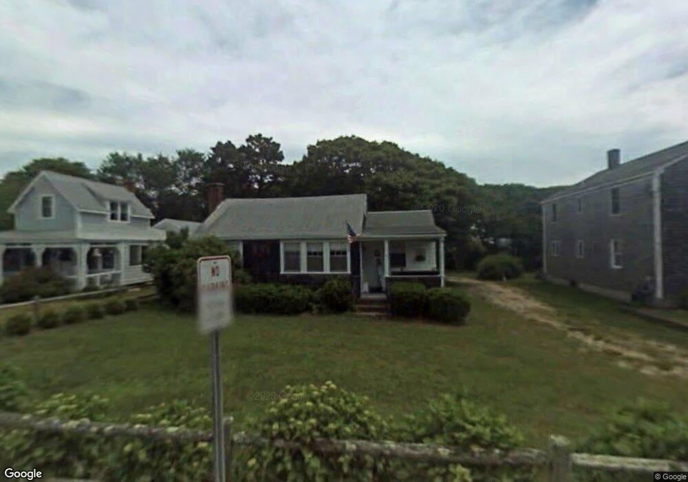
16 Depot St Dennis Port, MA 02639
Dennis Port NeighborhoodEstimated Value: $760,000 - $1,204,000
2
Beds
1
Bath
1,001
Sq Ft
$971/Sq Ft
Est. Value
About This Home
This home is located at 16 Depot St, Dennis Port, MA 02639 and is currently estimated at $972,064, approximately $971 per square foot. 16 Depot St is a home located in Barnstable County with nearby schools including Dennis-Yarmouth Regional High School and St. Pius X. School.
Ownership History
Date
Name
Owned For
Owner Type
Purchase Details
Closed on
Apr 1, 2009
Sold by
Pfeiffer Frank G and Martin Patricia E
Bought by
Pfeiffer Frank G and Martin Patricia E
Current Estimated Value
Purchase Details
Closed on
May 30, 2003
Sold by
Paquette Nancy J
Bought by
Pfeiffer Frank G and Martin Patricia E
Home Financials for this Owner
Home Financials are based on the most recent Mortgage that was taken out on this home.
Original Mortgage
$242,910
Interest Rate
5.86%
Mortgage Type
Purchase Money Mortgage
Purchase Details
Closed on
Nov 18, 1996
Sold by
Spadafora Joseph A and Spadafora Anne J
Bought by
Paquette Arthur J and Paquette Nancy J
Create a Home Valuation Report for This Property
The Home Valuation Report is an in-depth analysis detailing your home's value as well as a comparison with similar homes in the area
Home Values in the Area
Average Home Value in this Area
Purchase History
| Date | Buyer | Sale Price | Title Company |
|---|---|---|---|
| Pfeiffer Frank G | -- | -- | |
| Pfeiffer Frank G | $269,900 | -- | |
| Paquette Arthur J | $94,000 | -- |
Source: Public Records
Mortgage History
| Date | Status | Borrower | Loan Amount |
|---|---|---|---|
| Previous Owner | Paquette Arthur J | $242,910 |
Source: Public Records
Tax History Compared to Growth
Tax History
| Year | Tax Paid | Tax Assessment Tax Assessment Total Assessment is a certain percentage of the fair market value that is determined by local assessors to be the total taxable value of land and additions on the property. | Land | Improvement |
|---|---|---|---|---|
| 2025 | $3,949 | $912,000 | $308,700 | $603,300 |
| 2024 | $3,937 | $896,700 | $296,900 | $599,800 |
| 2023 | $3,835 | $821,300 | $269,900 | $551,400 |
| 2022 | $3,482 | $621,800 | $212,700 | $409,100 |
| 2021 | $3,240 | $537,300 | $208,600 | $328,700 |
| 2020 | $3,184 | $521,900 | $208,600 | $313,300 |
| 2019 | $3,570 | $507,500 | $222,000 | $285,500 |
| 2018 | $3,306 | $459,500 | $211,300 | $248,200 |
| 2017 | $3,205 | $289,100 | $194,700 | $94,400 |
| 2016 | $1,845 | $282,500 | $183,500 | $99,000 |
| 2015 | $1,808 | $282,500 | $183,500 | $99,000 |
| 2014 | $1,723 | $271,400 | $172,400 | $99,000 |
Source: Public Records
Map
Nearby Homes
- 11 Ocean Park W
- 9 Chase Ave Unit 6
- 405 Old Wharf Rd Unit B204
- 405 Old Wharf Rd Unit B204
- 402 Old Wharf Rd
- 402 Old Wharf Rd
- 102 Sea St
- 1 E Belmont Unit 630
- 26 Manning Rd
- 1 Belmont Rd Unit 630
- 1 Belmont Rd Unit 513
- 22 Ferncliff Rd
- 12 Cross St
- 37-A Beach Hills Rd
- 159 Center St Unit 22
- 37 Beach Hills Rd
- 262 Old Wharf Rd Unit 67
- 262 Old Wharf Rd Unit 5
- 262 Old Wharf Rd Unit 5
- 262 Old Wharf Rd Unit 20