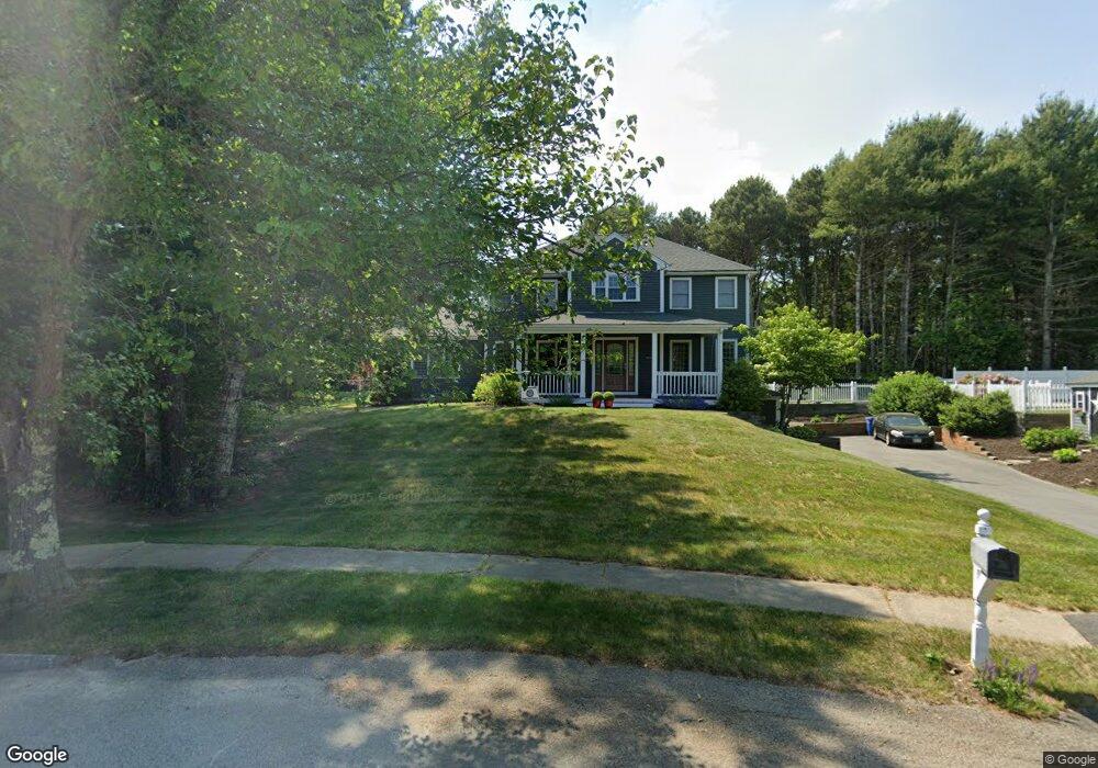
16 Dinah Path Plymouth, MA 02360
Estimated Value: $748,694 - $859,000
3
Beds
3
Baths
2,492
Sq Ft
$325/Sq Ft
Est. Value
About This Home
This home is located at 16 Dinah Path, Plymouth, MA 02360 and is currently estimated at $810,674, approximately $325 per square foot. 16 Dinah Path is a home located in Plymouth County with nearby schools including Indian Brook, Plymouth South Middle School, and Plymouth South High School.
Ownership History
Date
Name
Owned For
Owner Type
Purchase Details
Closed on
Jan 16, 1997
Sold by
Mullian Michael R
Bought by
Connolly Paul W and Skarbek Carol M
Current Estimated Value
Purchase Details
Closed on
Oct 12, 1990
Sold by
Lalli Frank A
Bought by
Fitzgerald Shaun
Purchase Details
Closed on
Mar 16, 1989
Sold by
Lalli Frank A
Bought by
Gilbert Evan L
Create a Home Valuation Report for This Property
The Home Valuation Report is an in-depth analysis detailing your home's value as well as a comparison with similar homes in the area
Home Values in the Area
Average Home Value in this Area
Purchase History
| Date | Buyer | Sale Price | Title Company |
|---|---|---|---|
| Connolly Paul W | $182,914 | -- | |
| Fitzgerald Shaun | $185,000 | -- | |
| Fitzgerald Shaun | $185,000 | -- | |
| Gilbert Evan L | $195,000 | -- | |
| Gilbert Evan L | $195,000 | -- |
Source: Public Records
Mortgage History
| Date | Status | Borrower | Loan Amount |
|---|---|---|---|
| Open | Gilbert Evan L | $255,000 | |
| Closed | Gilbert Evan L | $240,000 |
Source: Public Records
Tax History Compared to Growth
Tax History
| Year | Tax Paid | Tax Assessment Tax Assessment Total Assessment is a certain percentage of the fair market value that is determined by local assessors to be the total taxable value of land and additions on the property. | Land | Improvement |
|---|---|---|---|---|
| 2025 | $7,445 | $586,700 | $213,700 | $373,000 |
| 2024 | $7,257 | $563,900 | $209,300 | $354,600 |
| 2023 | $6,937 | $506,000 | $182,900 | $323,100 |
| 2022 | $6,302 | $408,400 | $166,300 | $242,100 |
| 2021 | $6,280 | $388,600 | $166,300 | $222,300 |
| 2020 | $6,280 | $384,100 | $161,900 | $222,200 |
| 2019 | $6,087 | $368,000 | $144,300 | $223,700 |
| 2018 | $5,774 | $350,800 | $127,300 | $223,500 |
| 2017 | $5,427 | $327,300 | $127,300 | $200,000 |
| 2016 | $5,182 | $318,500 | $116,800 | $201,700 |
| 2015 | $4,977 | $320,300 | $116,800 | $203,500 |
| 2014 | $4,764 | $314,900 | $116,800 | $198,100 |
Source: Public Records
Map
Nearby Homes
- 1096 Long Pond Rd
- 65 Lakewood Dr
- 1150 Long Pond Rd
- 18 Westcliff Dr
- 20 Westcliff Dr Unit 20
- 4 Westcliff Dr Unit Golfview
- 1 Kara's Way
- 42 Fairway Dr Unit Golfview
- 12 Kara's Way
- 21 Dublin Dr
- 53 White Cliff Dr
- 110 Valley Rd
- 6 Sea Cliff Dr Unit 6
- 6 Seacliff Dr Unit 6
- 2462 State Rd
- 92 Cliffside Dr
- 92 Cliffside Dr Unit White Cliff
- 112 Cliffside Dr Unit 112
- 15 Nonantum Rd
- 5 Laurie Ann's Ln
- 8 Dinah Path
- 37 Tananger Rd
- 22 Dinah Path
- 41 Tananger Rd
- 21 Dinah Path
- 15 Dinah Path
- 45 Tananger Rd
- 11 Dinah Path
- 11 Dinah Path Unit 2
- 7 Dinah Path
- 49 Tananger Rd
- 6 White Violet Ln
- 42 Tananger Rd
- 21 Tananger Rd
- 46 Tananger Rd
- 30 Tananger Rd
- 2 White Violet Ln
- 34 Tananger Rd
- 50 Tananger Rd
- 26 Tananger Rd