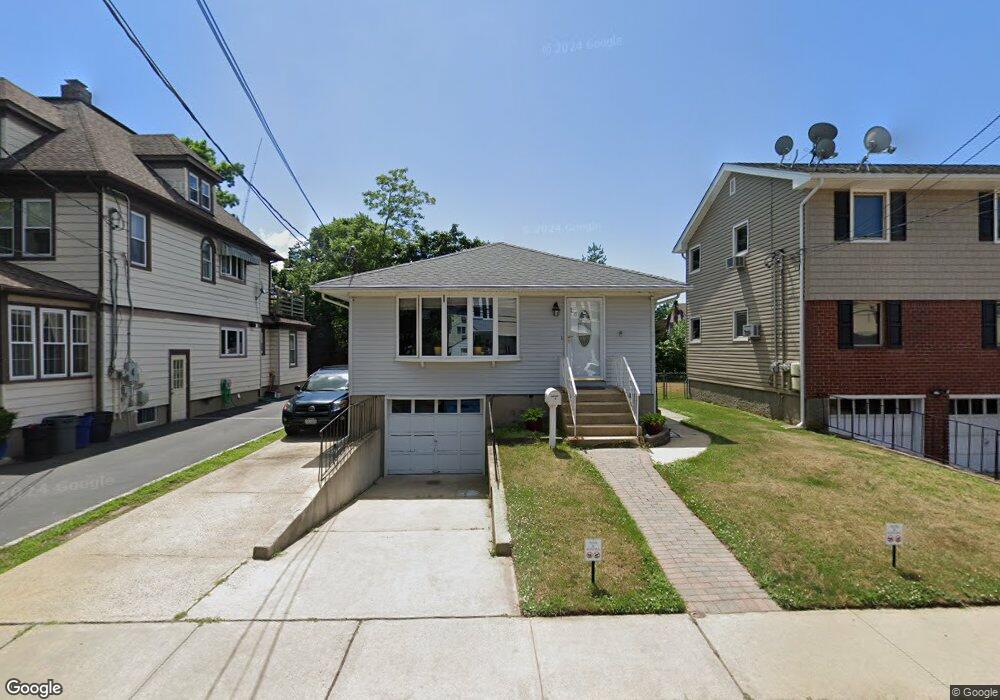
16 Doxsey Place Lynbrook, NY 11563
Estimated Value: $667,000 - $696,260
3
Beds
2
Baths
1,100
Sq Ft
$620/Sq Ft
Est. Value
About This Home
This home is located at 16 Doxsey Place, Lynbrook, NY 11563 and is currently estimated at $681,630, approximately $619 per square foot. 16 Doxsey Place is a home located in Nassau County with nearby schools including Lynbrook Senior High School and Our Lady Of Peace School.
Ownership History
Date
Name
Owned For
Owner Type
Purchase Details
Closed on
Oct 22, 2013
Sold by
Pritchard Karen and Pritchard Kevin
Bought by
Durrant Keisha
Current Estimated Value
Home Financials for this Owner
Home Financials are based on the most recent Mortgage that was taken out on this home.
Original Mortgage
$252,000
Outstanding Balance
$188,324
Interest Rate
4.36%
Estimated Equity
$493,306
Purchase Details
Closed on
Feb 11, 2009
Sold by
Pritchard Karen
Bought by
Pritchard Karen and Pritchard Kevin
Purchase Details
Closed on
Oct 12, 2000
Sold by
Campbell Howard E
Bought by
Smith Maureen
Create a Home Valuation Report for This Property
The Home Valuation Report is an in-depth analysis detailing your home's value as well as a comparison with similar homes in the area
Home Values in the Area
Average Home Value in this Area
Purchase History
| Date | Buyer | Sale Price | Title Company |
|---|---|---|---|
| Durrant Keisha | $315,000 | -- | |
| Pritchard Karen | -- | Attorney | |
| Smith Maureen | $225,000 | Liz Salem |
Source: Public Records
Mortgage History
| Date | Status | Borrower | Loan Amount |
|---|---|---|---|
| Open | Durrant Keisha | $252,000 |
Source: Public Records
Tax History Compared to Growth
Tax History
| Year | Tax Paid | Tax Assessment Tax Assessment Total Assessment is a certain percentage of the fair market value that is determined by local assessors to be the total taxable value of land and additions on the property. | Land | Improvement |
|---|---|---|---|---|
| 2025 | $8,342 | $407 | $174 | $233 |
| 2024 | $849 | $411 | $176 | $235 |
| 2023 | $7,191 | $441 | $188 | $253 |
| 2022 | $7,191 | $437 | $187 | $250 |
| 2021 | $9,211 | $485 | $198 | $287 |
| 2020 | $7,411 | $537 | $413 | $124 |
| 2019 | $6,797 | $575 | $373 | $202 |
| 2018 | $6,722 | $682 | $0 | $0 |
| 2017 | $6,199 | $682 | $442 | $240 |
| 2016 | $7,185 | $653 | $442 | $211 |
| 2015 | $970 | $653 | $394 | $259 |
| 2014 | $970 | $653 | $394 | $259 |
| 2013 | $890 | $653 | $394 | $259 |
Source: Public Records
Map
Nearby Homes
- 114 Atlantic Ave Unit 89
- 21 Carter Ct
- 183 Atlantic Ave Unit 2
- 183 Atlantic Ave Unit 8
- 108 Earle Ave
- 185 Atlantic Ave Unit C-1
- 185 Atlantic Ave Unit C-3
- 65 Earle Ave
- 200 Atlantic Ave Unit 223
- 200 Atlantic Ave Unit 212
- 200 Atlantic Ave Unit 321
- 85 Oakland Ave
- 59 Manor Rd
- 70 Denton Ave
- 73 Peterson Place
- 107 Melrose Ave
- 160 Rocklyn Ave
- 40 Daley Place Unit 124
- 9 Watkins St
- 230 Broadway
- 10 Doxsey Place
- 20 Doxsey Place
- 142 Atlantic Ave
- 138 Atlantic Ave
- 6 Doxsey Place
- 6 Doxsey Place Unit 2 fl
- 150 Atlantic Ave
- 17 Doxsey Place
- 17 Doxsey Place Unit 2nd fl
- 13 Doxsey Place
- 13 Doxsey Place Unit 2
- 13 Doxsey Place Unit 3
- 154 Atlantic Ave
- 19 Doxsey Place Unit Main
- 19 Doxsey Place Unit Lst Fl
- 19 Doxsey Place
- 28 Doxsey Place
- 28 Doxsey Place
- 156 Atlantic Ave
- 158 Atlantic Ave Unit 2