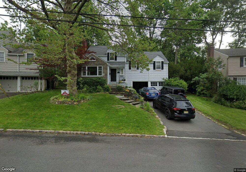
16 Dunnder Dr Summit, NJ 07901
Estimated Value: $1,269,721 - $1,737,000
--
Bed
--
Bath
2,194
Sq Ft
$670/Sq Ft
Est. Value
About This Home
This home is located at 16 Dunnder Dr, Summit, NJ 07901 and is currently estimated at $1,470,430, approximately $670 per square foot. 16 Dunnder Dr is a home located in Union County with nearby schools including L C Johnson Summit Middle School, Summit Sr High School, and Kent Place School.
Ownership History
Date
Name
Owned For
Owner Type
Purchase Details
Closed on
Jul 10, 2018
Sold by
Mccarty Terence M and Haines Elizabeth
Bought by
Haines Elizabeth
Current Estimated Value
Home Financials for this Owner
Home Financials are based on the most recent Mortgage that was taken out on this home.
Original Mortgage
$565,000
Interest Rate
4.6%
Mortgage Type
New Conventional
Purchase Details
Closed on
Jun 19, 2007
Sold by
Hutson Joshua E and Hutson Margaret A
Bought by
Mccarty Terence M and Haines Elizabeth
Home Financials for this Owner
Home Financials are based on the most recent Mortgage that was taken out on this home.
Original Mortgage
$417,000
Interest Rate
6.14%
Mortgage Type
Purchase Money Mortgage
Purchase Details
Closed on
Jun 23, 2004
Sold by
Schliemann Ulrich W
Bought by
Hutson Joshua E and Hutson Margaret A
Home Financials for this Owner
Home Financials are based on the most recent Mortgage that was taken out on this home.
Original Mortgage
$300,000
Interest Rate
6.25%
Purchase Details
Closed on
Mar 28, 1995
Sold by
Forrey Sarah
Bought by
Schliemann Ulrich W and Schliemann Christine A
Create a Home Valuation Report for This Property
The Home Valuation Report is an in-depth analysis detailing your home's value as well as a comparison with similar homes in the area
Home Values in the Area
Average Home Value in this Area
Purchase History
| Date | Buyer | Sale Price | Title Company |
|---|---|---|---|
| Haines Elizabeth | $373,405 | Servicelink | |
| Mccarty Terence M | $950,000 | United General Title Ins Co | |
| Hutson Joshua E | $820,625 | -- | |
| Schliemann Ulrich W | $373,500 | -- |
Source: Public Records
Mortgage History
| Date | Status | Borrower | Loan Amount |
|---|---|---|---|
| Previous Owner | Haines Elizabeth | $565,000 | |
| Previous Owner | Mccarty Terence M | $417,000 | |
| Previous Owner | Hutson Joshua E | $300,000 |
Source: Public Records
Tax History Compared to Growth
Tax History
| Year | Tax Paid | Tax Assessment Tax Assessment Total Assessment is a certain percentage of the fair market value that is determined by local assessors to be the total taxable value of land and additions on the property. | Land | Improvement |
|---|---|---|---|---|
| 2025 | $15,751 | $361,600 | $149,500 | $212,100 |
| 2024 | $14,781 | $361,600 | $149,500 | $212,100 |
| 2023 | $14,781 | $341,600 | $149,500 | $192,100 |
| 2022 | $14,631 | $341,600 | $149,500 | $192,100 |
| 2021 | $14,747 | $341,600 | $149,500 | $192,100 |
| 2020 | $14,894 | $341,600 | $149,500 | $192,100 |
| 2019 | $14,911 | $341,600 | $149,500 | $192,100 |
| 2018 | $14,815 | $341,600 | $149,500 | $192,100 |
| 2017 | $14,911 | $341,600 | $149,500 | $192,100 |
| 2016 | $14,692 | $341,600 | $149,500 | $192,100 |
| 2015 | $14,405 | $341,600 | $149,500 | $192,100 |
| 2014 | $14,033 | $341,600 | $149,500 | $192,100 |
Source: Public Records
Map
Nearby Homes
- 215 Kent Place Blvd
- 27 Beekman Rd
- 62 Beekman Rd
- 166 Colonial Rd
- 172 Colonial Rd
- 24 Gates Ave Unit A
- 709 Springfield Ave Unit 4
- 709 Springfield Ave Unit 3
- 67-75 New England Ave Unit 67D
- 412 Morris Ave Unit 17
- 50 New England Ave Unit C
- 55 River Rd
- 30 Aubrey St
- 25 Division Ave
- 147 Canoe Brook Pkwy
- 180 Canoe Brook Pkwy
- 146 Riveredge Dr
- 15 Maple St
- 175 Terrace Dr
- 14A Kensington Rd Unit A