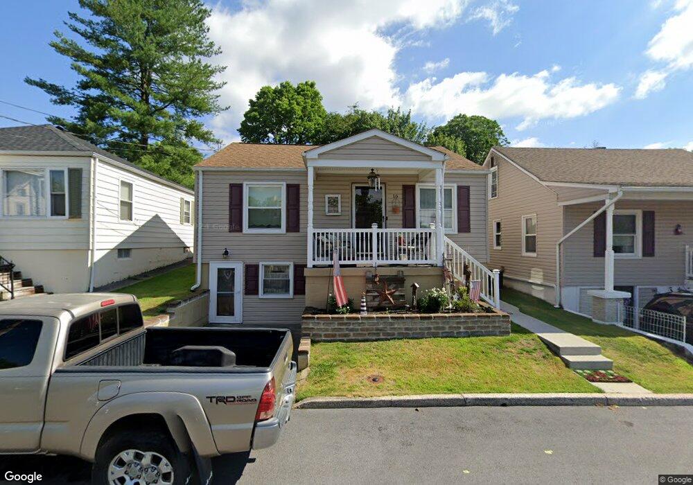
16 E Green St Funkstown, MD 21734
Estimated Value: $170,000 - $233,000
Studio
--
Bath
841
Sq Ft
$235/Sq Ft
Est. Value
About This Home
This home is located at 16 E Green St, Funkstown, MD 21734 and is currently estimated at $197,900, approximately $235 per square foot. 16 E Green St is a home located in Washington County with nearby schools including Ruth Ann Monroe Primary School, Eastern Elementary School, and E. Russell Hicks Middle School.
Ownership History
Date
Name
Owned For
Owner Type
Purchase Details
Closed on
Mar 30, 2001
Sold by
Kitchen Leon J and Betty
Bought by
Grim David A and Grim Deborah K
Current Estimated Value
Purchase Details
Closed on
May 28, 1992
Sold by
Frost Douglas G
Bought by
Kitchen Leon J and Kitchen Betty M
Home Financials for this Owner
Home Financials are based on the most recent Mortgage that was taken out on this home.
Original Mortgage
$75,500
Interest Rate
8.53%
Purchase Details
Closed on
Jul 9, 1987
Sold by
Garvin Franklin D and Garvin Bridget G
Bought by
Frost Douglas G
Home Financials for this Owner
Home Financials are based on the most recent Mortgage that was taken out on this home.
Original Mortgage
$44,321
Interest Rate
10.36%
Create a Home Valuation Report for This Property
The Home Valuation Report is an in-depth analysis detailing your home's value as well as a comparison with similar homes in the area
Home Values in the Area
Average Home Value in this Area
Purchase History
| Date | Buyer | Sale Price | Title Company |
|---|---|---|---|
| Grim David A | -- | -- | |
| Kitchen Leon J | $75,000 | -- | |
| Frost Douglas G | $53,500 | -- |
Source: Public Records
Mortgage History
| Date | Status | Borrower | Loan Amount |
|---|---|---|---|
| Previous Owner | Kitchen Leon J | $75,500 | |
| Previous Owner | Frost Douglas G | $44,321 | |
| Closed | Grim David A | -- |
Source: Public Records
Tax History
| Year | Tax Paid | Tax Assessment Tax Assessment Total Assessment is a certain percentage of the fair market value that is determined by local assessors to be the total taxable value of land and additions on the property. | Land | Improvement |
|---|---|---|---|---|
| 2025 | $1,189 | $163,000 | $0 | $0 |
| 2024 | $1,189 | $151,300 | $42,500 | $108,800 |
| 2023 | $1,125 | $137,767 | $0 | $0 |
| 2022 | $1,065 | $124,233 | $0 | $0 |
| 2021 | $998 | $110,700 | $42,500 | $68,200 |
| 2020 | $998 | $107,233 | $0 | $0 |
| 2019 | $970 | $103,767 | $0 | $0 |
| 2018 | $938 | $100,300 | $48,800 | $51,500 |
| 2017 | $933 | $99,733 | $0 | $0 |
| 2016 | -- | $99,167 | $0 | $0 |
| 2015 | $1,012 | $98,600 | $0 | $0 |
| 2014 | $1,012 | $98,600 | $0 | $0 |
Source: Public Records
Map
Nearby Homes
- 414 Beaver Creek Rd
- 2 Charlotte St
- 11 Funkstown Rd
- 12.3 AC Southern Blvd
- 90 Charlotte St
- 103 Charlotte St
- 104 Charlotte St
- 329 Emmert Rd
- 10378 Lantern Ln
- 202 S Fork Dr
- 605 Knightsbridge Dr
- 628 Knightsbridge Dr
- 10348 Bridle Ct
- 104 S Edgewood Dr Unit 104
- 1619 Dual Hwy
- 10229 Mar Rock Dr
- 0 Kenly Ave
- 124 Buttercup Dr
- 925 Frederick St
- 920 Frederick St
- 18 E Green St
- 14 E Green St
- 20 E Green St
- 12 E Green St
- 23 E Cemetery St
- 15 E Cemetery St
- 17 E Cemetery St
- 22 E Green St
- 10 E Green St
- 19 E Green St
- 17 E Green St
- 25 E Cemetery St
- 29 E Cemetery St
- 13 E Green St
- 7 E Cemetery St
- 24 E Green St
- 35 E Cemetery St
- 11 E Green St
- 23 E Green St
- 205 S Antietam St
Your Personal Tour Guide
Ask me questions while you tour the home.