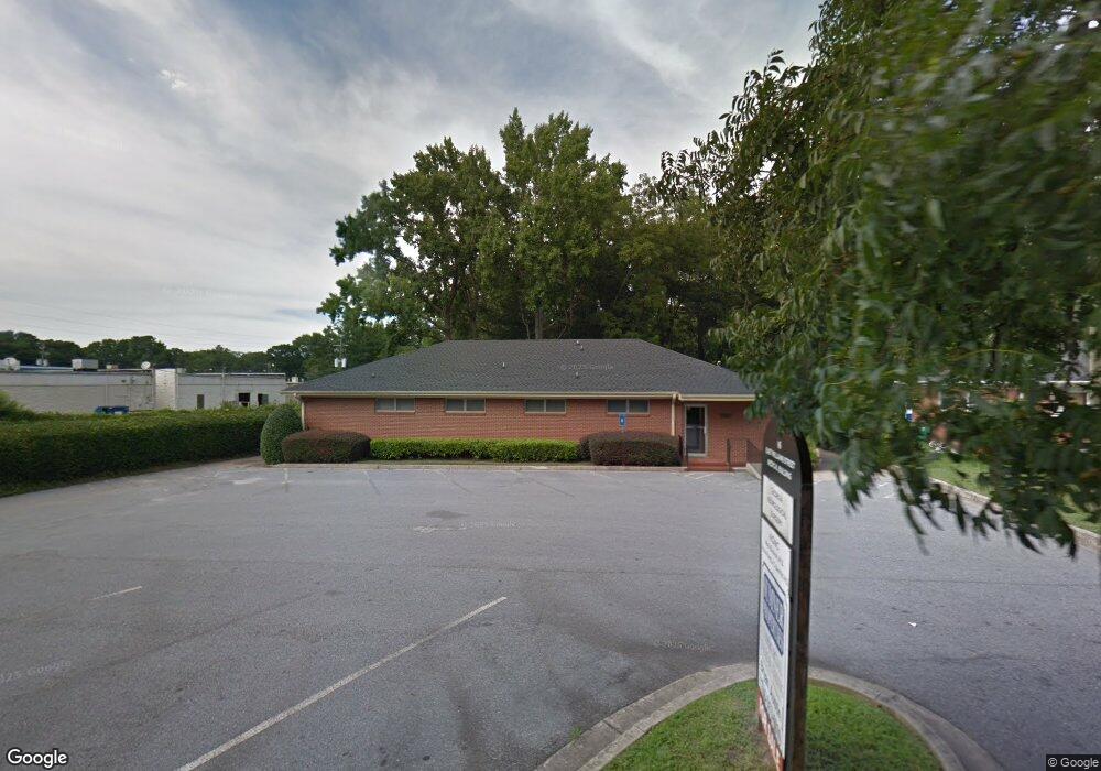
16 E Williams St Winder, GA 30680
Estimated Value: $297,584
Studio
--
Bath
2,504
Sq Ft
$119/Sq Ft
Est. Value
About This Home
This home is located at 16 E Williams St, Winder, GA 30680 and is currently estimated at $297,584, approximately $118 per square foot. 16 E Williams St is a home located in Barrow County with nearby schools including County Line Elementary School, Russell Middle School, and Winder-Barrow High School.
Ownership History
Date
Name
Owned For
Owner Type
Purchase Details
Closed on
Jul 16, 2025
Sold by
Equity Trust Co
Bought by
Meraki Property Management Llc
Current Estimated Value
Home Financials for this Owner
Home Financials are based on the most recent Mortgage that was taken out on this home.
Original Mortgage
$150,000
Outstanding Balance
$148,244
Interest Rate
6.81%
Mortgage Type
New Conventional
Estimated Equity
$149,340
Purchase Details
Closed on
Dec 21, 2022
Sold by
Amg Properties Llc
Bought by
Sauls Charles and Equity Trust Co Custodian Fbo
Purchase Details
Closed on
May 15, 2019
Sold by
Georgia Landmark Holdings Llc
Bought by
Amg Properties Llc
Purchase Details
Closed on
Apr 21, 2005
Sold by
Randolph William Q
Bought by
Farmer Michael E
Home Financials for this Owner
Home Financials are based on the most recent Mortgage that was taken out on this home.
Original Mortgage
$230,000
Interest Rate
5.79%
Create a Home Valuation Report for This Property
The Home Valuation Report is an in-depth analysis detailing your home's value as well as a comparison with similar homes in the area
Home Values in the Area
Average Home Value in this Area
Purchase History
| Date | Buyer | Sale Price | Title Company |
|---|---|---|---|
| Meraki Property Management Llc | $300,000 | -- | |
| Sauls Charles | $228,000 | -- | |
| Amg Properties Llc | $150,000 | -- | |
| Farmer Michael E | $230,000 | -- |
Source: Public Records
Mortgage History
| Date | Status | Borrower | Loan Amount |
|---|---|---|---|
| Open | Meraki Property Management Llc | $150,000 | |
| Previous Owner | Farmer Michael E | $230,000 |
Source: Public Records
Tax History
| Year | Tax Paid | Tax Assessment Tax Assessment Total Assessment is a certain percentage of the fair market value that is determined by local assessors to be the total taxable value of land and additions on the property. | Land | Improvement |
|---|---|---|---|---|
| 2025 | $2,543 | $91,200 | $23,866 | $67,334 |
| 2024 | $2,588 | $91,200 | $23,866 | $67,334 |
| 2023 | $2,580 | $91,200 | $23,866 | $67,334 |
| 2022 | $3,872 | $135,330 | $31,200 | $104,130 |
| 2021 | $2,383 | $76,674 | $10,000 | $66,674 |
| 2020 | $1,912 | $75,835 | $8,000 | $67,835 |
| 2019 | $2,651 | $75,835 | $8,000 | $67,835 |
| 2018 | $2,545 | $72,807 | $8,000 | $64,807 |
| 2017 | $2,010 | $67,379 | $8,000 | $59,379 |
| 2016 | $1,913 | $56,392 | $8,000 | $48,392 |
| 2015 | $1,915 | $56,392 | $8,000 | $48,392 |
| 2014 | $1,869 | $54,664 | $6,272 | $48,392 |
| 2013 | -- | $51,814 | $5,488 | $46,326 |
Source: Public Records
Map
Nearby Homes
- 131 Pinehurst Dr
- 267 Nancy St
- 317 Georgia Ave
- 17 W Wright St
- 10 W Wright St
- 160 N Broad St
- 0 Jerome St Unit 10359679
- 60 W Williams St
- 18 E New St
- 323 Lumpkin St
- 59 W Wright St
- 270 Griffith St
- 209 Georgia Ave
- 5 W Kimball St
- 3 W Kimball St
- 1 W Kimball St
- 227 Martin Luther King jr Dr
- 221 Martin Luther King jr Dr
- 352 3rd Ave
- 208 Shields St
- 22 E Williams St
- 17 E Williams St
- 13 E Williams St
- 232 Pinehurst Dr Unit 36
- 71 Pinehurst Dr
- 192 Pinehurst Dr
- 51 Pinehurst Dr
- 172 Pinehurst Dr
- 157 Woodruff Dr
- 112 Greystone Ct
- 131 Pinehurst Dr Unit 29
- 105 Woodruff Dr Unit 25
- 201 Pinehurst Dr Unit 31
- 171 Pinehurst Dr Unit 30
- 237 Pinehurst Dr
- 235 Pinehurst Dr
- 237 Pinehurst Dr Unit 38
- 237 Pinehurst Dr Unit LOT 34
- 235 Pinehurst Dr Unit LOT 33
- 131 Pinehurst Dr Unit 38
Your Personal Tour Guide
Ask me questions while you tour the home.