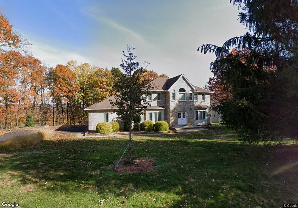
16 Emerson Rd Morris Plains, NJ 07950
Estimated Value: $868,000 - $1,168,000
--
Bed
--
Bath
3,348
Sq Ft
$314/Sq Ft
Est. Value
About This Home
This home is located at 16 Emerson Rd, Morris Plains, NJ 07950 and is currently estimated at $1,051,284, approximately $314 per square foot. 16 Emerson Rd is a home located in Morris County with nearby schools including Littleton Elementary School, Brooklawn Middle School, and Parsippany Hills High School.
Ownership History
Date
Name
Owned For
Owner Type
Purchase Details
Closed on
May 23, 2012
Sold by
Landrigan Karen A
Bought by
Landrigan Karen A and Landrigan Dennis F
Current Estimated Value
Home Financials for this Owner
Home Financials are based on the most recent Mortgage that was taken out on this home.
Original Mortgage
$289,987
Outstanding Balance
$39,737
Interest Rate
3.3%
Mortgage Type
FHA
Estimated Equity
$1,011,547
Purchase Details
Closed on
Dec 20, 2007
Sold by
Filippone Settimo
Bought by
Landrigan Karen
Purchase Details
Closed on
Jul 24, 1997
Sold by
Pineview Homes Inc
Bought by
Filippone Settimo and Landrigan Karen
Home Financials for this Owner
Home Financials are based on the most recent Mortgage that was taken out on this home.
Original Mortgage
$130,000
Interest Rate
7.55%
Create a Home Valuation Report for This Property
The Home Valuation Report is an in-depth analysis detailing your home's value as well as a comparison with similar homes in the area
Home Values in the Area
Average Home Value in this Area
Purchase History
| Date | Buyer | Sale Price | Title Company |
|---|---|---|---|
| Landrigan Karen A | -- | Westcor Land Title Ins Co | |
| Landrigan Karen | -- | None Available | |
| Filippone Settimo | $347,900 | -- |
Source: Public Records
Mortgage History
| Date | Status | Borrower | Loan Amount |
|---|---|---|---|
| Open | Landrigan Karen A | $289,987 | |
| Previous Owner | Filippone Settimo | $130,000 |
Source: Public Records
Tax History Compared to Growth
Tax History
| Year | Tax Paid | Tax Assessment Tax Assessment Total Assessment is a certain percentage of the fair market value that is determined by local assessors to be the total taxable value of land and additions on the property. | Land | Improvement |
|---|---|---|---|---|
| 2025 | $21,622 | $622,400 | $271,900 | $350,500 |
| 2024 | $21,211 | $622,400 | $271,900 | $350,500 |
| 2023 | $21,211 | $622,400 | $271,900 | $350,500 |
| 2022 | $19,736 | $622,400 | $271,900 | $350,500 |
| 2021 | $19,736 | $622,400 | $271,900 | $350,500 |
| 2020 | $19,195 | $622,400 | $271,900 | $350,500 |
| 2019 | $18,678 | $622,400 | $271,900 | $350,500 |
| 2018 | $18,149 | $622,400 | $271,900 | $350,500 |
| 2017 | $17,738 | $622,400 | $271,900 | $350,500 |
| 2016 | $17,433 | $622,400 | $271,900 | $350,500 |
| 2015 | $16,992 | $622,400 | $271,900 | $350,500 |
| 2014 | $16,743 | $622,400 | $271,900 | $350,500 |
Source: Public Records
Map
Nearby Homes
- 84 Stockton Ct
- 65 Stockton Ct
- 33 Continental Rd
- 2467 State Route 10 Unit 12-7A
- 2467 State Route 10 Unit 3B
- 2467 State Route 10 Unit 6-B
- 2467 State Route 10 Unit 5A
- 2467 State Route 10 Unit 24-6B
- 2467 New Jersey 10 Unit 6A
- 2467 New Jersey 10 Unit 1
- 2467 New Jersey 10 Unit 7A
- 2467 Route10 Unit 1A
- 11 Laurel St
- 2467 Route 10 Unit 4A
- 83 Patriots Rd
- 7 D Foxwood Dr Unit D
- 7 J Foxwood Dr Unit J
- 77 S Powder Mill Rd
- 22 A Foxwood Dr Unit A
- 2 A Foxwood Dr Unit A
- 17 Emerson Rd
- 18 Emerson Rd
- 19 Emerson Rd
- 3 Dean Gallo Ct
- 20 Emerson Rd
- 23 Emerson Rd
- 3502 Gates Ct Unit 1504
- 22 Emerson Rd
- 15 Guilford Ct
- 1 Dean Gallo Ct
- 11 Guilford Ct
- 8 Dean Gallo Ct
- 3 Guilford Ct
- 26 Emerson Rd
- 3208 Gates Ct Unit 2319
- 6 Dean Gallo Ct
- 24 Emerson Rd
- 26 Guilford Ct
- 24 Guilford Ct
- 52 Continental Rd