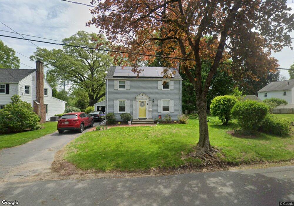
16 Fenor St West Springfield, MA 01089
Estimated Value: $322,000 - $398,000
3
Beds
1
Bath
1,560
Sq Ft
$223/Sq Ft
Est. Value
About This Home
This home is located at 16 Fenor St, West Springfield, MA 01089 and is currently estimated at $347,225, approximately $222 per square foot. 16 Fenor St is a home located in Hampden County with nearby schools including St Thomas The Apostle School.
Ownership History
Date
Name
Owned For
Owner Type
Purchase Details
Closed on
Feb 23, 1999
Sold by
Gates David J and Gates Pamela J
Bought by
Taylor Paul M and Taylor Elaine R
Current Estimated Value
Home Financials for this Owner
Home Financials are based on the most recent Mortgage that was taken out on this home.
Original Mortgage
$107,000
Interest Rate
6.75%
Mortgage Type
Purchase Money Mortgage
Create a Home Valuation Report for This Property
The Home Valuation Report is an in-depth analysis detailing your home's value as well as a comparison with similar homes in the area
Home Values in the Area
Average Home Value in this Area
Purchase History
| Date | Buyer | Sale Price | Title Company |
|---|---|---|---|
| Taylor Paul M | $134,000 | -- |
Source: Public Records
Mortgage History
| Date | Status | Borrower | Loan Amount |
|---|---|---|---|
| Open | Taylor Paul M | $95,000 | |
| Closed | Taylor Paul M | $107,000 | |
| Previous Owner | Taylor Paul M | $101,250 | |
| Previous Owner | Taylor Paul M | $90,000 |
Source: Public Records
Tax History Compared to Growth
Tax History
| Year | Tax Paid | Tax Assessment Tax Assessment Total Assessment is a certain percentage of the fair market value that is determined by local assessors to be the total taxable value of land and additions on the property. | Land | Improvement |
|---|---|---|---|---|
| 2025 | $3,477 | $233,800 | $83,800 | $150,000 |
| 2024 | $3,298 | $222,700 | $83,800 | $138,900 |
| 2023 | $3,125 | $201,100 | $81,900 | $119,200 |
| 2022 | $2,857 | $181,300 | $74,300 | $107,000 |
| 2021 | $2,772 | $164,000 | $68,300 | $95,700 |
| 2020 | $2,766 | $162,800 | $68,300 | $94,500 |
| 2019 | $2,761 | $162,800 | $68,300 | $94,500 |
| 2018 | $2,776 | $162,800 | $68,300 | $94,500 |
| 2017 | $2,776 | $162,800 | $68,300 | $94,500 |
| 2016 | $2,727 | $160,500 | $64,200 | $96,300 |
| 2015 | $2,674 | $157,400 | $62,900 | $94,500 |
| 2014 | $648 | $157,400 | $62,900 | $94,500 |
Source: Public Records
Map
Nearby Homes