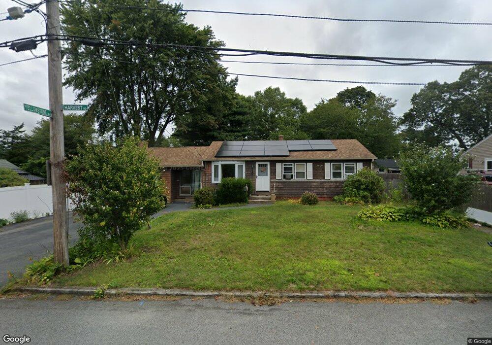
16 Harvest Rd Warwick, RI 02888
Spring Green NeighborhoodEstimated Value: $403,099 - $452,000
3
Beds
1
Bath
1,456
Sq Ft
$302/Sq Ft
Est. Value
About This Home
This home is located at 16 Harvest Rd, Warwick, RI 02888 and is currently estimated at $439,275, approximately $301 per square foot. 16 Harvest Rd is a home located in Kent County with nearby schools including St. Peter School.
Ownership History
Date
Name
Owned For
Owner Type
Purchase Details
Closed on
Jan 12, 2007
Sold by
Brodeur John F and Brodeur Margaret L
Bought by
Brodeur Mark
Current Estimated Value
Home Financials for this Owner
Home Financials are based on the most recent Mortgage that was taken out on this home.
Original Mortgage
$125,000
Outstanding Balance
$73,813
Interest Rate
6.18%
Mortgage Type
Purchase Money Mortgage
Estimated Equity
$365,462
Purchase Details
Closed on
Nov 7, 1991
Sold by
Zarrella Robert W
Bought by
Brodeur John F
Create a Home Valuation Report for This Property
The Home Valuation Report is an in-depth analysis detailing your home's value as well as a comparison with similar homes in the area
Home Values in the Area
Average Home Value in this Area
Purchase History
| Date | Buyer | Sale Price | Title Company |
|---|---|---|---|
| Brodeur Mark | $240,000 | -- | |
| Brodeur John F | $80,000 | -- | |
| Brodeur John F | $80,000 | -- |
Source: Public Records
Mortgage History
| Date | Status | Borrower | Loan Amount |
|---|---|---|---|
| Open | Brodeur John F | $13,500 | |
| Open | Brodeur John F | $125,000 |
Source: Public Records
Tax History Compared to Growth
Tax History
| Year | Tax Paid | Tax Assessment Tax Assessment Total Assessment is a certain percentage of the fair market value that is determined by local assessors to be the total taxable value of land and additions on the property. | Land | Improvement |
|---|---|---|---|---|
| 2025 | $4,793 | $377,400 | $124,800 | $252,600 |
| 2024 | $4,746 | $328,000 | $108,500 | $219,500 |
| 2023 | $4,654 | $328,000 | $108,500 | $219,500 |
| 2022 | $4,319 | $230,600 | $66,400 | $164,200 |
| 2021 | $4,319 | $230,600 | $66,400 | $164,200 |
| 2020 | $4,319 | $230,600 | $66,400 | $164,200 |
| 2019 | $4,319 | $230,600 | $66,400 | $164,200 |
| 2018 | $3,634 | $174,700 | $59,000 | $115,700 |
| 2017 | $3,536 | $174,700 | $59,000 | $115,700 |
| 2016 | $3,536 | $174,700 | $59,000 | $115,700 |
| 2015 | $3,353 | $161,600 | $56,800 | $104,800 |
| 2014 | $3,242 | $161,600 | $56,800 | $104,800 |
| 2013 | $3,198 | $161,600 | $56,800 | $104,800 |
Source: Public Records
Map
Nearby Homes
- 93 Grotto Ave
- 169 Partition St
- 63 Massasoit Dr
- 93 Easton Ave
- 1153 Post Rd
- 126 Fairfax Dr
- 1052 Post Rd
- 447 Harrington Ave
- 40 Easton Ave
- 56 Partition St
- 396 Elm St
- 110 Pilgrim Pkwy Unit 8
- 76 Massachusetts Ave
- 111 Aster St
- 33 Hargraves St
- 77 Kentucky Ave
- 27 Frederick St
- 23 Stoddard Place
- 63 Benbridge Ave
- 144 Hoxsie Ave
- 24 Harvest Rd
- 231 Sand Pond Rd
- 3 Yellowstone Ave
- 6 Harvest Rd
- 2 Yellowstone Ave
- 249 Sand Pond Rd
- 257 Sand Pond Rd
- 32 Harvest Rd
- 3 Harvest Rd
- 230 Sand Pond Rd
- 236 Sand Pond Rd
- 222 Sand Pond Rd
- 10 Yellowstone Ave
- 40 Harvest Rd
- 265 Sand Pond Rd
- 15 Yellowstone Ave
- 246 Sand Pond Rd
- 3 Grotto Ave
- 262 Sand Pond Rd
- 18 Yellowstone Ave