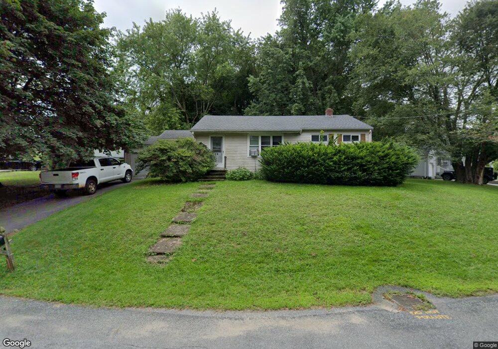
16 Hingham Rd North Grafton, MA 01536
Estimated Value: $430,000 - $492,000
3
Beds
1
Bath
936
Sq Ft
$488/Sq Ft
Est. Value
About This Home
This home is located at 16 Hingham Rd, North Grafton, MA 01536 and is currently estimated at $456,790, approximately $488 per square foot. 16 Hingham Rd is a home located in Worcester County with nearby schools including Grafton High School, Silver Spruce Montessori School, and Al-Hamra Academy.
Ownership History
Date
Name
Owned For
Owner Type
Purchase Details
Closed on
Dec 29, 2009
Sold by
Smith Jane C and Smith Janet M
Bought by
Gray Patrick
Current Estimated Value
Home Financials for this Owner
Home Financials are based on the most recent Mortgage that was taken out on this home.
Original Mortgage
$175,000
Outstanding Balance
$113,800
Interest Rate
4.92%
Mortgage Type
Purchase Money Mortgage
Estimated Equity
$342,990
Create a Home Valuation Report for This Property
The Home Valuation Report is an in-depth analysis detailing your home's value as well as a comparison with similar homes in the area
Home Values in the Area
Average Home Value in this Area
Purchase History
| Date | Buyer | Sale Price | Title Company |
|---|---|---|---|
| Gray Patrick | $185,000 | -- | |
| Gray Patrick | $185,000 | -- | |
| Gray Patrick | $185,000 | -- |
Source: Public Records
Mortgage History
| Date | Status | Borrower | Loan Amount |
|---|---|---|---|
| Open | Gray Patrick | $175,000 | |
| Closed | Gray Patrick | $175,000 |
Source: Public Records
Tax History
| Year | Tax Paid | Tax Assessment Tax Assessment Total Assessment is a certain percentage of the fair market value that is determined by local assessors to be the total taxable value of land and additions on the property. | Land | Improvement |
|---|---|---|---|---|
| 2025 | $5,356 | $384,200 | $174,800 | $209,400 |
| 2024 | $5,232 | $365,600 | $166,500 | $199,100 |
| 2023 | $5,101 | $324,700 | $166,500 | $158,200 |
| 2022 | $4,772 | $282,700 | $142,800 | $139,900 |
| 2021 | $4,596 | $267,500 | $129,800 | $137,700 |
| 2020 | $4,391 | $266,100 | $129,800 | $136,300 |
| 2019 | $4,183 | $251,100 | $126,000 | $125,100 |
| 2018 | $3,869 | $233,200 | $125,300 | $107,900 |
| 2017 | $3,703 | $225,800 | $117,900 | $107,900 |
| 2016 | $3,375 | $201,500 | $94,700 | $106,800 |
| 2015 | $3,328 | $201,700 | $93,600 | $108,100 |
| 2014 | $3,180 | $208,400 | $110,500 | $97,900 |
Source: Public Records
Map
Nearby Homes
- 158 Worcester St
- 14 Northgate Ct Unit 14
- 24 Hovey Pond Dr Unit 24
- 0 East St
- 3 Abby Rd
- 22 Snow Rd
- 5 Suzanne Terrace
- 5 Lincoln Ln Unit 5
- 72 Westborough Rd Unit 1
- 72 Westborough Rd Unit 2
- 4 John Dr
- 5 Ann Dr Unit 5
- 6 Audrina Ln
- 9 Logan Path
- 47 Orchard Meadow Dr
- 101 Orchard Meadow Dr Unit 59
- 1 Purinton St
- 47 Pointe Rok Dr Unit 47,G
- 137 Westboro Rd
- 8 Clearview St
Your Personal Tour Guide
Ask me questions while you tour the home.