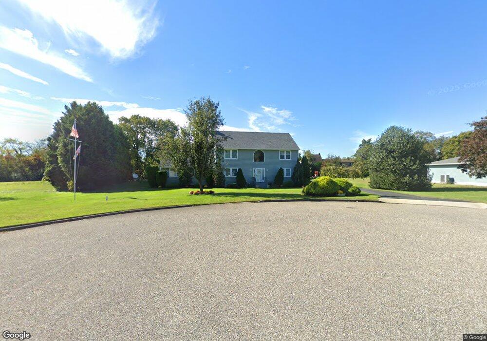
16 Homestead Rd Marmora, NJ 08223
Estimated Value: $694,000 - $933,000
--
Bed
--
Bath
2,802
Sq Ft
$281/Sq Ft
Est. Value
About This Home
This home is located at 16 Homestead Rd, Marmora, NJ 08223 and is currently estimated at $786,184, approximately $280 per square foot. 16 Homestead Rd is a home located in Cape May County with nearby schools including Upper Township Primary School, Upper Township Elementary School, and Upper Township Middle School.
Ownership History
Date
Name
Owned For
Owner Type
Purchase Details
Closed on
Jun 1, 2022
Sold by
Dougherty James M and Dougherty Sharon P
Bought by
Dougherty James M and Dougherty Sharon P
Current Estimated Value
Purchase Details
Closed on
Dec 7, 2000
Purchase Details
Closed on
Sep 24, 1993
Sold by
Sun National Bank
Bought by
Dougherty James M and Dougherty Sharon P
Purchase Details
Closed on
Jan 26, 1990
Sold by
Levari David and Prost Alan
Bought by
Levari David
Create a Home Valuation Report for This Property
The Home Valuation Report is an in-depth analysis detailing your home's value as well as a comparison with similar homes in the area
Home Values in the Area
Average Home Value in this Area
Purchase History
| Date | Buyer | Sale Price | Title Company |
|---|---|---|---|
| Dougherty James M | -- | Barnes Jeffrey P | |
| Dougherty James M | -- | Barnes Jeffrey P | |
| -- | -- | -- | |
| Dougherty James M | $50,000 | -- | |
| Levari David | $60,000 | -- |
Source: Public Records
Tax History Compared to Growth
Tax History
| Year | Tax Paid | Tax Assessment Tax Assessment Total Assessment is a certain percentage of the fair market value that is determined by local assessors to be the total taxable value of land and additions on the property. | Land | Improvement |
|---|---|---|---|---|
| 2025 | $10,238 | $446,100 | $165,500 | $280,600 |
| 2024 | $10,238 | $446,100 | $165,500 | $280,600 |
| 2023 | $9,734 | $446,100 | $165,500 | $280,600 |
| 2022 | $9,377 | $446,100 | $165,500 | $280,600 |
| 2021 | $9,038 | $446,100 | $165,500 | $280,600 |
| 2020 | $8,694 | $446,100 | $165,500 | $280,600 |
| 2019 | $8,463 | $446,100 | $165,500 | $280,600 |
| 2018 | $8,239 | $446,100 | $165,500 | $280,600 |
| 2017 | $8,137 | $446,100 | $165,500 | $280,600 |
| 2016 | $8,275 | $446,100 | $165,500 | $280,600 |
| 2015 | $8,052 | $446,100 | $165,500 | $280,600 |
| 2014 | $6,907 | $469,200 | $197,000 | $272,200 |
Source: Public Records
Map
Nearby Homes
- 202 N Shore Rd
- 125 N Shore Rd
- 16 Lenape Ln
- 32 Norwood Rd
- 14 Lyndhurst Rd
- 1 Roosevelt Blvd
- 601 2nd Ave
- 14 Roberts Ave
- 527 N 527 N Shore Rd
- 246 Egret Ln
- 430 S Shore Rd
- 214 Bartram Ln
- 3709 Waterview Blvd
- 15 Waterway Rd
- 3708 Westminster Ln
- 13 Waterway Rd
- 3604 Oxford Ln
- 3103 Bayland Dr
- 103 Somerset Ln
- 3108 Bay Ave