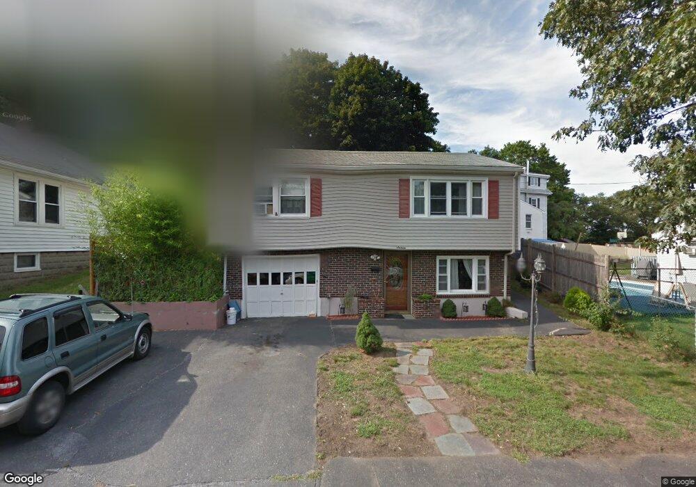
16 Johnson Rd Saugus, MA 01906
Downtown Saugus NeighborhoodEstimated Value: $550,000 - $609,000
3
Beds
2
Baths
1,475
Sq Ft
$397/Sq Ft
Est. Value
About This Home
This home is located at 16 Johnson Rd, Saugus, MA 01906 and is currently estimated at $585,095, approximately $396 per square foot. 16 Johnson Rd is a home located in Essex County with nearby schools including Saugus High School, Pioneer Charter School Of Science II, and Sacred Heart School.
Ownership History
Date
Name
Owned For
Owner Type
Purchase Details
Closed on
Sep 1, 2004
Sold by
Rooney Margaret M Est
Bought by
Apolaya Luis A and Apolaya Flor D
Current Estimated Value
Home Financials for this Owner
Home Financials are based on the most recent Mortgage that was taken out on this home.
Original Mortgage
$232,500
Outstanding Balance
$116,184
Interest Rate
6.01%
Mortgage Type
Purchase Money Mortgage
Estimated Equity
$468,911
Create a Home Valuation Report for This Property
The Home Valuation Report is an in-depth analysis detailing your home's value as well as a comparison with similar homes in the area
Home Values in the Area
Average Home Value in this Area
Purchase History
| Date | Buyer | Sale Price | Title Company |
|---|---|---|---|
| Apolaya Luis A | $303,500 | -- |
Source: Public Records
Mortgage History
| Date | Status | Borrower | Loan Amount |
|---|---|---|---|
| Open | Apolaya Luis A | $232,500 | |
| Closed | Apolaya Luis A | $60,700 | |
| Closed | Apolaya Luis A | $7,258 |
Source: Public Records
Tax History
| Year | Tax Paid | Tax Assessment Tax Assessment Total Assessment is a certain percentage of the fair market value that is determined by local assessors to be the total taxable value of land and additions on the property. | Land | Improvement |
|---|---|---|---|---|
| 2025 | $5,585 | $522,900 | $297,500 | $225,400 |
| 2024 | $5,339 | $501,300 | $280,500 | $220,800 |
| 2023 | $5,135 | $456,000 | $246,500 | $209,500 |
| 2022 | $5,005 | $416,700 | $226,100 | $190,600 |
| 2021 | $4,681 | $379,300 | $196,400 | $182,900 |
| 2020 | $4,323 | $362,700 | $187,000 | $175,700 |
| 2019 | $4,131 | $339,200 | $170,000 | $169,200 |
| 2018 | $3,794 | $327,600 | $164,900 | $162,700 |
| 2017 | $3,574 | $296,600 | $153,900 | $142,700 |
| 2016 | $3,538 | $290,000 | $153,600 | $136,400 |
| 2015 | $3,260 | $271,200 | $146,200 | $125,000 |
| 2014 | $3,087 | $265,900 | $146,200 | $119,700 |
Source: Public Records
Map
Nearby Homes
Your Personal Tour Guide
Ask me questions while you tour the home.