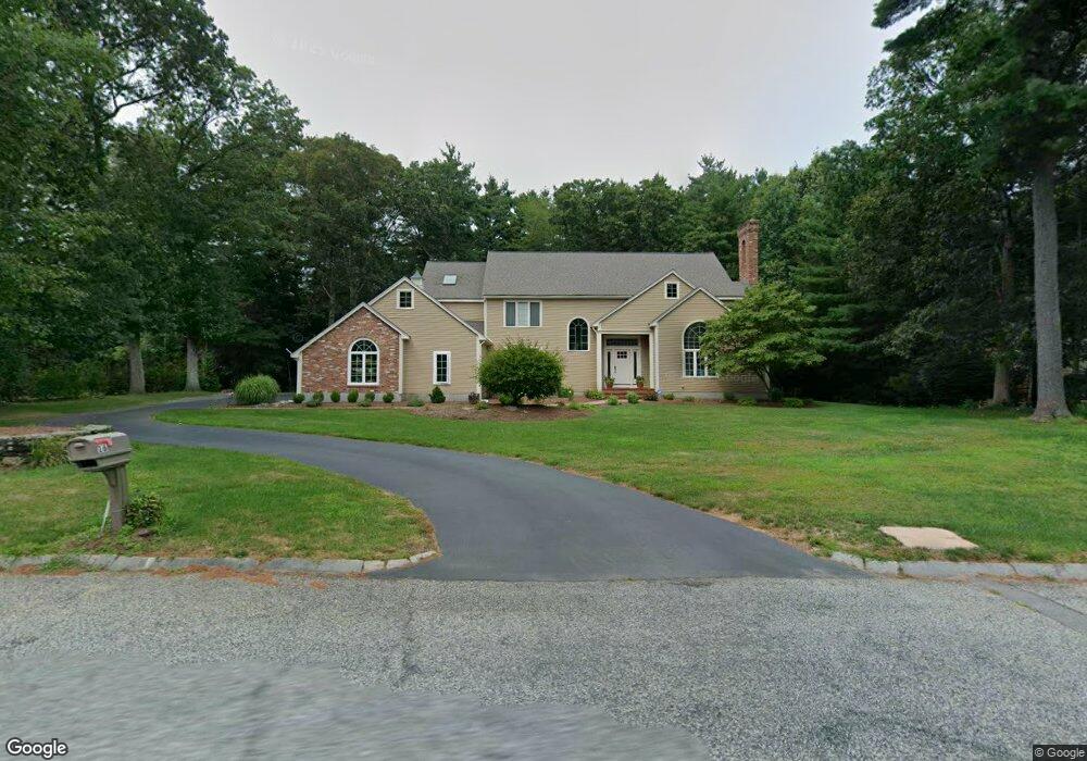
16 Lancashire Dr Mansfield, MA 02048
Estimated Value: $1,084,914 - $1,182,000
4
Beds
3
Baths
3,594
Sq Ft
$319/Sq Ft
Est. Value
About This Home
This home is located at 16 Lancashire Dr, Mansfield, MA 02048 and is currently estimated at $1,145,479, approximately $318 per square foot. 16 Lancashire Dr is a home located in Bristol County with nearby schools including Everett W. Robinson Elementary School, Jordan/Jackson Elementary School, and Harold L. Qualters Middle School.
Ownership History
Date
Name
Owned For
Owner Type
Purchase Details
Closed on
Jul 21, 2010
Sold by
Foley Eugene P
Bought by
Roodhouse Thomas W and Kennon Ann T
Current Estimated Value
Home Financials for this Owner
Home Financials are based on the most recent Mortgage that was taken out on this home.
Original Mortgage
$417,000
Interest Rate
4.76%
Mortgage Type
Purchase Money Mortgage
Purchase Details
Closed on
Jun 14, 1991
Sold by
Obrien & Meeks Constr
Bought by
Foley Eugene P and Foley Judith A
Home Financials for this Owner
Home Financials are based on the most recent Mortgage that was taken out on this home.
Original Mortgage
$264,000
Interest Rate
9.39%
Mortgage Type
Purchase Money Mortgage
Create a Home Valuation Report for This Property
The Home Valuation Report is an in-depth analysis detailing your home's value as well as a comparison with similar homes in the area
Home Values in the Area
Average Home Value in this Area
Purchase History
| Date | Buyer | Sale Price | Title Company |
|---|---|---|---|
| Roodhouse Thomas W | $580,000 | -- | |
| Foley Eugene P | $330,000 | -- |
Source: Public Records
Mortgage History
| Date | Status | Borrower | Loan Amount |
|---|---|---|---|
| Open | Foley Eugene P | $410,000 | |
| Closed | Roodhouse Thomas W | $417,000 | |
| Previous Owner | Foley Eugene P | $260,000 | |
| Previous Owner | Foley Eugene P | $262,500 | |
| Previous Owner | Foley Eugene P | $264,000 |
Source: Public Records
Tax History Compared to Growth
Tax History
| Year | Tax Paid | Tax Assessment Tax Assessment Total Assessment is a certain percentage of the fair market value that is determined by local assessors to be the total taxable value of land and additions on the property. | Land | Improvement |
|---|---|---|---|---|
| 2025 | $13,191 | $1,001,600 | $304,300 | $697,300 |
| 2024 | $12,061 | $893,400 | $267,800 | $625,600 |
| 2023 | $11,469 | $814,000 | $267,800 | $546,200 |
| 2022 | $10,939 | $721,100 | $247,900 | $473,200 |
| 2021 | $11,047 | $719,200 | $225,400 | $493,800 |
| 2020 | $10,846 | $706,100 | $225,400 | $480,700 |
| 2019 | $10,479 | $688,500 | $203,400 | $485,100 |
| 2018 | $10,437 | $670,300 | $194,000 | $476,300 |
| 2017 | $9,789 | $651,700 | $188,500 | $463,200 |
| 2016 | $9,325 | $605,100 | $186,300 | $418,800 |
| 2015 | $9,049 | $583,800 | $186,300 | $397,500 |
Source: Public Records
Map
Nearby Homes
- 24 Maverick Dr
- 150 Gilbert St
- 4 Buckskin Dr
- 255 Mckeon Dr
- 196 Donald Tennant Cir
- 11 Landry Ave
- 116 George St
- 115 Westfield Dr
- 176 Elm St
- 5 Old Wood Rd
- 406 South St
- 16 Treasure Island Rd
- 57 Vine St
- 15 Old Wood Rd
- 11 Buckthorn Ln
- 451R Gilbert St
- 2 Oak St Unit 2D
- 2 Oak St Unit 2A
- 2 Oak St Unit 2C
- 2 Oak St Unit 2B
- 20 Lancashire Dr
- 12 Lancashire Dr
- 15 Lancashire Dr
- 19 Lancashire Dr
- 24 Lancashire Dr
- 11 Lancashire Dr
- 23 Lancashire Dr
- 1604 West St
- 520 Williams St
- 1610 West St
- 27 Lancashire Dr
- 1600 West St
- 28 Lancashire Dr
- 526 Williams St
- 1630 West St
- 31 Lancashire Dr
- 32 Lancashire Dr
- 1591 West St
- 35 Lancashire Dr
- 1565 West St