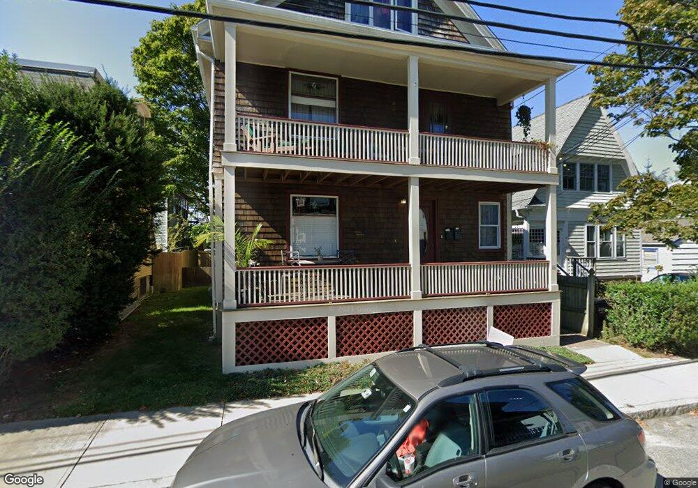
16 Malbone Rd Newport, RI 02840
Estimated Value: $876,000 - $1,106,000
4
Beds
3
Baths
2,205
Sq Ft
$435/Sq Ft
Est. Value
About This Home
This home is located at 16 Malbone Rd, Newport, RI 02840 and is currently estimated at $958,173, approximately $434 per square foot. 16 Malbone Rd is a home located in Newport County with nearby schools including Rogers High School, St Michael's Country Day School, and All Saints STEAM Academy.
Ownership History
Date
Name
Owned For
Owner Type
Purchase Details
Closed on
Jan 6, 2022
Sold by
Smith Luke A
Bought by
Luke A Smith Ret
Current Estimated Value
Purchase Details
Closed on
Jul 8, 1988
Sold by
Grills James J
Bought by
Smith Luke A
Home Financials for this Owner
Home Financials are based on the most recent Mortgage that was taken out on this home.
Original Mortgage
$158,400
Interest Rate
10.54%
Mortgage Type
Purchase Money Mortgage
Create a Home Valuation Report for This Property
The Home Valuation Report is an in-depth analysis detailing your home's value as well as a comparison with similar homes in the area
Home Values in the Area
Average Home Value in this Area
Purchase History
| Date | Buyer | Sale Price | Title Company |
|---|---|---|---|
| Luke A Smith Ret | -- | None Available | |
| Smith Luke A | $176,000 | -- |
Source: Public Records
Mortgage History
| Date | Status | Borrower | Loan Amount |
|---|---|---|---|
| Previous Owner | Smith Luke A | $63,400 | |
| Previous Owner | Smith Luke A | $125,000 | |
| Previous Owner | Smith Luke A | $124,800 | |
| Previous Owner | Smith Luke A | $158,400 |
Source: Public Records
Tax History
| Year | Tax Paid | Tax Assessment Tax Assessment Total Assessment is a certain percentage of the fair market value that is determined by local assessors to be the total taxable value of land and additions on the property. | Land | Improvement |
|---|---|---|---|---|
| 2025 | $5,578 | $642,000 | $142,700 | $499,300 |
| 2024 | $5,277 | $642,000 | $142,700 | $499,300 |
| 2023 | $4,210 | $424,400 | $109,200 | $315,200 |
| 2022 | $4,078 | $424,400 | $109,200 | $315,200 |
| 2021 | $3,960 | $424,400 | $109,200 | $315,200 |
| 2020 | $3,458 | $336,400 | $96,500 | $239,900 |
| 2019 | $3,458 | $336,400 | $96,500 | $239,900 |
| 2018 | $3,361 | $336,400 | $96,500 | $239,900 |
| 2017 | $3,191 | $284,700 | $74,200 | $210,500 |
| 2016 | $3,112 | $284,700 | $74,200 | $210,500 |
| 2015 | $3,038 | $284,700 | $74,200 | $210,500 |
| 2014 | $2,937 | $243,500 | $54,700 | $188,800 |
Source: Public Records
Map
Nearby Homes
- 2 Channing St
- 18 Malbone Rd
- 4 Channing St
- 20 Malbone Rd
- 6 Channing St
- 19 Malbone Rd
- 17 Malbone Rd
- 15 Malbone Rd
- 8 Channing St
- 21 Malbone Rd
- 1 Channing St
- 14 Malbone Rd
- 22 Malbone Rd Unit 2
- 22 Malbone Rd Unit 4
- 22 Malbone Rd Unit 1
- 22 Malbone Rd Unit 3
- 11 Malbone Rd Unit 1A
- 11 Malbone Rd Unit 1B
- 11 Malbone Rd Unit 2
- 11 Malbone Rd
Your Personal Tour Guide
Ask me questions while you tour the home.