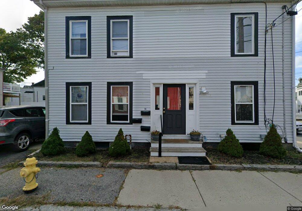
16 Marchant St Gloucester, MA 01930
Central Gloucester NeighborhoodEstimated Value: $624,000 - $925,912
5
Beds
3
Baths
2,268
Sq Ft
$325/Sq Ft
Est. Value
About This Home
This home is located at 16 Marchant St, Gloucester, MA 01930 and is currently estimated at $736,228, approximately $324 per square foot. 16 Marchant St is a home located in Essex County with nearby schools including East Veterans Memorial Elementary, Ralph B O'maley Middle School, and Gloucester High School.
Ownership History
Date
Name
Owned For
Owner Type
Purchase Details
Closed on
Jun 26, 2003
Sold by
Siegel Alan and Siegel Linda
Bought by
Lane Michael
Current Estimated Value
Purchase Details
Closed on
Oct 21, 1994
Sold by
Carl Mary
Bought by
Lane Michael W and Lane Richard
Home Financials for this Owner
Home Financials are based on the most recent Mortgage that was taken out on this home.
Original Mortgage
$50,000
Interest Rate
8.49%
Mortgage Type
Purchase Money Mortgage
Create a Home Valuation Report for This Property
The Home Valuation Report is an in-depth analysis detailing your home's value as well as a comparison with similar homes in the area
Home Values in the Area
Average Home Value in this Area
Purchase History
| Date | Buyer | Sale Price | Title Company |
|---|---|---|---|
| Lane Michael | $425,000 | -- | |
| Lane Michael W | $72,000 | -- |
Source: Public Records
Mortgage History
| Date | Status | Borrower | Loan Amount |
|---|---|---|---|
| Previous Owner | Lane Michael W | $125,000 | |
| Previous Owner | Lane Michael W | $50,000 | |
| Previous Owner | Lane Michael W | $50,000 | |
| Previous Owner | Lane Michael W | $14,000 |
Source: Public Records
Tax History
| Year | Tax Paid | Tax Assessment Tax Assessment Total Assessment is a certain percentage of the fair market value that is determined by local assessors to be the total taxable value of land and additions on the property. | Land | Improvement |
|---|---|---|---|---|
| 2025 | $5,357 | $551,100 | $125,500 | $425,600 |
| 2024 | $5,012 | $515,100 | $119,500 | $395,600 |
| 2023 | $5,206 | $491,600 | $106,700 | $384,900 |
| 2022 | $4,705 | $401,100 | $92,800 | $308,300 |
| 2021 | $4,553 | $366,000 | $84,400 | $281,600 |
| 2020 | $4,316 | $350,000 | $84,400 | $265,600 |
| 2019 | $4,011 | $316,100 | $84,400 | $231,700 |
| 2018 | $3,857 | $298,300 | $84,400 | $213,900 |
| 2017 | $3,659 | $277,400 | $76,000 | $201,400 |
| 2016 | $3,389 | $249,000 | $76,000 | $173,000 |
| 2015 | $3,325 | $243,600 | $76,000 | $167,600 |
Source: Public Records
Map
Nearby Homes
- 15 Mount Vernon St
- 139A Prospect St
- 50 Warner St
- 19 Trask St Unit 2
- 113 Pleasant St
- 191 Main St Unit 3
- 191 Main St Unit 2A
- 33 Maplewood Ave Unit 310
- 40 Sargent St
- 36 Eastern Ave
- 12 Arthur St
- 9 Cleveland Place
- 35 Middle St Unit 4
- 33 Middle St
- 3 Mondello Square
- 120 Washington St
- 98 Maplewood Ave
- 60 Rocky Neck Ave Unit 202
- 8 Mystic Ave
- 197 E Main St Unit 1
- 16 Marchant St Unit 1
- 16 Marchant St Unit 2R
- 16 Marchant St Unit 2L
- 14 Marchant St
- 123 Prospect St
- 13 Marchant St
- 2 Mount Vernon St
- 132 Prospect St
- 115 Prospect St
- 134 Prospect St
- 12 Marchant St
- 12 Marchant St Unit 2
- 125 1/2 Prospect St
- 125 Prospect St
- 125 Prospect St Unit 1
- 6 Mount Vernon St
- 126 Prospect St
- 130 Prospect St
- 124 Prospect St
- 9 Marchant St
Your Personal Tour Guide
Ask me questions while you tour the home.