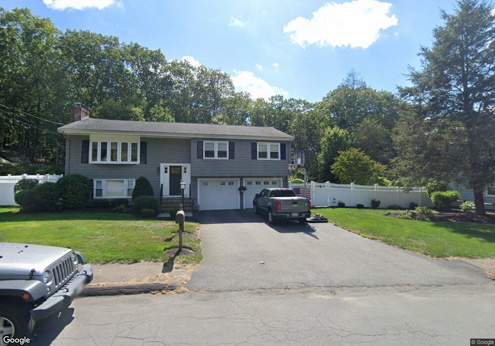
16 Mcandrew Rd Braintree, MA 02184
South Braintree NeighborhoodEstimated Value: $769,688 - $944,000
3
Beds
2
Baths
1,920
Sq Ft
$448/Sq Ft
Est. Value
About This Home
This home is located at 16 Mcandrew Rd, Braintree, MA 02184 and is currently estimated at $859,422, approximately $447 per square foot. 16 Mcandrew Rd is a home located in Norfolk County with nearby schools including Braintree High School, First Baptist Christian School, and Thayer Academy.
Ownership History
Date
Name
Owned For
Owner Type
Purchase Details
Closed on
Oct 20, 2003
Sold by
Donovan Helen
Bought by
Noonan Jeffrey and Noonan Robin
Current Estimated Value
Home Financials for this Owner
Home Financials are based on the most recent Mortgage that was taken out on this home.
Original Mortgage
$305,000
Interest Rate
6.43%
Mortgage Type
Purchase Money Mortgage
Purchase Details
Closed on
May 24, 1994
Sold by
Thistle Edith M
Bought by
Donovan Helen
Home Financials for this Owner
Home Financials are based on the most recent Mortgage that was taken out on this home.
Original Mortgage
$90,000
Interest Rate
8.44%
Mortgage Type
Purchase Money Mortgage
Create a Home Valuation Report for This Property
The Home Valuation Report is an in-depth analysis detailing your home's value as well as a comparison with similar homes in the area
Home Values in the Area
Average Home Value in this Area
Purchase History
| Date | Buyer | Sale Price | Title Company |
|---|---|---|---|
| Noonan Jeffrey | $365,000 | -- | |
| Donovan Helen | $202,000 | -- |
Source: Public Records
Mortgage History
| Date | Status | Borrower | Loan Amount |
|---|---|---|---|
| Open | Donovan Helen | $333,000 | |
| Closed | Donovan Helen | $333,000 | |
| Closed | Donovan Helen | $305,000 | |
| Previous Owner | Donovan Helen | $90,000 |
Source: Public Records
Tax History
| Year | Tax Paid | Tax Assessment Tax Assessment Total Assessment is a certain percentage of the fair market value that is determined by local assessors to be the total taxable value of land and additions on the property. | Land | Improvement |
|---|---|---|---|---|
| 2025 | $7,238 | $725,300 | $384,300 | $341,000 |
| 2024 | $6,543 | $690,200 | $354,000 | $336,200 |
| 2023 | $6,257 | $641,100 | $323,600 | $317,500 |
| 2022 | $5,977 | $600,700 | $283,200 | $317,500 |
| 2021 | $5,612 | $564,000 | $255,900 | $308,100 |
| 2020 | $5,331 | $540,700 | $232,600 | $308,100 |
| 2019 | $5,223 | $517,600 | $232,600 | $285,000 |
| 2018 | $5,015 | $475,800 | $202,300 | $273,500 |
| 2017 | $4,966 | $462,400 | $202,300 | $260,100 |
| 2016 | $4,650 | $423,500 | $182,000 | $241,500 |
| 2015 | $4,623 | $417,600 | $178,000 | $239,600 |
| 2014 | $4,247 | $371,900 | $159,800 | $212,100 |
Source: Public Records
Map
Nearby Homes
- 1 Geraldine Ln
- 278 Allerton Commons Ln
- 55 Bradford Commons Ln Unit 55
- 441 Grove St
- 365 Tilden Commons Ln Unit 365
- 169 Tyson Commons Ln
- 432 Grove St
- 972 Liberty St
- 23 Portland Rd
- 129 Albee Dr
- 300 West St
- 24 Evelyn Ln
- 43 Grove Cir
- 1696 Liberty St
- 501 Commerce Dr Unit 2110
- 501 Commerce Dr Unit 4308
- 1201 Matthew Woods Dr Unit 1201
- 193 Randolph St
- 426 John Mahar Hwy Unit 311
- 426 John Mahar Hwy Unit 406
Your Personal Tour Guide
Ask me questions while you tour the home.