Estimated Value: $675,102 - $855,000
3
Beds
2
Baths
1,782
Sq Ft
$415/Sq Ft
Est. Value
About This Home
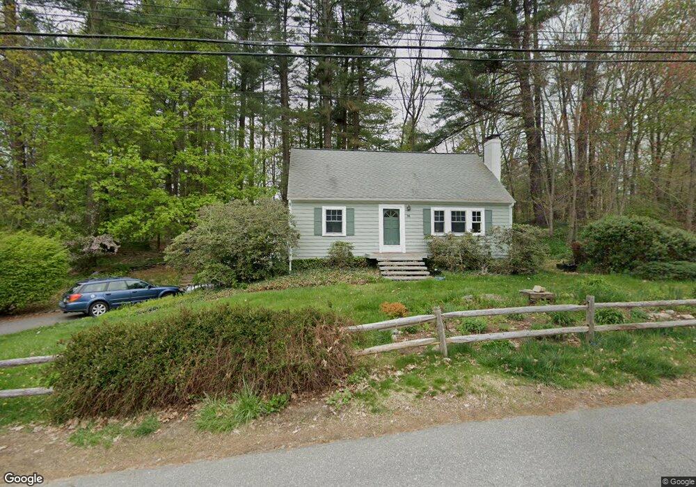
This home is located at 16 Mohawk Dr, Acton, MA 01720 and is currently estimated at $739,276, approximately $414 per square foot. 16 Mohawk Dr is a home located in Middlesex County with nearby schools including Acton-Boxborough Regional High School and Oak Meadow Montessori School.
Ownership History
Date
Name
Owned For
Owner Type
Purchase Details
Closed on
Jan 22, 2002
Sold by
Hartley J Matthew and Hartley Jennie W
Bought by
Howard G Kevin and Howard Rebecca S
Current Estimated Value
Home Financials for this Owner
Home Financials are based on the most recent Mortgage that was taken out on this home.
Original Mortgage
$283,200
Outstanding Balance
$109,225
Interest Rate
6.84%
Mortgage Type
Purchase Money Mortgage
Estimated Equity
$630,051
Purchase Details
Closed on
Jun 28, 1996
Sold by
Hauptman Clifford D and Hauptman Susan A
Bought by
Hartley J Matthew and Hartley Jennie W
Home Financials for this Owner
Home Financials are based on the most recent Mortgage that was taken out on this home.
Original Mortgage
$173,600
Interest Rate
8.05%
Mortgage Type
Purchase Money Mortgage
Create a Home Valuation Report for This Property
The Home Valuation Report is an in-depth analysis detailing your home's value as well as a comparison with similar homes in the area
Home Values in the Area
Average Home Value in this Area
Purchase History
| Date | Buyer | Sale Price | Title Company |
|---|---|---|---|
| Howard G Kevin | $354,000 | -- | |
| Hartley J Matthew | $217,000 | -- |
Source: Public Records
Mortgage History
| Date | Status | Borrower | Loan Amount |
|---|---|---|---|
| Open | Howard G Kevin | $283,200 | |
| Closed | Hartley J Matthew | $53,100 | |
| Previous Owner | Hartley J Matthew | $173,600 |
Source: Public Records
Tax History
| Year | Tax Paid | Tax Assessment Tax Assessment Total Assessment is a certain percentage of the fair market value that is determined by local assessors to be the total taxable value of land and additions on the property. | Land | Improvement |
|---|---|---|---|---|
| 2025 | $9,652 | $562,800 | $310,800 | $252,000 |
| 2024 | $9,305 | $558,200 | $310,800 | $247,400 |
| 2023 | $9,305 | $529,900 | $282,500 | $247,400 |
| 2022 | $8,500 | $437,000 | $245,400 | $191,600 |
| 2021 | $8,205 | $405,600 | $227,300 | $178,300 |
| 2020 | $7,625 | $396,300 | $227,300 | $169,000 |
| 2019 | $7,295 | $376,600 | $227,300 | $149,300 |
| 2018 | $7,293 | $376,300 | $227,300 | $149,000 |
| 2017 | $7,172 | $376,300 | $227,300 | $149,000 |
| 2016 | $6,905 | $359,100 | $227,300 | $131,800 |
| 2015 | $7,089 | $372,100 | $227,300 | $144,800 |
| 2014 | $6,983 | $359,000 | $227,300 | $131,700 |
Source: Public Records
Map
Nearby Homes
- 4 Littlefield Rd
- 5 Perkins Ln
- 235 Arlington St
- 20 Joseph Reed Ln
- 60 Nashoba Rd
- 79 Charter Rd
- 92 Willow St Unit 3
- 92 Willow St Unit 2
- 90 Willow St Unit 1
- 246 Main St Unit 2
- 7 Kelley Rd
- 18 Hayward Rd
- 11 Braebrook
- 184 Main St Unit 3
- 4 Omega Way
- 25 Nylander Way
- 46 Taylor Rd
- 33 Meadowbrook Rd
- 129 Main St Unit 129
- 131 Main St
Your Personal Tour Guide
Ask me questions while you tour the home.