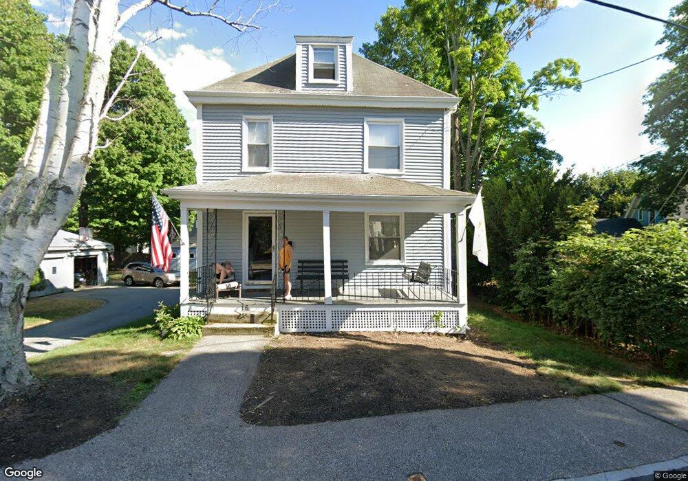
16 Myrtle St Westborough, MA 01581
Estimated Value: $624,000 - $728,000
5
Beds
2
Baths
1,707
Sq Ft
$397/Sq Ft
Est. Value
About This Home
This home is located at 16 Myrtle St, Westborough, MA 01581 and is currently estimated at $677,620, approximately $396 per square foot. 16 Myrtle St is a home located in Worcester County with nearby schools including Westborough High School, Ebridge Montessori School, and Westboro Knowledge Beginnings.
Ownership History
Date
Name
Owned For
Owner Type
Purchase Details
Closed on
Jun 4, 1990
Sold by
Dwyer G Gordon
Bought by
Dwyer Thomas W
Current Estimated Value
Create a Home Valuation Report for This Property
The Home Valuation Report is an in-depth analysis detailing your home's value as well as a comparison with similar homes in the area
Home Values in the Area
Average Home Value in this Area
Purchase History
| Date | Buyer | Sale Price | Title Company |
|---|---|---|---|
| Dwyer Thomas W | $110,000 | -- | |
| Dwyer Thomas W | $110,000 | -- |
Source: Public Records
Mortgage History
| Date | Status | Borrower | Loan Amount |
|---|---|---|---|
| Open | Dwyer Thomas W | $200,000 | |
| Closed | Dwyer Thomas W | $150,000 |
Source: Public Records
Tax History Compared to Growth
Tax History
| Year | Tax Paid | Tax Assessment Tax Assessment Total Assessment is a certain percentage of the fair market value that is determined by local assessors to be the total taxable value of land and additions on the property. | Land | Improvement |
|---|---|---|---|---|
| 2025 | $9,909 | $608,300 | $302,800 | $305,500 |
| 2024 | $9,345 | $569,500 | $281,500 | $288,000 |
| 2023 | $8,796 | $522,300 | $263,300 | $259,000 |
| 2022 | $8,100 | $438,100 | $211,400 | $226,700 |
| 2021 | $8,080 | $435,800 | $209,100 | $226,700 |
| 2020 | $7,667 | $418,500 | $197,500 | $221,000 |
| 2019 | $7,261 | $396,100 | $189,700 | $206,400 |
| 2018 | $6,636 | $359,500 | $174,200 | $185,300 |
| 2017 | $6,399 | $359,500 | $174,200 | $185,300 |
| 2016 | $6,363 | $358,100 | $174,200 | $183,900 |
| 2015 | $6,361 | $342,200 | $174,200 | $168,000 |
Source: Public Records
Map
Nearby Homes
- 75 South St
- 44 South St
- 15 Beach St
- 8 West St
- 18 Church St
- 14 Grove St Unit 2
- 14 Grove St Unit 3
- 22 Harvey Ln
- 7 Jennings Rd
- 6 Folly Ln
- 43 Church St
- 4 Upton Rd
- 7 Mayberry Dr Unit H
- 9 Mayberry Dr Unit 1
- 19 Fisher St
- 14C Mayberry Dr Unit 1
- 8 Mayberry Dr Unit 5
- 8 Piccadilly Way
- 9 Westminster Way
- 16 Ward Ln
- 12 Myrtle St
- 28 Ruggles St
- 30 Ruggles St
- 10 Myrtle St
- 11 Myrtle St
- 9 Myrtle St
- 9 Myrtle St Unit 1
- 9 Myrtle St Unit 2
- 8 Myrtle St
- 8 Myrtle St Unit 1
- 8 Myrtle St Unit 2
- 11 Forbes St
- 20 Forbes St Unit 22
- 22 Ruggles St
- 18 Forbes St
- 23 Ruggles St
- 6 Myrtle St
- 32 Ruggles St Unit 3
- 32 Ruggles St Unit 2
- 32 Ruggles St Unit 5