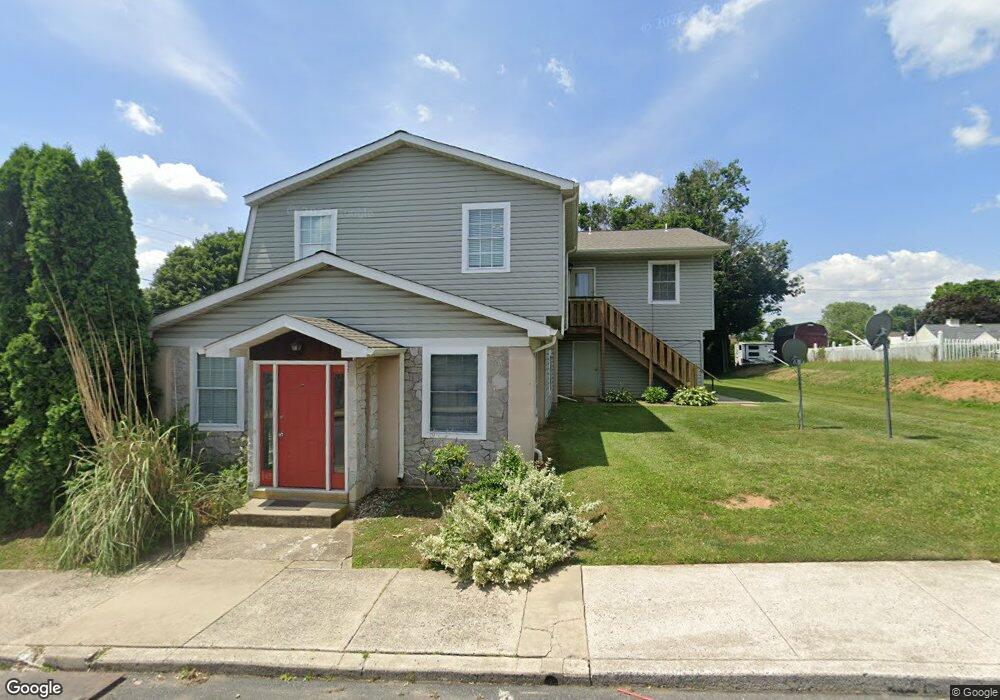
16 N 9th St Unit 24 Emmaus, PA 18049
Estimated Value: $271,000 - $869,000
2
Beds
2
Baths
1,188
Sq Ft
$535/Sq Ft
Est. Value
About This Home
This home is located at 16 N 9th St Unit 24, Emmaus, PA 18049 and is currently estimated at $635,170, approximately $534 per square foot. 16 N 9th St Unit 24 is a home located in Lehigh County with nearby schools including Jefferson Elementary School, Lower Macungie Middle School, and Emmaus High School.
Ownership History
Date
Name
Owned For
Owner Type
Purchase Details
Closed on
Sep 27, 2021
Sold by
Wrisley James A
Bought by
David Real Estate Holdings Llc
Current Estimated Value
Home Financials for this Owner
Home Financials are based on the most recent Mortgage that was taken out on this home.
Original Mortgage
$456,000
Outstanding Balance
$403,601
Interest Rate
2.8%
Mortgage Type
Future Advance Clause Open End Mortgage
Estimated Equity
$231,569
Purchase Details
Closed on
Jan 30, 1985
Bought by
Muslim Association Of Lehigh Valley
Create a Home Valuation Report for This Property
The Home Valuation Report is an in-depth analysis detailing your home's value as well as a comparison with similar homes in the area
Home Values in the Area
Average Home Value in this Area
Purchase History
| Date | Buyer | Sale Price | Title Company |
|---|---|---|---|
| David Real Estate Holdings Llc | $570,000 | Home Settlement Services | |
| Muslim Association Of Lehigh Valley | $60,000 | -- |
Source: Public Records
Mortgage History
| Date | Status | Borrower | Loan Amount |
|---|---|---|---|
| Open | David Real Estate Holdings Llc | $456,000 |
Source: Public Records
Tax History Compared to Growth
Tax History
| Year | Tax Paid | Tax Assessment Tax Assessment Total Assessment is a certain percentage of the fair market value that is determined by local assessors to be the total taxable value of land and additions on the property. | Land | Improvement |
|---|---|---|---|---|
| 2025 | $17,616 | $500,100 | $95,400 | $404,700 |
| 2024 | $16,136 | $500,100 | $95,400 | $404,700 |
| 2023 | $15,822 | $500,100 | $95,400 | $404,700 |
| 2022 | $15,301 | $500,100 | $404,700 | $95,400 |
| 2021 | $14,917 | $500,100 | $95,400 | $404,700 |
| 2020 | $14,789 | $500,100 | $95,400 | $404,700 |
| 2019 | $14,394 | $500,100 | $95,400 | $404,700 |
| 2018 | $13,851 | $500,100 | $95,400 | $404,700 |
| 2017 | $13,424 | $500,100 | $95,400 | $404,700 |
| 2016 | -- | $500,100 | $95,400 | $404,700 |
| 2015 | -- | $500,100 | $95,400 | $404,700 |
| 2014 | -- | $500,100 | $95,400 | $404,700 |
Source: Public Records
Map
Nearby Homes
- 657 Walnut St
- 659 Broad St
- 4109 Eveningstar Rd
- 3430 Gentlewind Way Unit IC 109
- 618 Broad St
- 569 Chestnut St Unit 571
- 543 Long St
- 339 Delong Ave Unit 343
- 4088 Eveningstar Rd
- 521 Wood St
- 97 Chestnut Hill Rd
- 3623 Daylily Dr
- 120 N 2nd St
- 118 N 2nd St
- 3810 Allen St
- 3186 Overlook Dr
- 4160 Newport Dr
- 3703 Samantha Ln Unit Lot 70
- 3736 Samantha Ln Unit Lot 7
- 3748 Samantha Ln
- 16 N 9th St Unit 3
- 20 N 9th St
- 20 N 9th St Unit 2
- 20 N 9th St Unit 4
- 20 N 9th St Unit 5
- 20 N 9th St Unit 1
- 20 N 9th St Unit 5
- 20 N 9th St Unit 5
- 20 N 9th St Unit 3
- 28 N 9th St
- 915 Green St
- 920 Walnut St Unit 924
- 907 Chestnut St Unit 911
- 913 Chestnut St
- 901 Chestnut St
- 25 N 9th St Unit 29
- 915 Chestnut St
- 849 Chestnut St
- 104 N 9th St
- 917 Chestnut St