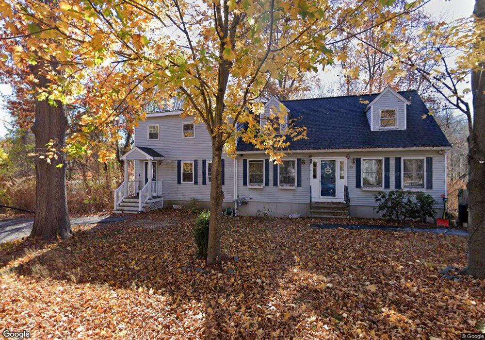
16 N Martin Rd Amesbury, MA 01913
Estimated Value: $660,000 - $792,370
4
Beds
2
Baths
2,132
Sq Ft
$344/Sq Ft
Est. Value
About This Home
This home is located at 16 N Martin Rd, Amesbury, MA 01913 and is currently estimated at $732,843, approximately $343 per square foot. 16 N Martin Rd is a home located in Essex County with nearby schools including Amesbury High School and Amesbury Seventh-Day Adventist School.
Ownership History
Date
Name
Owned For
Owner Type
Purchase Details
Closed on
Dec 17, 1993
Sold by
Radku Inc
Bought by
Cloutier Marc J and Cloutier Christina
Current Estimated Value
Home Financials for this Owner
Home Financials are based on the most recent Mortgage that was taken out on this home.
Original Mortgage
$102,700
Interest Rate
7.03%
Mortgage Type
Purchase Money Mortgage
Create a Home Valuation Report for This Property
The Home Valuation Report is an in-depth analysis detailing your home's value as well as a comparison with similar homes in the area
Home Values in the Area
Average Home Value in this Area
Purchase History
| Date | Buyer | Sale Price | Title Company |
|---|---|---|---|
| Cloutier Marc J | $108,150 | -- |
Source: Public Records
Mortgage History
| Date | Status | Borrower | Loan Amount |
|---|---|---|---|
| Open | Cloutier Marc J | $30,000 | |
| Open | Cloutier Marc J | $121,270 | |
| Closed | Cloutier Marc J | $100,000 | |
| Closed | Cloutier Marc J | $102,700 |
Source: Public Records
Tax History Compared to Growth
Tax History
| Year | Tax Paid | Tax Assessment Tax Assessment Total Assessment is a certain percentage of the fair market value that is determined by local assessors to be the total taxable value of land and additions on the property. | Land | Improvement |
|---|---|---|---|---|
| 2025 | $10,251 | $670,000 | $278,900 | $391,100 |
| 2024 | $10,433 | $667,100 | $266,000 | $401,100 |
| 2023 | $9,284 | $568,200 | $231,400 | $336,800 |
| 2022 | $8,537 | $482,600 | $203,500 | $279,100 |
| 2021 | $8,063 | $441,800 | $161,200 | $280,600 |
| 2020 | $7,350 | $427,800 | $155,700 | $272,100 |
| 2019 | $7,473 | $406,800 | $155,700 | $251,100 |
| 2018 | $7,585 | $399,400 | $148,200 | $251,200 |
| 2017 | $7,320 | $366,900 | $148,200 | $218,700 |
| 2016 | $6,729 | $331,800 | $126,300 | $205,500 |
| 2015 | $6,686 | $325,500 | $126,300 | $199,200 |
| 2014 | $6,593 | $314,400 | $148,200 | $166,200 |
Source: Public Records
Map
Nearby Homes
- 3 Marshall Dr
- 13 Bailey Pond Ln Unit 13
- 3 Cottage Ln
- 19 Cutter Ln Unit 19
- 36 Hillside Ave
- 3 Pinecrest Ave
- 11 Beacon St
- 15 Beacon St
- 49 W Greenwood St
- 2 Hitching Post Ln
- 60 Merrimac St Unit 907
- 60 Merrimac St Unit 604
- 60 Merrimac St Unit 508
- 50 Middle Rd
- 35 Merrimac St
- 6 Wells Ave Unit C
- 4 Greenwood St
- 31 Whitter Meadows Dr Unit 31
- 356 Main St
- 15 Sparhawk St Unit 3