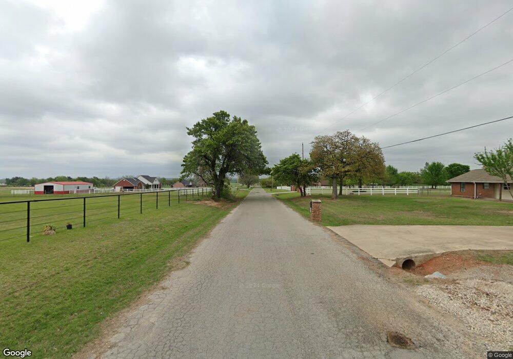
16 NE 50th St McLoud, OK 74851
Estimated Value: $204,000 - $979,000
3
Beds
2
Baths
1,753
Sq Ft
$364/Sq Ft
Est. Value
About This Home
This home is located at 16 NE 50th St, McLoud, OK 74851 and is currently estimated at $638,165, approximately $364 per square foot. 16 NE 50th St is a home located in Lincoln County with nearby schools including Virginia Smith Elementary School, Russell Babb Elementary School, and Clara Reynolds Elementary School.
Ownership History
Date
Name
Owned For
Owner Type
Purchase Details
Closed on
Feb 28, 2024
Sold by
Bacon Stephen C and Revo Barbara
Bought by
Bacon Joshua Wilbur and Bacon Leah Denise
Current Estimated Value
Home Financials for this Owner
Home Financials are based on the most recent Mortgage that was taken out on this home.
Original Mortgage
$637,500
Outstanding Balance
$626,213
Interest Rate
6.6%
Mortgage Type
New Conventional
Estimated Equity
$11,952
Purchase Details
Closed on
Apr 12, 2019
Sold by
Stephen Cal Bacon Living Trust
Bought by
Bacon Stephen C and In Barbara
Purchase Details
Closed on
Oct 15, 1997
Sold by
Bacon Sr Vearl Albert and Bacon De
Bought by
Bacon Stephen Cal and Bacon Kaylen
Purchase Details
Closed on
Mar 22, 1995
Sold by
Compton Mildred L
Bought by
Bacon Stephen C
Create a Home Valuation Report for This Property
The Home Valuation Report is an in-depth analysis detailing your home's value as well as a comparison with similar homes in the area
Purchase History
| Date | Buyer | Sale Price | Title Company |
|---|---|---|---|
| Bacon Joshua Wilbur | $850,000 | Lincoln County Title | |
| Bacon Stephen C | -- | None Available | |
| Bacon Stephen Cal | -- | -- | |
| Bacon Stephen C | $56,000 | -- |
Source: Public Records
Mortgage History
| Date | Status | Borrower | Loan Amount |
|---|---|---|---|
| Open | Bacon Joshua Wilbur | $637,500 |
Source: Public Records
Tax History
| Year | Tax Paid | Tax Assessment Tax Assessment Total Assessment is a certain percentage of the fair market value that is determined by local assessors to be the total taxable value of land and additions on the property. | Land | Improvement |
|---|---|---|---|---|
| 2025 | $1,332 | $15,128 | $655 | $14,473 |
| 2024 | $1,175 | $14,687 | $649 | $14,038 |
| 2023 | $1,175 | $14,927 | $1,444 | $13,483 |
| 2022 | $1,103 | $13,844 | $1,444 | $12,400 |
| 2021 | $841 | $10,765 | $1,444 | $9,321 |
| 2020 | $814 | $10,450 | $1,444 | $9,006 |
| 2019 | $789 | $10,146 | $1,444 | $8,702 |
| 2018 | $785 | $10,103 | $1,444 | $8,659 |
| 2017 | $970 | $10,034 | $1,444 | $8,590 |
| 2016 | $959 | $10,131 | $1,444 | $8,687 |
| 2015 | $838 | $11,440 | $1,444 | $9,996 |
| 2014 | $861 | $11,482 | $1,282 | $10,200 |
Source: Public Records
Map
Nearby Homes
- 332939 E 1020 Rd
- 331899 Timber Ln
- 331908 Shadow Wood Dr
- 100861 S Red Rock Trail
- 100711 S Stonecrest Cir
- 0005 NE 50th St
- 0 N Oak Rd
- 334174 E Painted Sky Rd
- 3872 Ada Ave
- 3865 Ada Ave
- 3864 Ada Ave
- 3880 Ada Ave
- 3864 Louthea Ln
- 3856 Ada Ave
- 21089 River Mist Dr
- 21081 River Mist Dr
- 3848 Ada Ave
- 3848 Louthea Ln
- 334273 E Painted Sky Dr
- 331178 E Captain Dr
- 328 N Highway 102
- 332795 E 1020 Rd
- 102225 S 3330 Rd
- 332828 E 1020 Rd
- 102115 S 3330 Rd
- 332774 E 1020 Rd
- 327 N Highway 102
- 102025 S 3330 Rd
- 102292 S Highway 102
- 102211 S Highway 102
- 101975 S 3330 Rd
- 326 N Highway 102
- 101919 S 3330 Rd
- 102032 S 3330 Rd
- 333034 E 1024 Rd
- 102218 S 3330 Rd
- 102406 S 3330 Rd
- 805 Rr 1
- 333068 E 1024 Rd
- 102821 S 3325 Rd
