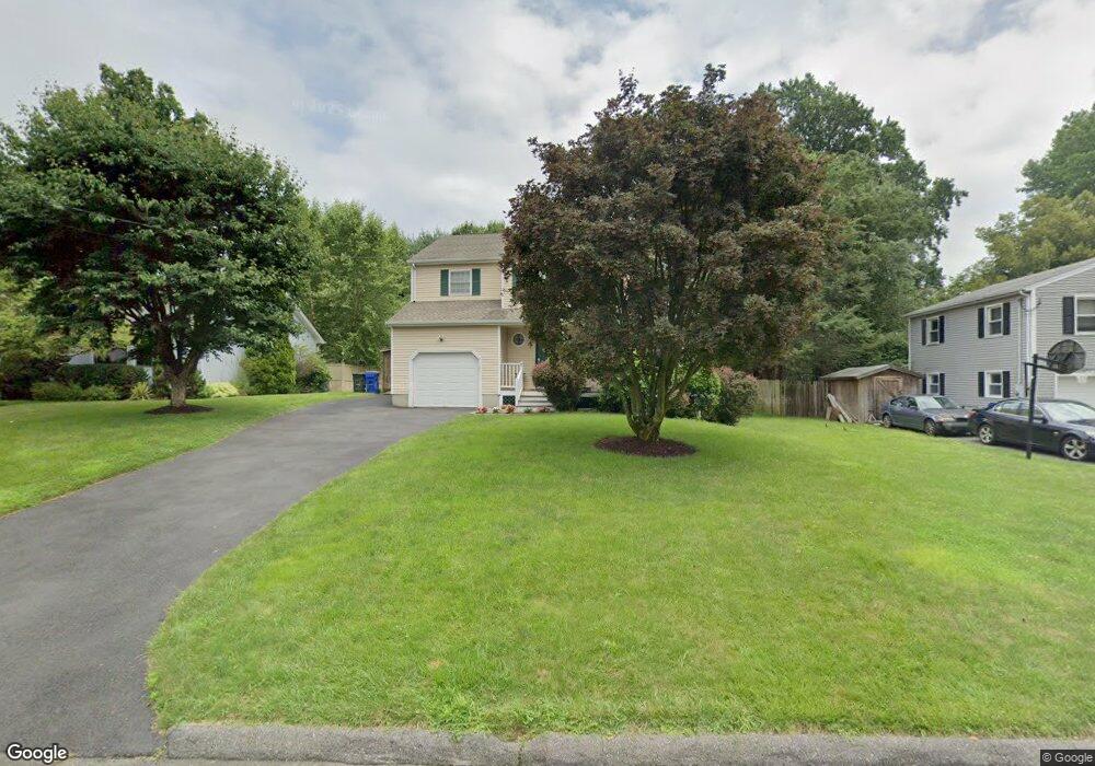
16 Oakledge Cir Norwalk, CT 06854
Brookside NeighborhoodEstimated Value: $741,000 - $913,000
3
Beds
3
Baths
1,876
Sq Ft
$437/Sq Ft
Est. Value
About This Home
This home is located at 16 Oakledge Cir, Norwalk, CT 06854 and is currently estimated at $820,603, approximately $437 per square foot. 16 Oakledge Cir is a home located in Fairfield County with nearby schools including Brookside Elementary School, Roton Middle School, and Brien Mcmahon High School.
Ownership History
Date
Name
Owned For
Owner Type
Purchase Details
Closed on
May 16, 1996
Sold by
New England Home Bldrs
Bought by
Hastings Donald and Barr Laura A
Current Estimated Value
Purchase Details
Closed on
Sep 11, 1995
Sold by
King Marcie and Howe Kory
Bought by
Ne Home Bldrs Inc
Purchase Details
Closed on
Aug 31, 1988
Sold by
Seaman Joseph
Bought by
Santomasssi Philip
Create a Home Valuation Report for This Property
The Home Valuation Report is an in-depth analysis detailing your home's value as well as a comparison with similar homes in the area
Home Values in the Area
Average Home Value in this Area
Purchase History
| Date | Buyer | Sale Price | Title Company |
|---|---|---|---|
| Hastings Donald | $275,285 | -- | |
| Hastings Donald | $275,285 | -- | |
| Ne Home Bldrs Inc | $70,000 | -- | |
| Ne Home Bldrs Inc | $70,000 | -- | |
| Santomasssi Philip | $270,000 | -- |
Source: Public Records
Mortgage History
| Date | Status | Borrower | Loan Amount |
|---|---|---|---|
| Open | Santomasssi Philip | $544,000 | |
| Closed | Santomasssi Philip | $456,000 |
Source: Public Records
Tax History Compared to Growth
Tax History
| Year | Tax Paid | Tax Assessment Tax Assessment Total Assessment is a certain percentage of the fair market value that is determined by local assessors to be the total taxable value of land and additions on the property. | Land | Improvement |
|---|---|---|---|---|
| 2025 | $11,789 | $496,580 | $195,000 | $301,580 |
| 2024 | $11,608 | $496,580 | $195,000 | $301,580 |
| 2023 | $8,702 | $348,540 | $148,960 | $199,580 |
| 2022 | $8,565 | $348,540 | $148,960 | $199,580 |
| 2021 | $7,288 | $348,540 | $148,960 | $199,580 |
| 2020 | $8,228 | $348,540 | $148,960 | $199,580 |
| 2019 | $8,123 | $348,540 | $148,960 | $199,580 |
| 2018 | $8,395 | $323,740 | $154,560 | $169,180 |
| 2017 | $8,101 | $323,740 | $154,560 | $169,180 |
| 2016 | $8,236 | $323,740 | $154,560 | $169,180 |
| 2015 | $7,397 | $323,740 | $154,560 | $169,180 |
| 2014 | $8,106 | $323,740 | $154,560 | $169,180 |
Source: Public Records
Map
Nearby Homes
- 17 Woodlawn Ave
- 39 Chatham Dr
- 1 Horizon Dr Unit 2
- 13 Joemar Rd
- 6 W Couch St
- 8 Crown Ave
- 47 Taylor Ave
- 59 Taylor Ave
- 7 Hadik Pkwy
- 18 Soundview Ave
- 187 Flax Hill Rd Unit D5
- 7 Hamilton Ave Unit 32
- 9 Observatory Place Unit A
- 10 Ledgebrook Dr Unit 1
- 47 Glasser St
- 15 Madison St Unit F9
- 15 Madison St Unit G11
- 14 Ferris Ave Unit 9
- 6 Orlando Rd
- 146 Gillies Ln Unit 146
- 18 Oakledge Cir
- 21 Richmond Hill Rd
- 19 Richmond Hill Rd
- 14 Oakledge Cir
- 12 Oakledge Cir
- 20 Oakledge Cir
- 23 Richmond Hill Rd
- 15 Richmond Hill Rd
- 7 Oakledge Cir
- 9 Oakledge Cir
- 25 Richmond Hill Rd
- 11 Oakledge Cir
- 19 Oakledge Cir
- 5 Oakledge Cir
- 13 Richmond Hill Rd
- 10 Oakledge Cir
- 11 Richmond Hill Rd
- 3 Oakledge Cir
- 20 Richmond Hill Rd
- 27 Richmond Hill Rd