
Seller's Agent in 2025
Adam Parent
Maine Real Estate Co
(207) 604-4624
6 in this area
226 Total Sales
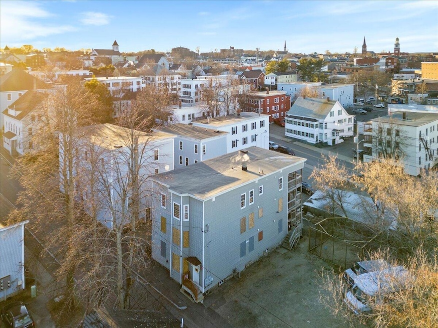
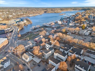
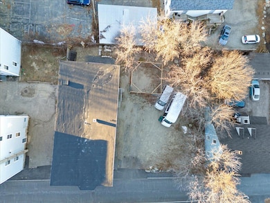
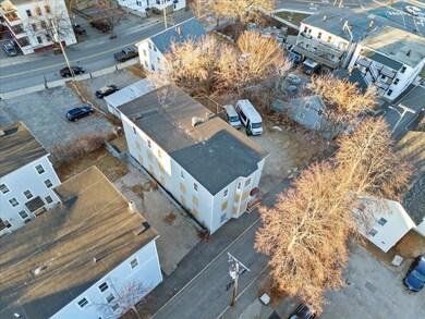


Three Story Building in the Heart of Biddeford. Currently featured as a three unit (one unit per floor). The first floor unit is setup with four bedroom & two bathrooms. The second floor unit is setup with five bedrooms & one bathroom. The third floor unit is setup with five bedrooms & one bathroom. Each unit has a storage & a large deck. With the size of this building, it could be an option to cover into a 6 unit building for maximum efficiency or remove some interior walls (non-load bearing) to make larger bedrooms in each unit. Ample opportunity here! Great location and large parking area. Don't miss out on this one of a kind property.
| Date | Type | Sale Price | Title Company |
|---|---|---|---|
| Warranty Deed | $672,000 | -- | |
| Quit Claim Deed | -- | -- | |
| Quit Claim Deed | -- | -- | |
| Quit Claim Deed | -- | -- | |
| Interfamily Deed Transfer | -- | -- | |
| Interfamily Deed Transfer | -- | -- |
| Date | Status | Loan Amount | Loan Type |
|---|---|---|---|
| Open | $525,000 | Purchase Money Mortgage | |
| Previous Owner | $234,815 | FHA |
| Date | Event | Price | List to Sale | Price per Sq Ft |
|---|---|---|---|---|
| 10/10/2025 10/10/25 | Sold | $672,000 | -2.6% | $145 / Sq Ft |
| 08/13/2025 08/13/25 | Pending | -- | -- | -- |
| 08/05/2025 08/05/25 | For Sale | $689,900 | -- | $149 / Sq Ft |
| Year | Tax Paid | Tax Assessment Tax Assessment Total Assessment is a certain percentage of the fair market value that is determined by local assessors to be the total taxable value of land and additions on the property. | Land | Improvement |
|---|---|---|---|---|
| 2024 | $5,487 | $385,900 | $115,800 | $270,100 |
| 2023 | $5,013 | $382,100 | $115,800 | $266,300 |
| 2022 | $4,150 | $252,900 | $57,800 | $195,100 |
| 2021 | $3,961 | $217,300 | $47,300 | $170,000 |
| 2020 | $0 | $174,100 | $36,800 | $137,300 |
| 2019 | $0 | $174,100 | $36,800 | $137,300 |
| 2018 | $3,430 | $174,100 | $36,800 | $137,300 |
| 2017 | $3,185 | $158,700 | $36,800 | $121,900 |
| 2016 | $0 | $158,700 | $36,800 | $121,900 |
| 2015 | $3,090 | $158,700 | $36,800 | $121,900 |
| 2014 | $3,014 | $158,700 | $36,800 | $121,900 |
| 2013 | -- | $187,700 | $47,200 | $140,500 |
Seller's Agent in 2025
Adam Parent
Maine Real Estate Co
(207) 604-4624
6 in this area
226 Total Sales
Buyer's Agent in 2025
Sarah Msuya
Dream Home Realty LLC
(207) 887-9543
2 in this area
119 Total Sales
Source: Maine Listings
MLS Number: 1633151
APN: BIDD-000041-000000-000124
Disclaimer: Certain information contained herein is derived from information provided by parties other than Homes.com. All information provided is deemed reliable, but is not guaranteed to be accurate and should be independently verified.
![]() Listing data is derived in whole or in part from Maine Real Estate Information System, Inc. (d/b/a Maine Listings) and is for consumers' personal, noncommercial use only. Dimensions are approximate and not guaranteed. All data should be independently verified.
Listing data is derived in whole or in part from Maine Real Estate Information System, Inc. (d/b/a Maine Listings) and is for consumers' personal, noncommercial use only. Dimensions are approximate and not guaranteed. All data should be independently verified.
© 2025 Maine Real Estate Information System, Inc. All Rights Reserved. Equal Housing Opportunity.
Homes.com, LLC, 17600 Laguna Canyon Rd Irvine, CA 92618 (888)-952-6393
![]()