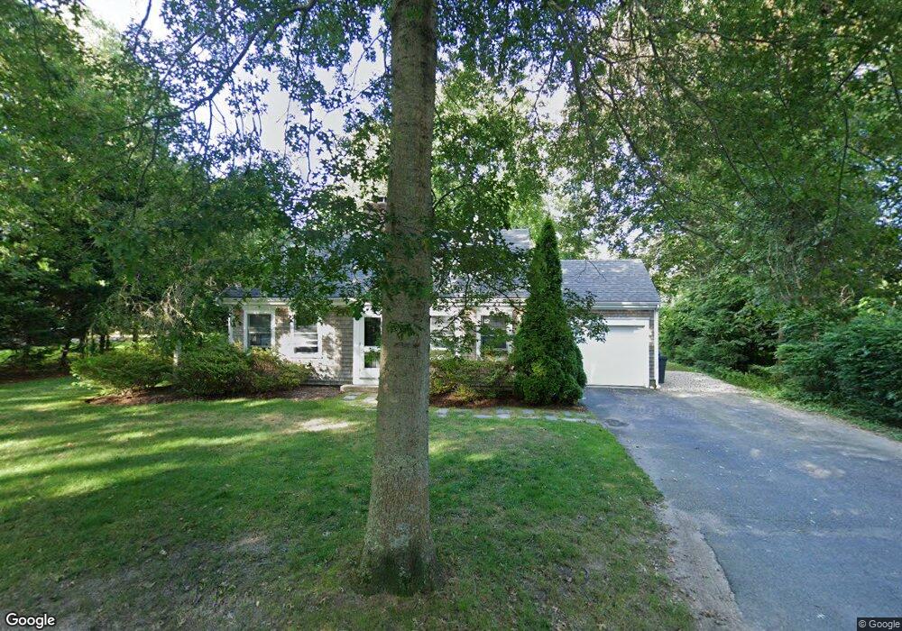
16 Pin Oak Way Falmouth, MA 02540
Falmouth Village NeighborhoodEstimated Value: $1,027,910 - $1,533,000
3
Beds
2
Baths
1,608
Sq Ft
$772/Sq Ft
Est. Value
About This Home
This home is located at 16 Pin Oak Way, Falmouth, MA 02540 and is currently estimated at $1,240,978, approximately $771 per square foot. 16 Pin Oak Way is a home located in Barnstable County with nearby schools including Mullen-Hall School, Lawrence School, and Morse Pond School.
Ownership History
Date
Name
Owned For
Owner Type
Purchase Details
Closed on
Dec 3, 2009
Sold by
Kendall Richard E and Kendall Richard A
Bought by
Kendall Richard A
Current Estimated Value
Purchase Details
Closed on
Aug 27, 2001
Sold by
Kendall Robert L and Kendall Richard E
Bought by
Kendall Richard A
Create a Home Valuation Report for This Property
The Home Valuation Report is an in-depth analysis detailing your home's value as well as a comparison with similar homes in the area
Home Values in the Area
Average Home Value in this Area
Purchase History
| Date | Buyer | Sale Price | Title Company |
|---|---|---|---|
| Kendall Richard A | -- | -- | |
| Kendall Richard A | -- | -- | |
| Kendall Richard A | $120,000 | -- | |
| Kendall Richard A | $120,000 | -- |
Source: Public Records
Mortgage History
| Date | Status | Borrower | Loan Amount |
|---|---|---|---|
| Open | Kendall Richard A | $181,000 | |
| Closed | Kendall Richard A | $208,000 | |
| Previous Owner | Kendall Richard A | $225,000 |
Source: Public Records
Tax History Compared to Growth
Tax History
| Year | Tax Paid | Tax Assessment Tax Assessment Total Assessment is a certain percentage of the fair market value that is determined by local assessors to be the total taxable value of land and additions on the property. | Land | Improvement |
|---|---|---|---|---|
| 2025 | $5,046 | $859,600 | $476,100 | $383,500 |
| 2024 | $4,726 | $752,600 | $432,800 | $319,800 |
| 2023 | $4,385 | $633,700 | $358,200 | $275,500 |
| 2022 | $4,357 | $541,300 | $314,900 | $226,400 |
| 2021 | $4,355 | $512,300 | $314,900 | $197,400 |
| 2020 | $4,155 | $483,700 | $286,300 | $197,400 |
| 2019 | $4,097 | $478,600 | $286,300 | $192,300 |
| 2018 | $4,070 | $473,200 | $286,300 | $186,900 |
| 2017 | $3,972 | $465,600 | $286,300 | $179,300 |
| 2016 | $3,891 | $464,900 | $286,300 | $178,600 |
| 2015 | $3,808 | $464,900 | $286,300 | $178,600 |
| 2014 | $3,776 | $463,300 | $286,200 | $177,100 |
Source: Public Records
Map
Nearby Homes
- 71 Main St
- 98 Main St
- 98 Main St Unit 1
- 65 Walker St
- 30 Katherine Lee Bates Rd
- 33 Oakwood Ave
- 15 Hedge Ln
- 480 Main St Unit 1
- 38 Landfall Unit 38
- 38 Landfall
- 110 Dillingham Ave Unit 322
- 253 Scranton Ave
- 354 Gifford St Unit 5
- 354 Gifford St Unit 2
- 354 Gifford St Unit 6
- 45 Haynes Ave
- 87 Oyster Pond Rd
- 27 Upland Ave
- 37 Rydal Mount Dr
- 22 Alma Rd
- 140 Locust St
- 26 Pin Oak Way
- 128 Locust St
- 21 Pin Oak Way
- 156 Locust St
- 212 Siders Pond Rd
- 36 Pin Oak Way
- 206 Siders Pond Rd
- 114 Locust St
- 114 Locust St Unit 1-3
- 7 Dwight Place
- 160 Locust St
- 35 Pin Oak Way
- 141 Locust St Unit A
- 141 Locust St Unit C
- 141 Locust St Unit B
- 141 Locust St Unit 1AU
- 141 Locust St Unit 2
- 141 Locust St
- 145 Locust St