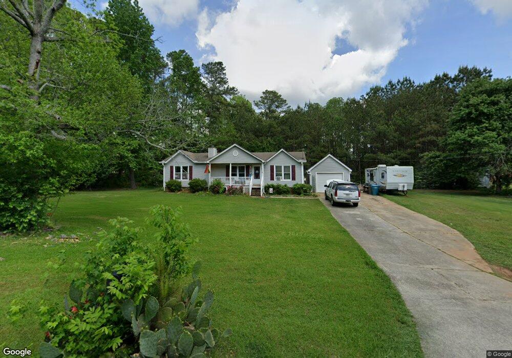
16 Poplar Point Dr Unit 6 Carrollton, GA 30116
Abilene NeighborhoodEstimated Value: $224,000 - $231,779
3
Beds
2
Baths
1,200
Sq Ft
$191/Sq Ft
Est. Value
About This Home
This home is located at 16 Poplar Point Dr Unit 6, Carrollton, GA 30116 and is currently estimated at $228,695, approximately $190 per square foot. 16 Poplar Point Dr Unit 6 is a home located in Carroll County with nearby schools including Sharp Creek Elementary School, Bay Springs Middle School, and Villa Rica High School.
Ownership History
Date
Name
Owned For
Owner Type
Purchase Details
Closed on
Mar 9, 2021
Sold by
Brown Booker T Jr Estate
Bought by
Smothers Alyssa
Current Estimated Value
Home Financials for this Owner
Home Financials are based on the most recent Mortgage that was taken out on this home.
Original Mortgage
$142,373
Outstanding Balance
$127,692
Interest Rate
2.73%
Mortgage Type
FHA
Estimated Equity
$101,003
Purchase Details
Closed on
Nov 6, 2013
Sold by
Brown Booker T
Bought by
Brown Booker T
Home Financials for this Owner
Home Financials are based on the most recent Mortgage that was taken out on this home.
Original Mortgage
$14,000
Interest Rate
4.26%
Mortgage Type
New Conventional
Purchase Details
Closed on
Jan 14, 1991
Bought by
Brown Booker and Brown Tony
Create a Home Valuation Report for This Property
The Home Valuation Report is an in-depth analysis detailing your home's value as well as a comparison with similar homes in the area
Home Values in the Area
Average Home Value in this Area
Purchase History
| Date | Buyer | Sale Price | Title Company |
|---|---|---|---|
| Smothers Alyssa | $145,000 | -- | |
| Brown Booker T | -- | -- | |
| Brown Booker | $62,200 | -- |
Source: Public Records
Mortgage History
| Date | Status | Borrower | Loan Amount |
|---|---|---|---|
| Open | Smothers Alyssa | $142,373 | |
| Previous Owner | Brown Booker T | $14,000 |
Source: Public Records
Tax History Compared to Growth
Tax History
| Year | Tax Paid | Tax Assessment Tax Assessment Total Assessment is a certain percentage of the fair market value that is determined by local assessors to be the total taxable value of land and additions on the property. | Land | Improvement |
|---|---|---|---|---|
| 2024 | $1,504 | $66,479 | $4,000 | $62,479 |
| 2023 | $1,504 | $61,334 | $4,000 | $57,334 |
| 2022 | $1,255 | $50,038 | $4,000 | $46,038 |
| 2021 | $1,132 | $44,142 | $4,000 | $40,142 |
| 2020 | $134 | $39,457 | $4,000 | $35,457 |
| 2019 | $138 | $36,746 | $4,000 | $32,746 |
| 2018 | $145 | $30,758 | $4,000 | $26,758 |
| 2017 | $146 | $30,758 | $4,000 | $26,758 |
| 2016 | $146 | $30,758 | $4,000 | $26,758 |
| 2015 | $148 | $25,535 | $4,000 | $21,535 |
| 2014 | $605 | $25,535 | $4,000 | $21,535 |
Source: Public Records
Map
Nearby Homes
- 0 Old Airport Rd Unit 10599783
- 0 Old Airport Rd Unit 10599779
- 0 Old Airport Rd Unit 10599776
- 0 Old Airport Rd Unit 7642336
- 180 Old Airport Rd
- 22 Summer Ct
- 35 Pawn Dr
- 206 Asher Dr
- The Ellison II Plan at Jameson Towns
- The Norwood II Plan at Jameson Towns
- The Maddux II Plan at Jameson Towns
- 0 Shady Grove Rd Unit 10601173
- 0 Shady Grove Rd Unit 10601172
- 1890 Shady Grove Rd
- 1866 Shady Grove Rd
- 255 Morgan Rd
- 221 Turtle Cove
- 255 Emerald Pointe Dr
- 110 Stoney Brook Dr
- 105 Providence Ct
- 16 Poplar Point Dr Unit 6
- 16 Poplar Point Dr
- 34 Poplar Point Dr
- 325 Old Airport Rd
- 10 Hickory Cir
- 300 Old Airport Rd
- 7 Poplar Point Dr
- 200 Hickory Cir Unit 21
- 20 Arbor Park
- 338 Old Airport Rd
- 52 Poplar Point Dr
- 30 E Knight Dr
- 15 Hickory Cir
- 40 E Knight Dr
- 30 Hickory Cir
- 20 E Knight Dr
- 0 Hickory Cir Unit 7150503
- 0 Hickory Cir Unit 7158147
- 0 Hickory Cir Unit 8658893
- 0 Hickory Cir Unit 8631140