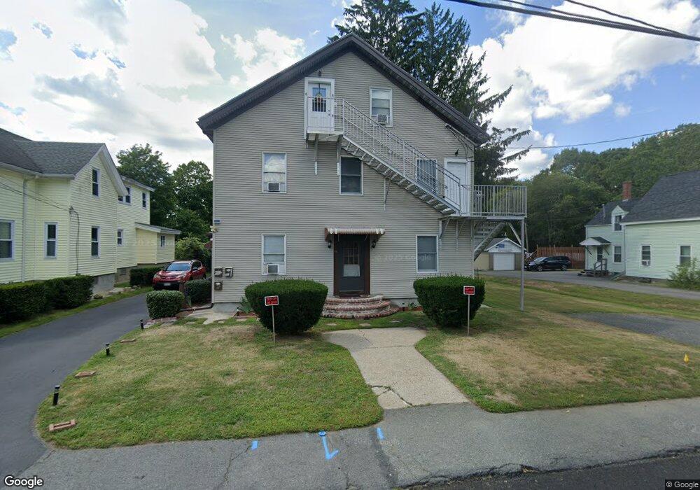
16 Presbrey Ct Unit 2 Taunton, MA 02780
Estimated Value: $548,721 - $717,000
1
Bed
1
Bath
2,723
Sq Ft
$232/Sq Ft
Est. Value
About This Home
This home is located at 16 Presbrey Ct Unit 2, Taunton, MA 02780 and is currently estimated at $630,930, approximately $231 per square foot. 16 Presbrey Ct Unit 2 is a home located in Bristol County with nearby schools including Mulcahey Elementary School, Taunton High School, and Our Lady of Lourdes School.
Ownership History
Date
Name
Owned For
Owner Type
Purchase Details
Closed on
Oct 28, 2016
Sold by
Robens Rui and Robens Maria N
Bought by
Simoes Jeffrey
Current Estimated Value
Home Financials for this Owner
Home Financials are based on the most recent Mortgage that was taken out on this home.
Original Mortgage
$284,747
Outstanding Balance
$230,951
Interest Rate
3.75%
Mortgage Type
FHA
Estimated Equity
$399,979
Create a Home Valuation Report for This Property
The Home Valuation Report is an in-depth analysis detailing your home's value as well as a comparison with similar homes in the area
Home Values in the Area
Average Home Value in this Area
Purchase History
| Date | Buyer | Sale Price | Title Company |
|---|---|---|---|
| Simoes Jeffrey | $290,000 | -- |
Source: Public Records
Mortgage History
| Date | Status | Borrower | Loan Amount |
|---|---|---|---|
| Open | Simoes Jeffrey | $284,747 |
Source: Public Records
Tax History Compared to Growth
Tax History
| Year | Tax Paid | Tax Assessment Tax Assessment Total Assessment is a certain percentage of the fair market value that is determined by local assessors to be the total taxable value of land and additions on the property. | Land | Improvement |
|---|---|---|---|---|
| 2025 | $6,526 | $596,500 | $101,800 | $494,700 |
| 2024 | $6,216 | $555,500 | $101,800 | $453,700 |
| 2023 | $5,921 | $491,400 | $101,800 | $389,600 |
| 2022 | $5,550 | $421,100 | $84,900 | $336,200 |
| 2021 | $4,808 | $338,600 | $77,200 | $261,400 |
| 2020 | $4,714 | $317,200 | $77,200 | $240,000 |
| 2019 | $4,427 | $280,900 | $77,200 | $203,700 |
| 2018 | $4,120 | $262,100 | $77,600 | $184,500 |
| 2017 | $3,715 | $236,500 | $73,600 | $162,900 |
| 2016 | $3,312 | $211,200 | $71,400 | $139,800 |
| 2015 | $3,128 | $208,400 | $71,100 | $137,300 |
| 2014 | $3,030 | $207,400 | $70,100 | $137,300 |
Source: Public Records
Map
Nearby Homes
- 252 Somerset Ave
- 450 Somerset Ave Unit 2-7
- 450 Somerset Ave Unit 6-6
- 4 Parkin Ct
- 22 Everett St
- 56 Silver St
- 6 Southeast St
- 16 Clinton St
- 72 Barnum St
- 90 E Water St
- 132 Winthrop St
- 278 Cohannet St
- 98 Winthrop St
- 125 Highland St Unit 103
- 46 Harrison St Unit 4
- 215 High St Unit 21
- 215 High St Unit 20
- 195 Pratt St Unit A
- 19 Mason St
- 41 Hart Ave
- 16 Presbrey Ct
- 14 Presbrey Ct
- 18 Presbrey Ct
- 12 Presbrey Ct
- 21 Presbrey Ct
- 20 Presbrey Ct
- 15 Briggs St
- 9 Presbrey Ct
- 17 Briggs St
- 5 Briggs St
- 23 Presbrey Ct
- 19 Briggs St
- 3 Briggs St
- 1 Briggs St
- 25 Presbrey Ct
- 25 Presbrey Ct Unit 3
- 21 Briggs St
- 21 Briggs St Unit 2
- 365 Somerset Ave Unit 3
- 365 Somerset Ave