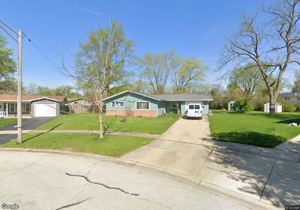
16 Princeton Ct North Aurora, IL 60542
Estimated Value: $296,262 - $320,000
3
Beds
1
Bath
1,311
Sq Ft
$232/Sq Ft
Est. Value
About This Home
This home is located at 16 Princeton Ct, North Aurora, IL 60542 and is currently estimated at $304,316, approximately $232 per square foot. 16 Princeton Ct is a home located in Kane County with nearby schools including Goodwin Elementary School, Jewel Middle School, and West Aurora High School.
Ownership History
Date
Name
Owned For
Owner Type
Purchase Details
Closed on
Dec 13, 2002
Sold by
Rogers Scott W and Rogers Elizabeth W
Bought by
King Mark
Current Estimated Value
Home Financials for this Owner
Home Financials are based on the most recent Mortgage that was taken out on this home.
Original Mortgage
$139,500
Interest Rate
6.13%
Purchase Details
Closed on
Jul 29, 2002
Sold by
Rogers Scott W and Rogers Elizabeth W
Bought by
Rogers Scott W and Rogers Elizabeth W
Home Financials for this Owner
Home Financials are based on the most recent Mortgage that was taken out on this home.
Original Mortgage
$106,500
Interest Rate
6.64%
Purchase Details
Closed on
Apr 28, 1995
Sold by
Mabry Daryl K and Mabry Christa C
Bought by
Rogers Scott W and Wilson Elizabeth S
Home Financials for this Owner
Home Financials are based on the most recent Mortgage that was taken out on this home.
Original Mortgage
$113,548
Interest Rate
8.42%
Mortgage Type
FHA
Create a Home Valuation Report for This Property
The Home Valuation Report is an in-depth analysis detailing your home's value as well as a comparison with similar homes in the area
Home Values in the Area
Average Home Value in this Area
Purchase History
| Date | Buyer | Sale Price | Title Company |
|---|---|---|---|
| King Mark | $155,000 | Chicago Title Insurance Co | |
| Rogers Scott W | -- | Chicago Title Insurance Co | |
| Rogers Scott W | $114,500 | Law Title Ins Co Inc |
Source: Public Records
Mortgage History
| Date | Status | Borrower | Loan Amount |
|---|---|---|---|
| Previous Owner | King Mark | $139,500 | |
| Previous Owner | Rogers Scott W | $106,500 | |
| Previous Owner | Rogers Scott W | $113,548 |
Source: Public Records
Tax History Compared to Growth
Tax History
| Year | Tax Paid | Tax Assessment Tax Assessment Total Assessment is a certain percentage of the fair market value that is determined by local assessors to be the total taxable value of land and additions on the property. | Land | Improvement |
|---|---|---|---|---|
| 2024 | $4,994 | $73,611 | $13,622 | $59,989 |
| 2023 | $4,762 | $65,771 | $12,171 | $53,600 |
| 2022 | $4,525 | $60,010 | $11,105 | $48,905 |
| 2021 | $5,014 | $64,057 | $10,339 | $53,718 |
| 2020 | $5,239 | $65,541 | $9,603 | $55,938 |
| 2019 | $5,063 | $60,725 | $8,897 | $51,828 |
| 2018 | $4,616 | $54,230 | $8,230 | $46,000 |
| 2017 | $4,521 | $51,915 | $7,583 | $44,332 |
| 2016 | $4,048 | $45,867 | $6,327 | $39,540 |
| 2015 | -- | $39,766 | $5,441 | $34,325 |
| 2014 | -- | $37,215 | $5,233 | $31,982 |
| 2013 | -- | $37,701 | $5,158 | $32,543 |
Source: Public Records
Map
Nearby Homes
- 6 S Sycamore Ln
- 328 W State St
- 320 Harmony Dr
- 43 S Juniper Dr Unit 3
- 307 John St
- 306 Harmony Dr
- 202 Larchwood Ln
- 727 Harmony Ct
- 302 Pin Oak Dr
- 16 S Grace St
- 503 Redwood Ct
- 22 Silver Trail Unit 2
- 218 Timber Oaks Dr
- 791 Cottonwood Dr
- 12 N Lincolnway
- 341 Pheasant Hill Dr
- 438 Mallard Point Dr
- 442 Mallard Point Dr
- 413 N Sycamore Ln
- 148 N Lincolnway
- 14 Princeton Ct
- 18 Princeton Ct
- 416 Harmony Dr
- 17 Hawthorne Dr
- 15 Hawthorne Dr
- 19 Hawthorne Dr
- 418 Harmony Dr
- 414 Harmony Dr
- 21 Hawthorne Dr
- 13 Hawthorne Dr
- 20 Princeton Ct
- 412 Harmony Dr
- 15 Princeton Ct
- 413 Princeton Dr
- 420 Harmony Dr
- 17 Princeton Ct
- 410 Harmony Dr
- 19 Princeton Ct
- 417 Harmony Dr
- 419 Harmony Dr